Queensland is the second largest state in Australia. It contains 472 separate protected areas with a total land area of 69,388 km2 (26,791 sq mi). 223 of these are National parks, which is the highest number of any Australian state or territory, totalling 65,871 km2 (25,433 sq mi). Seven others are Scientific National Parks, totalling 522 km2 (202 sq mi).

Currawinya is a national park near Hungerford in South West Queensland, Australia, 828 km west of Brisbane. Part of the mulga lands bioregion this is an area of dry sandy plain with small trees and shrubs. The Paroo River passes through the park.

Great Sandy National Park is a coastal national park in the Fraser Coast Region, Queensland, Australia.

The Diamantina River is a major river located in Central West Queensland and the far north of South Australia.

Mount Isa is a city in the Gulf Country region of Queensland, Australia. It came into existence because of the vast mineral deposits found in the area. Mount Isa Mines (MIM) is one of the most productive single mines in world history, based on combined production of lead, silver, copper and zinc.

The Paroo River, a series of waterholes, connected in wet weather as a running stream of the Darling catchment within the Murray–Darling basin, is located in the South West region of Queensland and Far West region of New South Wales, Australia. It is the home of the Paarkantji people.

The Barkly Tableland is a rolling plain of grassland in Australia. It runs from the eastern part of the Northern Territory into western Queensland. It is one of the five regions in the Northern Territory and covers 283,648 square kilometres (109,517 sq mi), 21% of the Northern Territory. The Barkly Tableland runs parallel to the southern shore of the Gulf of Carpentaria, from about Mount Isa, Queensland to near Daly Waters.

The Georgina River is the north-westernmost of the three major rivers of the Channel Country in Central West Queensland, that also flows through a portion of the Northern Territory, in central Australia. Part of the Lake Eyre basin, the Georgina flows in extremely wet years into Lake Eyre.

Hungerford is an outback town in the Shire of Bulloo and a locality in the Shire of Bulloo and Shire of Paroo, South West Queensland, Australia. It is immediately north of the border with New South Wales and the Dingo fence. At the 2016 census, Hungerford and the surrounding area within Queensland had a population of 23. The locality of Hungerford on the New South Wales side of the border had a population of 15.
Kalali is a poorly attested Australian Aboriginal language. It is one of several geographically transitional 'Karna–Mari fringe' languages that have not been convincingly classified, and is best considered an isolate branch within the Pama–Nyungan family. Gavan Breen provisionally includes Minkabari and the 'Ngura' dialect Pitjara/Bidjara/Bitharra, which together have been called the Bulloo River language.

The Bulloo RiverBUUL-oo is an isolated drainage system in western Queensland, central Australia. Its floodplain, which extends into northern New South Wales, is an important area for waterbirds when inundated. It comprises most of the Bulloo-Bancannia drainage basin.

The Mulga Lands are an interim Australian bioregion of eastern Australia consisting of dry sandy plains with low mulga woodlands and shrublands that are dominated by Acacia aneura (mulga).

The prong-snouted blind snake is a species of non-venomous worm-like burrowing snakes belonging to the Typhlopidae family. It is endemic to central southern, continental Australia.
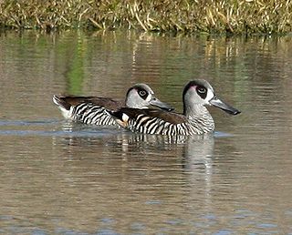
The Paroo Floodplain and Currawinya Important Bird Area is a 7,874 km2 (3,040 sq mi) site comprising the floodplain and the associated wetlands of the Paroo River in north-western New South Wales and south-western Queensland, Australia. It includes extensive areas of the Paroo-Darling and Currawinya National Parks, both of which are listed under the Ramsar Convention as wetland sites of international importance, as well as of the Nocoleche Nature Reserve.

South West Queensland is a remote region in the Australian state of Queensland which covers 319,808 km2 (123,479 sq mi). The region lies to the south of Central West Queensland and west of the Darling Downs and includes the Maranoa district and parts of the Channel Country. The area is noted for its cattle grazing, cotton farming, opal mining and oil and gas deposits.

Boorara Station most commonly known as Boorara is a pastoral lease that operates as a sheep and cattle station in south west Queensland.
Coalstoun Lakes is a rural town and locality in the North Burnett Region, Queensland, Australia.
The Badjiri or Budjari, also written Badyidi, are an Australian Aboriginal people group of Queensland. They are not to be confused with the Pitjara.
Dynevor is a locality in the Shire of Bulloo, Queensland, Australia.

