
The North Island, also officially named Te Ika-a-Māui, is one of the two main islands of New Zealand, separated from the larger but much less populous South Island by Cook Strait. The island's area is 113,729 square kilometres (43,911 sq mi), making it the world's 14th-largest island. It has a population of 3,896,200, accounting for approximately 77% of the total residents of New Zealand.
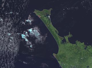
The Aupouri Peninsula is a tombolo at the northern tip of the North Island of New Zealand. It projects between the Tasman Sea to the west and the Pacific Ocean to the east. It constitutes the northern part of the Far North District, incorporating North Cape, Houhora and the northern half of Awanui.

Ahipara is a town and locality in Northland, New Zealand at the southern end of Ninety Mile Beach, with the Tauroa Peninsula to the west and Herekino Forest to the east. Ahipara Bay is to the north west. Kaitaia is 14 km to the north east, and Pukepoto is between the two.
Waiharara is a community at the base of the Aupouri Peninsula in Northland, New Zealand. State Highway 1 runs through the community. To the west is Aupouri Forest, and beyond that Ninety Mile Beach. To the east is Rangaunu Harbour. Houhora is 22 km north west, and Awanui is 16 km south east. Lake Waiparera, 35 metres above sea level, is immediately to the north west.
Half Mile Lagoon is a lake in the Northland Region of New Zealand. It is located 5 km to the northwest of Ngataki, on the Aupouri Peninsula.
Lake Kihona is a dune lake in the Northland Region of New Zealand. It is located to the northwest of Te Kao on the Aupouri Peninsula.
Lake Morehurehu is a dune lake in the Northland Region of New Zealand. It is located to the Northeast of Te Kao on the Aupouri Peninsula.
Lake Ngatu is a dune lake in the Northland Region of New Zealand. It is located to the northwest of Awanui, near Waipapakauri.

Lake Rotoroa is a dune lake in the Northland Region of New Zealand. It is located to the west of Awanui.
Lake Taharoa is located in the Northland Region of New Zealand near Ripiro Beach. There is also a lake of the same name in the Waikato region.
Lake Te Kahika is a dune lake located on the Aupouri Peninsula in the Northland Region of New Zealand. It is one of the country's northernmost lakes.
Lake Waiparera is a dune lake in the Northland Region of New Zealand.It is located immediately North-West of Waiharara on the Aupouri Peninsula. The lake is the largest of the Aupouri Lakes. The catchment is predominately pasture, with the remainder scrub or wetland. The lake has several inflows (drains), with no obvious outflows. The lake is easily accessed from SH1.
The Awaroa River is a short river in the Waikato District of New Zealand's North Island. It flows east from its source in the dunes near Karioitahi Beach and Lake Puketi, then south from Waiuku joining with the Aka Aka Stream before reaching the Waikato River in its tidal reaches close to Motutieke Island.
Building consent authorities (BCAs) are officials who enforce New Zealand's regulatory building control system. The New Zealand Building Act 2004 sets out a registration and accreditation scheme and technical reviews. The Act creates operational roles for BCAs.
Lake Rotokawau is the name of numerous lakes in New Zealand:
Lake Heather is a dune lake in the Far North District of New Zealand. It is located west of the town of Awanui, and between the larger Lake Ngatu and Lake Rotoroa.
Lake Rotokawau is a dune lake on the Karikari Peninsula in the Far North District of New Zealand. It is northeast of Rangiputa village and near Puwheke Beach. It is sometimes referred to as 'Lake Rotokawau West' and is the larger of two adjacent lakes.

Lake Rotokawau is a small volcanic lake 4.1 km (2.5 mi) east of Lake Rotorua in the Bay of Plenty region of New Zealand's North Island. The name is also used for lakes in the Kaipara District, Chatham Islands, on Aupouri Peninsula and near Lake Waikare in Waikato. Access is via Lake Rotokawau Road, from SH30 at Tikitere. The lake is owned and managed by Ngāti Rangiteaorere.
