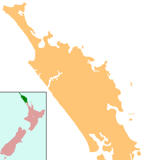
The Aupouri Peninsula is a tombolo at the northern tip of the North Island of New Zealand. It projects between the Tasman Sea to the west and the Pacific Ocean to the east. It constitutes the northern part of the Far North District, incorporating North Cape, Houhora and the northern half of Awanui.
Lake Omapere is the largest lake in the Northland Region of New Zealand. It is located to the North of Kaikohe.

Te Henga is a coastal community of the Auckland Region in the north of the North Island, New Zealand. The Māori name for the area "Te Henga" is in reference to the long foredunes which run along the beach and look like the "Henga" or "Gunwhale" of an upturned waka hull. This name originally applied to a wide area of the lower Waitakere River valley, but during the early 1900s the area became popular with visiting European immigrants who began to refer to the area as "Bethells Beach" after the Bethells Family who live there and still own much of the area. In 1976 the New Zealand Geographic Board officially named the area "Te Henga ".

Ahipara is a town and locality in Northland, New Zealand at the southern end of Ninety Mile Beach, with the Tauroa Peninsula to the west and Herekino Forest to the east. Ahipara Bay is to the north west. Kaitaia is 14 km to the north east, and Pukepoto is between the two.

The Awanui River is a river in the far north of New Zealand, close to the point at which the Aupouri Peninsula joins the rest of the Northland Peninsula. The Awanui flows first west and then north, for a total of 30 kilometres (19 mi), before flowing into Rangaunu Harbour. The town of Kaitaia is along its banks.

Half Mile Lagoon is a lake in the Northland Region of New Zealand. It is located 5 km to the northwest of Ngataki, on the Aupouri Peninsula.

Lake Kihona is a dune lake in the Northland Region of New Zealand. It is located to the northwest of Te Kao on the Aupouri Peninsula.

Lake Morehurehu is a dune lake in the Northland Region of New Zealand. It is located to the Northeast of Te Kao on the Aupouri Peninsula.

Lake Ngakeketa is a dune lake in the Northland Region of New Zealand. It is located near Te Paki Stream Road, in the general area of the Te Paki Recreation Reserve.

Lake Ngatu is a dune lake in the Northland Region of New Zealand. It is located to the northwest of Awanui, near Waipapakauri.

Lake Rotokawau is a dune lake on the Aupouri Peninsula the Far North, New Zealand. The name is also used for lakes in the Kaipara District, Chatham Islands, in Bay of Plenty and near Lake Waikare in Waikato.

Lake Rotoroa is a dune lake in the Northland Region of New Zealand. It is located to the west of Awanui.

Lake Taharoa is located in the Northland Region of New Zealand near Ripiro Beach. There is also a lake of the same name in the Waikato region.
Lake Waiparera is a dune lake in the Northland Region of New Zealand.It is located immediately North-West of Waiharara on the Aupouri Peninsula. The lake is the largest of the Aupouri Lakes. The catchment is predominately pasture, with the remainder scrub or wetland. The lake has several inflows (drains), with no obvious outflows. The lake is easily accessed from SH1.
Lake Waiporohita is a dune lake in the Northland Region of New Zealand. It is located near Tokerau Beach on the Karikari Peninsula.

Lake Harihari is a dune-dammed lake 10 km south of Kawhia in the Waikato region of New Zealand. Its water quality is the best amongst the Waikato dune lakes. It is ranked eighth in importance in the region. Its quality has been attributed to its remoteness.

Lake Heather is a dune lake in the Far North District of New Zealand. It is located west of the town of Awanui, and between the larger Lake Ngatu and Lake Rotoroa.

Lake Rotopokaka is a dune lake in the Far North District of New Zealand. It is adjacent to Tokerau Beach on the east coast of the Karikari Peninsula. The lake is also known as 'Coca Cola lake' as the peat and tannins in the water give the lake a distinct 'cola' colour.
William Desmond Te Kahika Junior, also known as Billy TK J(n)r, is a New Zealand conspiracy theorist, blues musician, guitarist, businessman and political candidate who lives in Whangārei. He is the son of Māori musician, guitarist, vocalist, and songwriter Billy TK. During the 2020 New Zealand general election, Te Kahika attracted media coverage both as the leader of the fringe New Zealand Public Party (NZPP) and for his propogation of conspiracy theories. Both Te Kahika and the NZPP have opposed the New Zealand Government's lockdown restrictions in response to the COVID-19 pandemic.


