
The Northland Region is the northernmost of New Zealand's 16 local government regions. New Zealanders sometimes refer to it as the Winterless North because of its mild climate. The main population centre is the city of Whangārei, and the largest town is Kerikeri. At the 2018 New Zealand census Northland recorded a surprising population growth spurt of 18.1% since the previous 2013 census, placing it as the fastest growing region of New Zealand, ahead of other strong growth regions such as the Bay of Plenty and Waikato.
The Aupouri Peninsula is a tombolo at the northern tip of the North Island of New Zealand. It projects between the Tasman Sea to the west and the Pacific Ocean to the east. It constitutes the northern part of the Far North District, incorporating North Cape, Houhora and the northern half of Awanui.

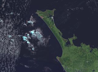
Lake Ōmāpere is the largest lake in the Northland Region of New Zealand. It is located to the North of Kaikohe.
The Marsden Point Branch is a 19 km (12 mi) branch line railway, which is to be built in the Northland Region of New Zealand's North Island. It will diverge from the North Auckland Line at Oakleigh, south of Whangārei, and serve Northport at Marsden Point. The proposal has existed since the 1970s and land for the rail corridor is being actively purchased. In October 2017, the new Labour–NZ First coalition government announced that it would spend $600 million on rehabilitating the North Auckland Line and building the branch at a cost of $200 million, the total works to cost $800 million. In June 2021 it was announced that the line would be built and was expected to take about 5 years.

The Awanui River is a river in the far north of New Zealand, close to the point at which the Aupouri Peninsula joins the rest of the Northland Peninsula. The Awanui flows first west and then north, for a total of 30 kilometres (19 mi), before flowing into Rangaunu Harbour. The town of Kaitaia is along its banks.
Half Mile Lagoon is a lake in the Northland Region of New Zealand. It is located 5 km to the northwest of Ngataki, on the Aupouri Peninsula.
Lake Mokeno is a lake in the Northland Region of New Zealand.
Lake Morehurehu is a dune lake in the Northland Region of New Zealand. It is located to the Northeast of Te Kao on the Aupouri Peninsula.
Lake Ngakapua is a dune lake in the Northland Region of New Zealand. It is located to the northwest of Awanui, near Waipapakauri on the Aupouri Peninsula.

Lake Ngatu is a dune lake in the Northland Region of New Zealand. It is located to the northwest of Awanui, near Waipapakauri.

Lake Rotoroa is a dune lake in the Northland Region of New Zealand. It is located to the west of Awanui.
Lake Taharoa is located in the Northland Region of New Zealand near Ripiro Beach. There is also a lake of the same name in the Waikato region.
Lake Te Kahika is a dune lake located on the Aupouri Peninsula in the Northland Region of New Zealand. It is one of the country's northernmost lakes.
Lake Waiparera is a dune lake in the Northland Region of New Zealand.It is located immediately North-West of Waiharara on the Aupouri Peninsula. The lake is the largest of the Aupouri Lakes. The catchment is predominately pasture, with the remainder scrub or wetland. The lake has several inflows (drains), with no obvious outflows. The lake is easily accessed from SH1.

Water pollution in New Zealand is an increasing concern for those who use and care for waterways and for New Zealand regulatory bodies. An increase in population is linked to an increase in water pollution, due to a range of causes such as rural land use, industrial use and urban development. Fresh water quality is under pressure from agriculture, hydropower, urban development, pest invasions and climate change. While pollution from point sources has been reduced, diffuse pollution such as nutrients, pathogens and sediments development and from stormwater in towns is not under control. There are more than 800 water quality monitoring sites around New Zealand that are regularly sampled.
The Awaroa River is a short river in the Waikato District of New Zealand's North Island. It flows east from its source in the dunes near Karioitahi Beach and Lake Puketi, then south from Waiuku joining with the Aka Aka Stream before reaching the Waikato River in its tidal reaches close to Motutieke Island.
Lake Heather is a dune lake in the Far North District of New Zealand. It is located west of the town of Awanui, and between the larger Lake Ngatu and Lake Rotoroa.

Lake Rotopokaka is a dune lake in the Far North District of New Zealand. It is adjacent to Tokerau Beach on the east coast of the Karikari Peninsula. The lake is also known as 'Coca Cola lake' as the peat and tannins in the water give the lake a distinct 'cola' colour.

The Awaroa River is a river in the Ōtorohanga District, on the west coast of New Zealand's North Island. It flows north from its source near Te Koraha, through Hauturu to Kawhia Harbour. The river passes through both pasture and indigenous forest. Over half of the river is in forest.
