The Truckee–Carson Irrigation District (TCID) is a political subdivision of the State of Nevada, which operates dams at Lake Tahoe, diversion dams on the Truckee River in Washoe County, and the Lake Lahontan reservoir.

The Los Angeles Aqueduct system, comprising the Los Angeles Aqueduct and the Second Los Angeles Aqueduct, is a water conveyance system, built and operated by the Los Angeles Department of Water and Power. The Owens Valley aqueduct was designed and built by the city's water department, at the time named The Bureau of Los Angeles Aqueduct, under the supervision of the department's Chief Engineer William Mulholland. The system delivers water from the Owens River in the Eastern Sierra Nevada Mountains to Los Angeles, California.

Garrison Dam is an earth-fill embankment dam on the Missouri River in central North Dakota, U.S. Constructed by the U.S. Army Corps of Engineers from 1947 to 1953, at over 2 miles (3.2 km) in length, the dam is the fifth-largest earthen dam in the world. The reservoir impounded by the dam is Lake Sakakawea, which extends to Williston and the confluence with the Yellowstone River, near the Montana border.

The Windham Textile and History Museum is a museum in Willimantic, Connecticut, in the New England region of the United States. It is currently located in Main St.

Leech Lake is a lake located in north central Minnesota, United States. It is southeast of Bemidji, located mainly within the Leech Lake Indian Reservation, and completely within the Chippewa National Forest. It is used as a reservoir. The lake is the third largest in Minnesota, covering 102,947.83 acres (416.6151 km2) with 195 miles (314 km) of shoreline and has a maximum depth of 156 feet (48 m).

Bagnell Dam impounds the Osage River in the U.S. state of Missouri, creating the Lake of the Ozarks. The dam is located in the city of Lakeside in Miller County, near the Camden-Miller County line. The 148-foot (45 m) tall concrete gravity dam was built by the Union Electric Company to generate hydroelectric power at its Osage Powerplant. It is 2,543 feet (775 m) long, including a 520-foot (160 m) long spillway and a 511-foot (156 m) long power station. The facility with eight generators has a maximum capacity of 215 megawatts. The dam provides power to 42,000 homes.

The Eli Whitney Museum, in Hamden, Connecticut, is an experimental learning workshop for students, teachers, and families. The museum's main building is located on a portion of the Eli Whitney Gun Factory site, a gun factory erected by Eli Whitney in 1798. The museum focuses on teaching experiments that are the roots of design and invention, featuring hands-on building projects and exhibits on Whitney and A. C. Gilbert.

The Croton Aqueduct or Old Croton Aqueduct was a large and complex water distribution system constructed for New York City between 1837 and 1842. The great aqueducts, which were among the first in the United States, carried water by gravity 41 miles (66 km) from the Croton River in Westchester County to reservoirs in Manhattan. It was built because local water resources had become polluted and inadequate for the growing population of the city. Although the aqueduct was largely superseded by the New Croton Aqueduct, which was built in 1890, the Old Croton Aqueduct remained in service until 1955.

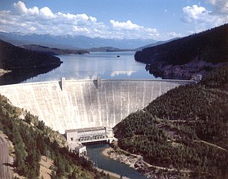
Hungry Horse Dam is an arch dam in the western United States, on the South Fork Flathead River in the Rocky Mountains of northwest Montana. It is located in Flathead National Forest in Flathead County, about fifteen miles (24 km) south of the west entrance to Glacier National Park, nine miles (14 km) southeast of Columbia Falls, and twenty miles (32 km) northeast of Kalispell. The Hungry Horse project, dam, and powerplant are operated by the U.S. Bureau of Reclamation. The entrance road leading to the dam is located in Hungry Horse.
Champion International was a large paper and wood products producer based since 1980 in Stamford, Connecticut. It was acquired by International Paper in 2000.

Rainbow Dam is a hydroelectric dam on the Missouri River, 29 feet (8.8 m) high and 1,055 feet (322 m) long, located six miles northeast of Great Falls in the U.S. state of Montana.
The Central Utah Project is a US federal water project that was authorized for construction under the Colorado River Storage Project Act of April 11, 1956, as a participating project. In general, the Central Utah Project develops a portion of Utah's share of the yield of the Colorado River, as set out in the Colorado River Compact of 1922.

The Lowell Power Canal System is the largest power canal system in the United States, at 5.6 miles in length. It is operating through six major canals on two levels, controlled by numerous gates. The system was begun in the 1790s, beginning its life as a transportation canal called the Pawtucket Canal, which was constructed to get logs from New Hampshire down the Merrimack River to shipbuilding centers at Newburyport, Massachusetts, bypassing the 30-plus-foot drop of the Pawtucket Falls.

Hardy Dam is an earth-filled embankment dam and powerplant complex on the Muskegon River in Big Prairie Township, Newaygo County, Michigan. At the time of its completion, it was the largest earthen dam in North America east of the Mississippi. Its impoundment forms a lake with over 50 miles of shoreline. The dam impounds a reservoir with a surface area of 4,000 acres and its power plant has an installed capacity of 31.5 MW.

Greeneville is a neighborhood of the city of Norwich, Connecticut, located northeast of downtown Norwich along the west bank of the Shetucket River. Most of the neighborhood is designated Greeneville Historic District, a historic district that is listed on the National Register of Historic Places.

The South Central Connecticut Regional WaterAuthority is a public water supply utility in Connecticut, United States. The RWA supplies water in a 15-town region with a population of about 430,000. The RWA acts as a steward of the environment in the local region by protecting more than 26,000 acres of watershed lands, and promoting sustainability.

The Dundee Canal was an industrial canal in Clifton and Passaic in Passaic County, New Jersey. It was built between 1858 and 1861 and ran parallel to the Passaic River. It supplied hydropower and water for manufacturing. There was interest by some members of the business community to modify the canal to support navigational uses, but the canal was never used for that purpose.
Pokegama Lake Dam is a dam in Cohasset, Itasca County, Minnesota, northwest of the city of Grand Rapids.

The Monadnock Mills are a historic mill complex in Claremont, New Hampshire. They extend along the southern bank of the Sugar River on both sides of Water Street, between the Broad Street bridge to the east, and the junction of Main and Water Streets in the west, where they abut the industrial area formerly associated with the Sullivan Machinery Company; there also a small number of surviving elements on the north side of the river opposite this area. The complex represents the surviving elements of what was once the largest manufacturing complex in the upper Connecticut River watershed area, and one of its oldest. The mills were listed on the National Register of Historic Places in 1979. Many of its buildings have been repurposed to other uses.


