Lambroughton Loch

Last updated

Lambroughton Loch
Lambroughton Loch and West Lambroughton.JPG
Site of Lambroughton Loch below West Lambroughton Farm
North Ayrshire UK relief location map.jpg
Red pog.svg
Lambroughton Loch
Location North Ayrshire, Scotland
Coordinates 55°39′8.1″N4°33′8.0″W / 55.652250°N 4.552222°W / 55.652250; -4.552222 Coordinates: 55°39′8.1″N4°33′8.0″W / 55.652250°N 4.552222°W / 55.652250; -4.552222
Type Drained freshwater loch
Primary inflows Lochridge Burn
Primary outflows Garrier Water
Basin  countriesScotland
Settlements Kilmaurs

Lambroughton Loch or Wheatrig Loch was situated in a low-lying area between the farms and dwellings of Hillhead, Lambroughton, Wheatrig, Titwood and Lochridge mainly in the Parish of Dreghorn, North Ayrshire. The loch was mainly fed by the Lochridge (previously Lochrig) Burn, the Garrier Burn and surface runoff, such as from the old rig and furrows indicated by Roy's maps of the mid-18th century. [1] The loch outflow was via the Lochridge Burn that runs into the Garrier Burn, passes the site of the old Lochend habitation and into the Bracken Burn near Little Alton. The rivulet or watercourse is known as the Garrier Burn beyond this point.

Contents

History

Map showing the Garrier and Lochrdige Burns McNaughtmap.jpg
Map showing the Garrier and Lochrdige Burns

Lambroughton Loch, apparently mostly drained before the 1700s, was fed by the Lochridge and Garrier Burn and its outflow formed a confluence with the Bracken Burn and is then known as the Garrier Burn that runs into the River Irvine near Gatehead. The loch was mostly located on the lands of Lambroughton, Hillhead, and Wheatrig. The 'cut' through the natural dam ridge that once held back the loch waters below Hillhead and Wheatrig lay near the old dwelling of Lochend. Indications at Lochend suggest that an artificial dam also existed. Successive Ordnance Survey maps have perpetuated an error in the naming of the Garrier Burn which has been confused with the Bracken Burn as shown by McNaught's map of the parish. [2] Flooding during the winter remains substantial and curling took place here in the 19th century. [3]

The nearby placenames of Lochend, Cranshaw (Wood of the Cranes or Herons), Langmuir and Lochridge are self-evident as indicators of the nature of the area and the one time existence of the loch. [4] A bog is marked as existing below Mid Lambroughton in 1788-91. [5]

Blaeu's map of 1654 places a 'Lambrochmill' in this area and a 'Crunshaw Mill' is also recorded. [5] [6] The loch's drainage may relate to the abolition of thirlage in 1779 resulting in the need for 'heads of water' to power a number of smaller mills become unnecessary and the lochs were reclaimed as farming land; this fate for example was met by Millburn Mill that was powered by the waters of Lochlea. [7] [8]

The Garrier Burn at Titwood Garrier Burn Titwood.JPG
The Garrier Burn at Titwood

A track ran from Wheatrig (previously Whatrig, Whiterig in 1775, Whiteriggs in 1832 and Whyrigg in 1654) Farm across the Garrier Burn to Hillhead Farm. A Cranshaw habitation is marked in 1832 and 1821, but not marked in 1775. A cran in Scots was a "crane" or "heron" and the 'shaw' or small wood; a copse is still present. Cranes or herons are still a common sight and in the past they may have nested in the wood on the nearby lands of Hillhead, hence the name. Cranshaw was a building located near Little Alton on the northern side of the lane, and on the east side of the Garrier Burn as clearly indicated in the Montgomerie Estate plans of 1788 - 91. [9]

Lochend is associated with two small fields on the 1860 OS, although it is not marked on earlier or later maps. It is however mentioned, together with 'Crumshaw Mill' in papers of 1618 relating to the Glencairn estates. [10] A Lambroch Mill is shown in this general area on Blaeu's map of 1654, the survey dating however from the early 1600s. The old bridge at Alton with its proximity to the 'Old Toun', may have been the Lambroch Bridge marked on Blaeu's 1654 map.

Drainage

The loch's drainage may have begun in the early 18th century when Alexander Montgomerie, 10th Earl of Eglinton, was pursuing a number of agricultural improvements on his extensive estates. Further drainage work may have taken place in the 1740s as part of the improvements undertaken to provide employment for Montgomerie Irish estate workers during the Irish potato famines of the 1740s and the mid-19th century. Many drainage schemes also date to the end of World War I when many soldiers returned en masse to civilian life. [11]

Ownership

King Robert the Bruce gave the lands of Lambroughton to Sir Robert Cuninghame of Kilmaurs in 1320. [12] In 1675, Sir John Cunninghame Bart., conveyed to Robert Cunningham, druggist / apothecary, Edinburgh, the lands of 'Auldtoun, Langmuir, Langsyde and Lambrochtoune in whose family they seem to have remained until 1820, when George Cunninghame was the owner. These lands were part of the Eglinton Estate from 1520 when they were obtained by Hugh, the first Earl of Eglinton [13] until the late 20th century. [14]

Etymology

Scotland relief location map.jpg
Red pog.svg
Loch of Lambroughton
Previous location of the Loch of Lambroughton, Ayrshire
The site of the Cranshaw / Lochend Cottage or mill Lochend, Lambroughton Loch.JPG
The site of the Cranshaw / Lochend Cottage or mill

The Garrier's name is thought to be derived, according to McNaught, [2] from the Gaelic 'ruigh or righ' meaning 'fast running water' The Scots word 'Gaw' is also the term given to a 'cut made by a plough' or a furrow or channel made to draw off water. [15]

The Garrier burn is now seasonal as its headwaters are the drained Buiston Loch, pronounced 'Biston', (previously Buston). The Garrier is still pronounced locally as 'Gawreer'.[ citation needed ]

Habitats

The site is now represented by a low, marshy area centred at NS 358 543 on the OS map. The Ordnance Survey maps of the mid-19th century indicate that the area was farming land devoid of marsh, bog, or wetland, however the area in 2010 is as stated above. The loch site is located away from significant human disturbance and is a favoured site for resting and feeding by migrating birds such as Canada geese, greylag and pink-footed geese.[ citation needed ]

Micro-history

The Royal Caledonian Curling Club records that a curling match took place on Wheatrig Loch on 11 December 1856. [3]

On 27 January 2009, a BP tanker train carrying liquid fuels (diesel and heating oil) from Mossend to Riccarton was derailed near the bridge over the Stewarton to Kilmaurs road at Peacockbank Farm. Several wagons subsequently caught fire. [16] The Lochridge Burn was badly polluted and extensive pollution reparation works were carried out; the Garrier Burn escaped major contamination.

See also

Related Research Articles

Lambroughton is a village in the old Barony of Kilmaurs, Scotland. This is a rural area famous for its milk and cheese production and the Ayrshire or Dunlop breed of cattle.

Cunninghamhead is a hamlet in North Ayrshire, Scotland. It was the centre of the lands of Cunninghamhead, Perceton and Annick Lodge in Cunninghame. This mainly rural area is noted for its milk and cheese production and the Ayrshire, Cunninghame or Dunlop breed of cattle.

<span class="mw-page-title-main">Clan Cunningham</span> Scottish clan

Clan Cunningham is a Scottish clan. The traditional origins of the clan are placed in the 12th century. However, the first contemporary record of the clan chiefs is in the thirteenth century. The chiefs of the Clan Cunningham supported Robert the Bruce during the Wars of Scottish Independence. In the 15th and 16th centuries, the Clan Cunningham feuded with the Clan Montgomery. Historically, the chief of Clan Cunningham held the title of Earl of Glencairn. However, in modern times the chief of the clan is Cunningham of Corsehill. On 18 December 2013, Sir John Christopher Foggo Montgomery Cunninghame, Baronet of Corsehill, was recognized by Lord Lyon as Clan Chief after the chiefship had been vacant for over 200 years.

<span class="mw-page-title-main">Barony and Castle of Corsehill</span> Barony in East Ayrshire, Scotland

The old Barony and castle of Corsehill lay within the feudal Baillerie of Cunninghame, near Stewarton, now East Ayrshire, Scotland.

Thorntoun School was opened by Barnardo's in September 1971 for children with emotional difficulties aged 11 to 16 years. The school closed in 1990 and Thorntoun is now a nursing home. The complex lies between the villages of Springside and Crosshouse, Kilmarnock in East Ayrshire, Scotland. The old Thorntoun mansion house was demolished in the late 1960s, leaving the West Lodge, some of the home farm outbuildings, the stables and the walled garden as 'memorials' to the ancient history of the site. Many fine trees remain from the estate policies and the surviving gardens are very well maintained (2007). An entrance with a slight deviation from the old course has been created to serve the large modern buildings which house the nursing home.

Kilmaurs Place, The Place or Kilmaurs House, is an old mansion house and the ruins of Kilmaurs Tower grid reference NS41234112 are partly incorporated, Kilmaurs, East Ayrshire, Scotland. The house stands on a prominence above the Carmel Water and has a commanding view of the surrounding area. Once the seat of the Cunningham Earls of Glencairn it ceased to be the main residence after 1484 when Finlaystone became the family seat. Not to be confused with Kilmaurs Castle that stood on the lands of Jocksthorn Farm.

<span class="mw-page-title-main">Kilmaurs Castle</span>

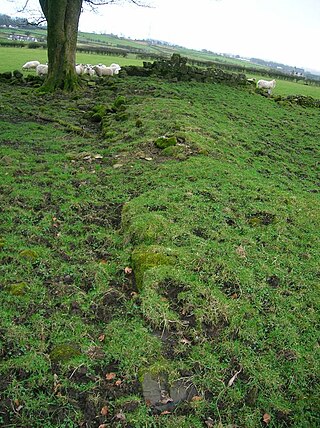
Kilmaurs Castle was located on the lands of Jocksthorn Farm, near Kilmaurs in East Ayrshire, Scotland. It is described by Timothy Pont in the early 17th century as "Ye castell is ane ancient ftronge building belonging to ye Earls of Glencairne environed with a fair park called Carmell wod from ye vatter of Carmell yat runs by it." Dobie goes on to state that "The old baronial manor place is supposed to have been situated about a mile south-east of Kilmaurs, where some ruins can still be pointed out on the farm of Jakisthorn or Jock's-thorn, probably the original Villam de Cuninghame - the first possession of the family." The castle is not to be confused with the later Cunninghame family possession known as Kilmaurs Place which Dobie calls "..comparatively modern" in 1876.

The Barony of Peacockbank was in the old feudal Baillerie of Cunninghame, near Stewarton in what is now East Ayrshire, Scotland.

<span class="mw-page-title-main">The Lands of Lochridge</span>

The Lochridge estate was in the old feudal Baillerie of Cunninghame, near Stewarton in what is now East Ayrshire, Scotland.

<span class="mw-page-title-main">Hill of Beith Castle</span>

The old Barony and castle, fortalice, or tower house of Hill of Beith lay in the feudal Regality of Kilwinning, within the Baillerie of Cunninghame, and the Sherrifdom of Ayr, now the Parish of Beith, North Ayrshire, Scotland.

<span class="mw-page-title-main">Buiston Loch</span> An occasional lake in Ayrshire, Scotland

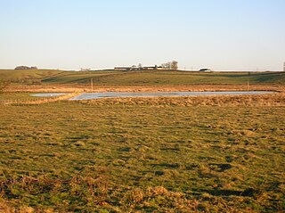
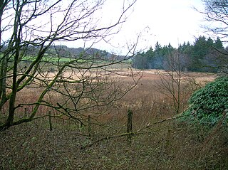
Buiston Loch, also known as Buston, Biston, and Mid Buiston was situated in the mid-Ayrshire clayland at an altitude of 90 m OD. The loch was natural, sitting in a hollow created by glaciation. The loch waters drained via the Garrier Burn that joins the Bracken and Lochridge Burns before joining the River Irvine.

<span class="mw-page-title-main">Halket Loch</span> Body of water

Halket Loch' also known as Halkhead or Halketh, was situated in the mid-Ayrshire clayland near Lugton. It is visible as a surface depression in pastureland, sometimes partially flooded, situated in a low-lying area close to farms and dwellings of East, North and Middle Halket and Craighead in the Parish of Dunlop, East Ayrshire, Scotland. The loch was natural, sitting in a hollow created by glaciation. The loch waters drained via the Glazert Water that joins the Annick Water.

<span class="mw-page-title-main">Littlestane Loch</span> Former lake in Irvine, Scotland

Littlestane Loch, was situated in the mid-Ayrshire clayland near Stanecastle, Irvine, North Ayrshire, Scotland. It is nowadays (2011) only visible as an area of permanent water in the Scottish Wildlife Trust Sourlie Nature Reserve. The loch was natural, sitting in a hollow created by glaciation. The loch waters outflow was via the Red Burn that flows into the River Garnock. The site of Littlestane Loch site is partly built over and much of the site is now public open space lying within the Parish of Girdle Toll.

<span class="mw-page-title-main">Fail Loch</span> Body of water

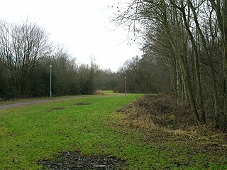
Fail Loch or Faile Loch was situated in a low-lying area near the old monastery of Fail in the Parish of Tarbolton, South Ayrshire, Scotland. The old Lochlea Loch lies nearby and its waters still feed into Fail Loch via the Mill Burn.

<span class="mw-page-title-main">Hessilhead Loch</span> Body of water

Hessilhead Loch or Hazelhead Loch was situated in a low-lying area near the old Castle of Hessilhead in the Parish of Beith, North Ayrshire, Scotland. The old loch, used in the defence of the castle, was probably infilled when the castle ruins were landscaped in the 19th century.

<span class="mw-page-title-main">Knockewart Loch</span> Body of water

Knockewart Loch or Loch Jargon was situated in a hollow lying area beneath Knockewart Hill in the Parish of Ardrossan, North Ayrshire, Scotland. The old loch has become largely drained and overgrown since the late 19th century.

<span class="mw-page-title-main">Blae Loch (Beith)</span> A lake in Ayrshire, Scotland

The Blae Loch is a small freshwater loch situated in a hollow in a low-lying area beneath Blaelochhead Hill in the Parish of Beith, North Ayrshire, Scotland.

<span class="mw-page-title-main">Galrigs Loch (South Ayrshire)</span> Body of water

The Galrigs Loch was a substantial freshwater loch situated in low lying area between Newfield and Dundonald in South Ayrshire, Scotland. It was drained in the early 18th century.

<span class="mw-page-title-main">Murder of Hugh Montgomerie</span>

The Murder of Hugh Montgomerie, 4th Earl of Eglinton at the Annick Ford in Stewarton, East Ayrshire, Scotland, took place in 1586 as a consequence of a long running feud between the Montgomeries, Earls of Eglinton and the Cunninghames, Earls of Glencairn, families who were competing for power and influence locally and nationally. The significant repercussions of this act were felt throughout the county of Ayrshire and beyond. The spelling 'Montgomerie' is used throughout for both the family and Montgomery for the clan and clan and district names 'Cunninghame' in the same fashion.

<span class="mw-page-title-main">Lands of Tour and Kirkland</span> Human settlement in Scotland

The Lands of Tour and Kirkland (NS416406) formed a small estate close to the old Kirktoun and St Maurs-Glencairn collegiate church about 1 km south-east of Kilmaurs, East Ayrshire, Parish of Kilmaurs, Scotland. The word 'Tour' in Scots refers to a 'tower' and 'kirk' to a parish church.

References

Notes
  1. William Roy's Map Retrieved : 2010-12-22
  2. 1 2 McNaught
  3. 1 2 Curling Sites [ permanent dead link ] Retrieved : 2011-03-18
  4. Thomson's Map Retrieved : 2010-12-23
  5. 1 2 National Archives of Scotland. RHP35796/1-5
  6. Blaeu Atlas of Scotland Retrieved 2010-12-23
  7. Ferguson.
  8. Paterson, Page 751
  9. National Archives of Scotland. RHP35796 / 1-5.
  10. Glencairn Papers
  11. MacIntosh, Pages 37 & 39
  12. Dobie, Page 186
  13. Dobie, Page 320
  14. National Archive sof Scotland. RHP/35795 - 35808.
  15. Warrack.
  16. METRO. 28 January 2009. Page 5.
Sources
  1. Dobie, James D. (ed Dobie, J.S.) (1876). Cunninghame, Topographized by Timothy Pont 1604–1608, with continuations and illustrative notices. Glasgow: John Tweed.
  2. Earls of Glencairn papers. (1618) Ref. GD39. Scottish National Archives.
  3. Ferguson, Robert (2005). A Miller's Tale. The Life and Times of Dalgarven Mill. ISBN   0-9550935-0-3.
  4. MacIntosh, Donald (2006). Travels in Galloway. Glasgow : Neil Wilson. ISBN   1-897784-92-9.
  5. Paterson, James (1863–66). History of the Counties of Ayr and Wigton. V. - II - Kyle. Edinburgh: J. Stillie.
  6. Warrack, Alexander (1982)Chambers Scots Dictionar. Chambers. ISBN   0-550-11801-2.