Lambton | |
|---|---|
 | |
| Motto(s): Le jour viendra(French) "The day will come" | |
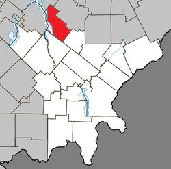 Location within Le Granit RCM | |
 Lambton Location in southern Quebec | |
| Coordinates: 45°50′N71°05′W / 45.83°N 71.08°W [1] | |
| Country | |
| Province | |
| Region | Estrie |
| RCM | Le Granit |
| Constituted | December 23, 1976 |
| Government | |
| • Mayor | Michel Lamontagne |
| • Federal riding | Mégantic—L'Érable |
| • Prov. riding | Mégantic |
| Area | |
• Total | 124.70 km2 (48.15 sq mi) |
| • Land | 108.45 km2 (41.87 sq mi) |
| Population | |
• Total | 1,630 |
| • Density | 15/km2 (39/sq mi) |
| • Pop 2016-2021 | |
| • Dwellings | 1,143 |
| Time zone | UTC−5 (EST) |
| • Summer (DST) | UTC−4 (EDT) |
| Postal code(s) | |
| Area codes | 418 and 581 |
| Highways | |
| Website | www |
Lambton is a municipality of about 1600 people in Le Granit Regional County Municipality in the Estrie region of Quebec, Canada.
Contents
Lambton is mostly rural and agricultural area with some business on the two main roads in town.