Milan, Quebec

Last updated

Milan
MilanQuebec.jpg
Milan Quebec location diagram.png
Location within Le Granit RCM
Canada Southern Quebec location map.png
Red pog.svg
Milan
Location in southern Quebec
Coordinates: 45°36′N71°08′W / 45.600°N 71.133°W / 45.600; -71.133 Coordinates: 45°36′N71°08′W / 45.600°N 71.133°W / 45.600; -71.133 [1]
CountryFlag of Canada (Pantone).svg  Canada
Province Flag of Quebec.svg  Quebec
Region Estrie
RCM Le Granit
Constituted1 June 1948
Named for Milan, Italy [1]
Government
[2]
  MayorClaude Turcotte
   Federal riding Mégantic—L'Érable
   Prov. riding Mégantic
Area
  Total130.80 km2 (50.50 sq mi)
  Land129.44 km2 (49.98 sq mi)
Population
 (2021) [3]
  Total318
  Density2.5/km2 (6/sq mi)
  Pop 2016–2021
Increase2.svg 6.4%
  Dwellings
212
Time zone UTC−5 (EST)
  Summer (DST) UTC−4 (EDT)
Postal code(s)
Area code(s) 819
HighwaysQc214.svg Route 214
Website www.munmilan.qc.ca

Milan is a municipality of about 300 people in Le Granit Regional County Municipality in the Estrie region in Quebec, Canada.

The community was established 1877 by Scottish immigrants from Lewis, and originally known as Marsden. Due to confusion with the township of Marston, the community's name was changed to Milan some years later.

Climate

Climate data for Milan
MonthJanFebMarAprMayJunJulAugSepOctNovDecYear
Record high °C (°F)16
(61)
16
(61)
21.5
(70.7)
28
(82)
30
(86)
31.5
(88.7)
33.3
(91.9)
32.2
(90.0)
30
(86)
26.7
(80.1)
21.7
(71.1)
17.2
(63.0)
33.3
(91.9)
Average high °C (°F)−6.6
(20.1)
−5.1
(22.8)
0.7
(33.3)
7.5
(45.5)
16.1
(61.0)
20.7
(69.3)
22.8
(73.0)
21.5
(70.7)
16.5
(61.7)
10
(50)
2.7
(36.9)
−3.7
(25.3)
8.6
(47.5)
Daily mean °C (°F)−11.9
(10.6)
−10.6
(12.9)
−4.8
(23.4)
2.4
(36.3)
10
(50)
14.8
(58.6)
17.3
(63.1)
16.1
(61.0)
11.3
(52.3)
5.3
(41.5)
−1.3
(29.7)
−8.5
(16.7)
3.3
(37.9)
Average low °C (°F)−17.2
(1.0)
−16
(3)
−10.2
(13.6)
−2.8
(27.0)
3.9
(39.0)
9
(48)
11.7
(53.1)
10.7
(51.3)
6
(43)
0.6
(33.1)
−5.4
(22.3)
−13.3
(8.1)
−1.9
(28.6)
Record low °C (°F)−38.3
(−36.9)
−39
(−38)
−34.5
(−30.1)
−22.8
(−9.0)
−12.2
(10.0)
−2.2
(28.0)
0
(32)
−1.1
(30.0)
−8.5
(16.7)
−12.8
(9.0)
−26
(−15)
−35
(−31)
−39
(−38)
Average precipitation mm (inches)105.8
(4.17)
89.2
(3.51)
101.1
(3.98)
85.8
(3.38)
105.7
(4.16)
127.5
(5.02)
125.9
(4.96)
137.9
(5.43)
115.8
(4.56)
104.7
(4.12)
109.8
(4.32)
113.1
(4.45)
1,322.4
(52.06)
Source: Environment Canada [4]

Related Research Articles

Saint-Éloi, Quebec Parish municipality in Quebec, Canada

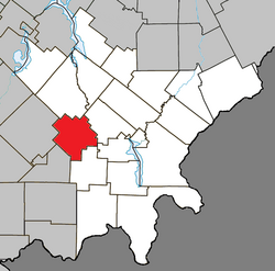
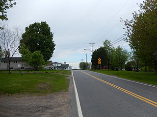
Saint-Éloi is a parish municipality in the region of Bas-Saint-Laurent, Quebec, Canada. Its population was 310 in the Canada 2021 Census.

Kinnears Mills, Quebec Municipality in Quebec, Canada

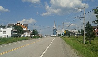
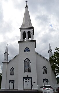
Kinnear's Mills is a municipality located in the Les Appalaches Regional County Municipality in the Chaudière-Appalaches region of Quebec, Canada. Its population was 397 as of the Canada 2021 Census. It is known as the "Village of Churches," as four churches are located close to each other in the village centre.

Saint-Joseph-des-Érables Municipality in Quebec, Canada

Saint-Joseph-des-Érables is a municipality in the Municipalité régionale de comté Robert-Cliche in Quebec, Canada. It is part of the Chaudière-Appalaches region and the population is 377 as of 2021.

Saint-Séverin, Chaudière-Appalaches, Quebec Parish municipality in Quebec, Canada

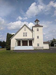
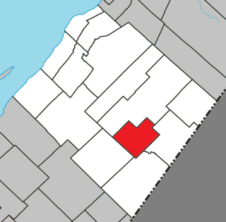
Saint-Séverin is a parish in the Robert-Cliche Regional County Municipality in Quebec, Canada. It is part of the Chaudière-Appalaches region and the population is 300 as of 2021. It is named after Reverend Édouard-Séverin Fafard, founder of the parish in 1864.

Lac-Poulin, Quebec Village municipality in Quebec, Canada

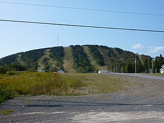
Lac-Poulin is a village in the Beauce-Sartigan Regional County Municipality in the Chaudière-Appalaches region of Quebec, Canada. Its population was 171 as of 2021. Lac-Poulin is an enclave of Saint-Benoît-Labre.

Piopolis, Quebec Municipality in Quebec, Canada

Piopolis is a municipality of about 400 people in Le Granit Regional County Municipality in the Estrie region in Quebec, Canada.

Sainte-Jeanne-dArc, Bas-Saint-Laurent, Quebec Parish municipality in Quebec, Canada

Sainte-Jeanne-d'Arc is a parish municipality in La Mitis Regional County Municipality in the Bas-Saint-Laurent region of Quebec, Canada. Its population in the Canada 2021 Census was 217.

Chartierville Municipality in Quebec, Canada

Chartierville is a small municipality of about 300 people in Le Haut-Saint-François Regional County Municipality, in the Estrie region of Quebec, Canada, on the Canada–United States border.

Saint-Sévère, Quebec Parish municipality in Quebec, Canada

Saint-Sévère is a parish municipality in the Mauricie region of the province of Quebec in Canada.

Lemieux, Quebec Municipality in Quebec, Canada

Lemieux is a municipality in the Centre-du-Québec region of the province of Quebec in Canada.

Parisville, Quebec Parish municipality in Quebec, Canada

Parisville is a parish municipality in the Centre-du-Québec region of the province of Quebec in Canada.

Saint-Marcellin, Quebec Parish municipality in Quebec, Canada

Saint-Marcellin is a parish municipality in the Canadian province of Quebec, located in the Rimouski-Neigette Regional County Municipality.

Saint-Léandre, Quebec Parish municipality in Quebec, Canada

Saint-Léandre is a parish municipality in the Canadian province of Quebec, located in La Matanie Regional County Municipality.

Lac-Tremblant-Nord Municipality in Quebec, Canada

Lac-Tremblant-Nord is a small village and municipality in the Laurentides region of Quebec, Canada, part of the Les Laurentides Regional County Municipality. Its territory surrounds the northern portion of Lake Tremblant, includes Bibite Lake, and extends to Gervais Lake. The village is located on the south shore of the Lake Tremblant, a few kilometers west of the Mont Tremblant Resort.

Mont-Saint-Pierre, Quebec Village municipality in Quebec, Canada

Mont-Saint-Pierre is a village municipality in Quebec, Canada, located in the regional county municipality of La Haute-Gaspésie in the administrative region of Gaspésie–Îles-de-la-Madeleine.

Sainte-Irène, Quebec Parish municipality in Quebec, Canada

Sainte-Irène is a parish municipality in Quebec, Canada. It is where the Quebec French version of King of the Hill takes place.

Saint-Alexandre-des-Lacs Parish municipality in Quebec, Canada

Saint-Alexandre-des-Lacs is a parish municipality in Quebec, Canada.

Saint-Guy, Quebec Municipality in Quebec, Canada

Saint-Guy is a municipality in the Bas-Saint-Laurent region of Quebec, Canada.

Sainte-Félicité, Chaudière-Appalaches, Quebec Municipality in Quebec, Canada

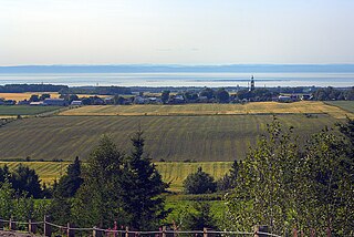
Sainte-Félicité is a municipality in L'Islet Regional County Municipality in the Chaudière-Appalaches region of Quebec. Its population in the Canada 2021 Census was 350.

Saint-Venant-de-Paquette Municipality in Quebec, Canada

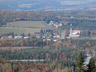
Saint-Venant-de-Paquette is a municipality in Quebec, Canada. The village, founded in 1862, is situated north of East-Hereford, south of St. Malo, and east of Coaticook.

References

  1. 1 2 "Reference number 41064 in Banque de noms de lieux du Québec". toponymie.gouv.qc.ca (in French). Commission de toponymie du Québec.
  2. 1 2 "Geographic code 30040 in the official Répertoire des municipalités". www.mamh.gouv.qc.ca (in French). Ministère des Affaires municipales et de l'Habitation.
  3. 1 2 "Tableau de profil, Profil du recensement, Recensement de la population de 2021". 9 February 2022.
  4. Environment Canada Canadian Climate Normals 1971–2000, accessed 17 July 2010