
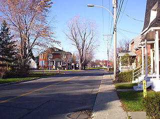
Mascouche is an off-island suburb of Montreal, in southern Quebec, Canada. The city is located on the Mascouche River within the Les Moulins Regional County Municipality and has a population of 51,183, ranking 20th among Quebec municipalities.

Rivière-du-Loup is a small city on the south shore of the Saint Lawrence River in Quebec. The city is the seat for the Rivière-du-Loup Regional County Municipality and the judicial district of Kamouraska. Its one of the largest cities in Bas-Saint-Laurent.
Vaudreuil-Dorion is a suburb of Greater Montreal, in the Montérégie region of southwestern Quebec, Canada. The result of the merger of two towns, Vaudreuil and Dorion, it is located in the Vaudreuil-Soulanges Regional County Municipality.

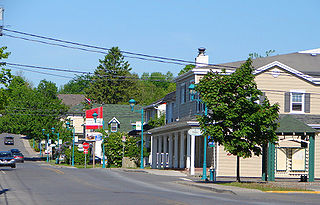
Saint-Jérôme is a suburban city located about 45 kilometres (28 mi) northwest of Montreal on the Rivière du Nord. The town is a gateway to the Laurentian Mountains and its resorts via the Autoroute des Laurentides.
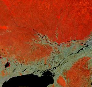
Vaudreuil-Soulanges is a regional county municipality in Quebec, Canada. It is located on a triangular peninsula in the western Montérégie region of Quebec, formed by the confluence of the Ottawa River to the north, and the St. Lawrence River to the south. Ontario is located west of here.

Sainte-Julie, is an off-island suburb of Montreal, in southwestern Quebec, Canada, east of Montreal in Marguerite-D'Youville Regional County Municipality. The population as of the Canada 2021 Census was 30,045. In 2009 Sainte-Julie was called one of the best towns in which to live in Québec.
Saint-Lazare is an off-island suburb of Montreal, in southwestern Quebec, Canada in the Regional County Municipality of Vaudreuil-Soulanges.

Sillery, a former independent city founded in 1637, is one of 35 administrative sectors, which are unincorporated places, located in the post-expansion jurisdiction of the City of Quebec, Quebec, Canada. Sillery was one of multiple self-governing municipalities amalgamated into a vastly expanded Quebec City, that went into legal effect on January 1, 2002, as part of the province-wide 2000–06 municipal reorganization in Quebec. Located alongside in what pre-merger was the southwestern border of Quebec City, Sillery is a constituent district of the borough of Sainte-Foy–Sillery–Cap-Rouge. The territorially expanded City of Quebec consists of six boroughs.

Baie-du-Febvre is a municipality in the Nicolet-Yamaska Regional County Municipality of Quebec, Canada. The population as of the Canada 2021 Census was 961. The municipality lies on the south shore of Lac Saint-Pierre, a section of the Saint Lawrence River.

Matapédia is a municipality at the southern tip of the Gaspé Peninsula, in eastern Quebec, Canada. Matapédia is located along Quebec Route 132 on the border of New Brunswick.

Rivière-à-Claude is a municipality in the Gaspésie-Îles-de-la-Madeleine region of the province of Quebec in Canada. In addition to Rivière-à-Claude itself, the municipality also includes the community of Ruisseau-à-Rebours.

La Bostonnais is a municipality in the Mauricie region of the province of Quebec in Canada. The community is about 10 kilometres (6.2 mi) north of La Tuque's town centre along Quebec Route 155.

Bristol is a municipality in the Ottawa Valley, on the Quebec side in the Outaouais region, part of the Pontiac Regional County Municipality, Quebec, Canada. It is located on the north shore of Lac des Chats across from Arnprior, Ontario.

The Papal Zouaves were an infantry battalion, later regiment, dedicated to the purpose of defending the Papal States. Named after the French zouave regiments, the Zuavi Pontifici were mainly young men, unmarried and Catholic, who volunteered to assist Pope Pius IX in his struggle against the Italian unificationist Risorgimento.

Bouchette is a municipality in the geographic centre of the La Vallée-de-la-Gatineau Regional County Municipality, Quebec, Canada, 75 kilometres (47 mi) north of Gatineau. Its territory is along the shores of Gatineau River and western Thirty-One Mile Lake.

Boileau is a village and municipality in the Outaouais region of Quebec, Canada, part of the Papineau Regional County Municipality. The municipality was known as Ponsonby until 1993.

Saint-Colomban is a city in the regional county municipality of La Rivière-du-Nord in Québec, Canada. It is situated in the Laurentides region of Québec and was named in honour of Saint Columbanus.
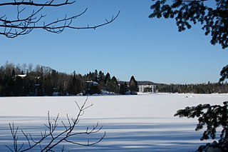
Estérel is a city in Les Pays-d'en-Haut Regional County Municipality in the Laurentides region of Quebec, Canada. The municipal territory almost entirely extends around Lake Masson, whereas the village itself is situated on the eastern shore of this lake.

Sainte-Sophie is a municipality in the Laurentides region of Quebec, Canada, part of the La Rivière-du-Nord Regional County Municipality.

Carleton-sur-Mer is the fifth largest town of the Gaspésie's south shore, in southeastern Quebec, Canada, located on Route 132, along Chaleur Bay. It is the seat of the Avignon Regional County Municipality.


