
Salzburg is an Austrian federal state. In German it is called a Bundesland, a German-to-English dictionary translates that to federal state and the European Commission calls it a province. In German, its official name is Land Salzburg, to distinguish it from its eponymous capital Salzburg. For centuries, it was an independent Prince-Bishopric of the Holy Roman Empire. It borders Germany and Italy.
Ache or Aches may refer to:
Altötting is a Landkreis (district) in Bavaria, Germany. It is bounded by Austria and the Bavarian districts of Traunstein, Mühldorf and Rottal-Inn.

The Inn is a river in Switzerland, Austria and Germany. The 518 km (322 mi) long river is a right tributary of the Danube, being the third largest tributary of the Danube by discharge. The highest point of its drainage basin is the summit of Piz Bernina at 4,049 m (13,284 ft). The Engadine, the valley of the En, is the only Swiss valley whose waters end up in the Black Sea.

The Salzach is a river in Austria and Germany. It is 227 kilometres (141 mi) in length and is a right tributary of the Inn, which eventually joins the Danube. Its drainage basin of 6,829 km2 (2,637 sq mi) comprises large parts of the Northern Limestone and Central Eastern Alps. 83% of its drainage basin lies in Austria, the remainder in Germany (Bavaria). Its largest tributaries are Lammer, Berchtesgadener Ache, Saalach, Sur and Götzinger Achen.
Berchtesgadener Land is a Landkreis (district) in Bavaria, Germany. It is bounded by the district of Traunstein and by the state of Austria.
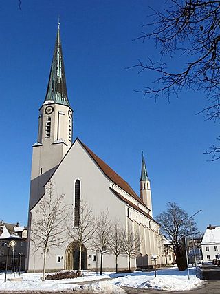
Freilassing, until 1923 Salzburghofen is a town of some 16,000 inhabitants in the southeastern corner of Bavaria, Germany. It belongs to the "Regierungsbezirk" Oberbayern and the "Landkreis" (County) of Berchtesgadener Land. Located very close to the German-Austrian border, Freilassing can be seen as the biggest satellite of Salzburg, the centre of which is eight kilometres away, on the other side of the border.

The Saalach is a 105-kilometre-long (65 mi) river in Austria and Germany, and a left tributary of the Salzach.

The Kitzbühel Alps are a mountain range of the Central Eastern Alps surrounding the town of Kitzbühel in Tyrol, Austria. Geologically they are part of the western slate zone.

Lake Zell is a small freshwater lake in the Austrian Alps. It takes its name from the city of Zell am See, which is located on a small delta protruding into the lake. The lake is 4 kilometres (2.5 mi) long and 1.5 kilometres (0.93 mi) across at its widest. It is up to 73 metres deep and at an elevation of 750 metres above sea level.
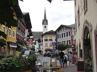
Golling an der Salzach is a market town in the Hallein district of Salzburg, Austria.

Kuchl is a market town in the Hallein district of Salzburg, Austria.
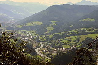
The Salzburg Slate Alps are a mountain range of the Eastern Alps, in the Austrian state of Salzburg. Situated within the greywacke zone, they could be regarded either as part of the Northern Limestone Alps or of the Central Eastern Alps.

The Salzkammergut Mountains are a mountain range of the Northern Limestone Alps, located in the Austrian states of Salzburg and Upper Austria. They are named after the Salzkammergut historic region, part of the Hallstatt-Dachstein / Salzkammergut Cultural Landscape UNESCO World Heritage Site.

Burg Golling is a castle in Golling an der Salzach, in the Austrian state of Salzburg, erected by the Prince-Archbishops of Salzburg in the 13th century. The large fortress is located on a rock above the Salzach valley near the strategically important narrows between the Hagen and Tennen Mountains, at 469 metres (1,539 ft) above sea level.

The Hoher Göll is a 2,522 m (8,274 ft) mountain in the Berchtesgaden Alps. It is the highest peak of the Göll massif, which straddles the border between the German state of Bavaria and the Austrian state of Salzburg.

The Tennen Mountains is a small, but rugged, mountain range in the Northern Limestone Alps, which lies in front of the Eastern Alps for its entire length. It is a very heavily karstified high plateau, about 60 km² in area, with many caves. The range is located in Austria in the district of Salzburg near Bischofshofen.
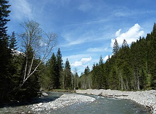
The Fuscher Ache is a river of Salzburg, Austria, a right tributary of the River Salzach.
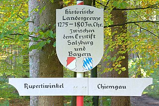
The Rupertiwinkel is a small historic region on the southeastern border of Bavaria, Germany. Part of the Archbishopric of Salzburg until the early 19th century, it is named after the first Salzburg bishop Saint Rupert (c.660–710), apostle to the Duchy of Bavaria.


