| Tennen Mountains | |
|---|---|
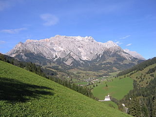
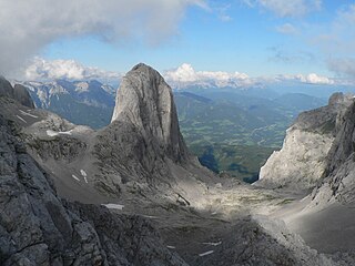
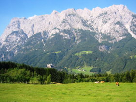
The mighty west face of the Tennen seen from the Hochkönig. | |
| Highest point | |
| Peak | Raucheck |
| Elevation | 2,430 m (7,970 ft) |
| Dimensions | |
| Length | 15 km (9.3 mi) |
| Geography | |
 Tennen Mountains (in red) within the Alps. The borders of the range according to Alpine Club classification of the Eastern Alps | |
| Location | Northern Limestone Alps, Salzburg, Austria |
| Country | Austria |
| Range coordinates | 47°30′N13°14′E / 47.500°N 13.233°E Coordinates: 47°30′N13°14′E / 47.500°N 13.233°E |
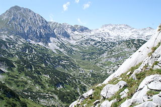
The Tennen Mountains [1] [2] [3] [4] [5] (German : Tennengebirge) is a small, but rugged, mountain range in the Northern Limestone Alps, which lies in front of the Eastern Alps for its entire length. It is a very heavily karstified high plateau, about 60 km² in area, with many caves. The range is located in Austria in the district of Salzburg near Bischofshofen.

German is a West Germanic language that is mainly spoken in Central Europe. It is the most widely spoken and official or co-official language in Germany, Austria, Switzerland, South Tyrol (Italy), the German-speaking Community of Belgium, and Liechtenstein. It is also one of the three official languages of Luxembourg and a co-official language in the Opole Voivodeship in Poland. The languages which are most similar to German are the other members of the West Germanic language branch: Afrikaans, Dutch, English, the Frisian languages, Low German/Low Saxon, Luxembourgish, and Yiddish. There are also strong similarities in vocabulary with Danish, Norwegian and Swedish, although those belong to the North Germanic group. German is the second most widely spoken Germanic language, after English.

The Northern Limestone Alps, also called the Northern Calcareous Alps, are the ranges of the Eastern Alps north of the Central Eastern Alps located in Austria and the adjacent Bavarian lands of southeastern Germany. The distinction from the latter group, where the higher peaks are located, is based on differences in geological composition.

Eastern Alps is the name given to the eastern half of the Alps, usually defined as the area east of a line from Lake Constance and the Alpine Rhine valley up to the Splügen Pass at the Alpine divide and down the Liro River to Lake Como in the south. The peaks and mountain passes are lower compared to the Western Alps, while the range itself is broader and less arched.
Contents
- Extent and neighbouring ranges
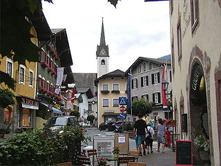
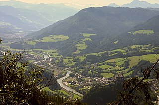
- Valley settlements
- Summit
- Geology
- Caves
- Walking and climbing
- Huts
- Long distance trails
- References
- External links
Some 37 square kilometres of the Tennen plateau are above the 2,000 metre line and that part of the range within the state of Salzburg was turned into a nature reserve in 1982.

A nature reserve is a protected area of importance for flora, fauna or features of geological or other special interest, which is reserved and managed for conservation and to provide special opportunities for study or research. Nature reserves may be designated by government institutions in some countries, or by private landowners, such as charities and research institutions, regardless of nationality. Nature reserves fall into different IUCN categories depending on the level of protection afforded by local laws. Normally it is more strictly protected than a nature park.