Via Alpina

Last updated
Map of the Via Alpina VAkomprimiert.jpg
Map of the Via Alpina

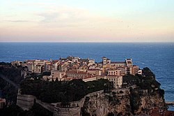
The Via Alpina is a network of five long-distance hiking trails across the alpine regions of Slovenia, Austria, Germany, Liechtenstein, Switzerland, Italy, France, and Monaco. [1] The longest of trails is the red trail, whose termini are in Trieste and Monaco.

Contents

The Via Alpina was created by a group of public and private organisations from the 8 Alpine countries in 2000, receiving EU funding from 2001 until 2008. It was initiated by the Association Grande Traversée des Alpes in Grenoble, which hosted the Via Alpina international secretariat until January 2014, when it was transferred to the International Commission for the Protection of the Alps CIPRA (Liechtenstein). There are national secretariats (hosted by public administrations or hiking associations) in each country. Its aim is to support sustainable development in remote mountain areas and promote the Alpine cultures and cultural exchanges.

Purple trail

Trzic, Slovenia Trzic 09 2009.jpg
Trzic, Slovenia
Lavamund, Austria Lavamuend Ansicht ueber den Drau-Stausee 01012011 233.jpg
Lavamünd, Austria
Maria Alm, Austria Maria Alm P1030641.jpg
Maria Alm, Austria
Oberstdorf, Bavarian Alps, Germany Nebelhorn Oberstdorf.jpg
Oberstdorf, Bavarian Alps, Germany

Yellow Trail

Gorizia, N.E. Italy Gorizia-Gorica.JPG
Gorizia, N.E. Italy
Ovaro (Davar), Italy Davar.jpg
Ovaro (Davar), Italy
Zams anm Inn, Austrian Tyrol Ortsansicht Zams.JPG
Zams anm Inn, Austrian Tyrol

Green Trail

Urnerboden. Switzerland Urnerboden2.jpg
Urnerboden. Switzerland

The Via Alpina green trail follows the Swiss National Route no. 1 (previously known as the Swiss Alpine Pass Route) from Sargans to Lenk, which then continues over a further four passes to Montreux. [2] [3]

Blue Trail

From D11 to D51, coinciding to a large extent with the Piedmontese Grande Traversata delle Alpi (GTA).

Simplon Pass, Switzerland Simplonpass1.JPG
Simplon Pass, Switzerland
Gressoney-St-Jean, N.W. Italy Gressoney-St-Jean - ete.JPG
Gressoney-St-Jean, N.W. Italy
Sospel, Maritime Alps, S.E. France Sospel-la-Bevera-2.jpg
Sospel, Maritime Alps, S.E. France

Red Trail

The longest trail, crossing all 8 countries.

Muggia, Trieste, Italy Muggia z001.JPG
Muggia, Trieste, Italy
Palais de Monaco, the end of the Red Trail Palais de Monaco.jpg
Palais de Monaco, the end of the Red Trail

46°26′16.28″N9°42′42.89″E / 46.4378556°N 9.7119139°E / 46.4378556; 9.7119139

References

  1. "Wandern auf der Via Alpina - Willkommen" . Retrieved 6 April 2016.
  2. "Via Alpina" . Retrieved 6 April 2016.
  3. Reynolds, Kev (2011). "Trek 10 - Alpine Pass Route". Trekking in the Alps. Cicerone. pp. 124–135. ISBN   978 1 85284 600 8.