Marquartstein | |
|---|---|
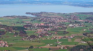
 Aerial view | |
 Coat of arms | |
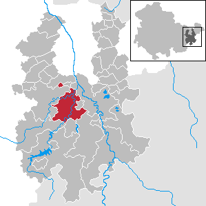
Location of Marquartstein within Traunstein district  | |
 Marquartstein  Marquartstein | |
| Coordinates: 47°45′31″N12°27′42″E / 47.75861°N 12.46167°E Coordinates: 47°45′31″N12°27′42″E / 47.75861°N 12.46167°E | |
| Country | Germany |
| State | Bavaria |
| Admin. region | Oberbayern |
| District | Traunstein |
| Municipal assoc. | Marquartstein |
| Government | |
| • Mayor | Andreas Scheck |
| Area | |
| • Total | 13.4 km2 (5.2 sq mi) |
| Elevation | 530-800 m (−2,090 ft) |
| Population (2017-12-31) [2] | |
| • Total | 3,283 |
| • Density | 250/km2 (630/sq mi) |
| Time zone | CET/CEST (UTC+1/+2) |
| Postal codes | 83250 |
| Dialling codes | 08641 |
| Vehicle registration | TS |
| Website | www.marquartstein.de |
Marquartstein is a municipality in the southeastern part of Bavaria, Germany and is part of the Verwaltungsgemeinschaft Marquartstein and Staudach-Egerndach. It is situated in a region called Chiemgau, approximately 10 km south of Lake Chiemsee between Munich and Salzburg. Most of the area is situated in the valley of the river Tiroler Achen, which separates the village into two parts. Marquartstein is at the edge of the Alps. Its geographical location is 47°46′N12°28′E / 47.767°N 12.467°E .

Bavaria, officially the Free State of Bavaria, is a landlocked federal state of Germany, occupying its southeastern corner. With an area of 70,550.19 square kilometres, Bavaria is the largest German state by land area comprising roughly a fifth of the total land area of Germany. With 13 million inhabitants, it is Germany's second-most-populous state after North Rhine-Westphalia. Bavaria's main cities are Munich and Nuremberg.

Germany, officially the Federal Republic of Germany, is a country in Central and Western Europe, lying between the Baltic and North Seas to the north, and the Alps, Lake Constance and the High Rhine to the south. It borders Denmark to the north, Poland and the Czech Republic to the east, Austria and Switzerland to the south, France to the southwest, and Luxembourg, Belgium and the Netherlands to the west.

Chiemgau is the common name of a geographic area in Upper Bavaria. It refers to the foothills of the Alps between the rivers Inn and Traun, with the Chiemsee at its center. The political districts that contain the Chiemgau are Rosenheim and Traunstein. Wendelstein is the name of a famous mountain close by but not strictly in the Chiemgau, while Kampenwand is actually the most inviting peak south of Chiemsee.
Contents