Lower Austria is one of the nine states of Austria, located in the northeastern corner of the country. Major cities are Amstetten, Krems an der Donau, Wiener Neustadt and Sankt Pölten, which has been the capital of Lower Austria since 1986, replacing Vienna, which became a separate state in 1921. With a land area of 19,186 km2 (7,408 sq mi) and a population of 1.699 million people, Lower Austria is the largest and second-most-populous state in Austria.

The Salzach is a river in Austria and Germany. It is 227 kilometres (141 mi) in length and is a right tributary of the Inn, which eventually joins the Danube. Its drainage basin of 6,829 km2 (2,637 sq mi) comprises large parts of the Northern Limestone and Central Eastern Alps. 83% of its drainage basin lies in Austria, the remainder in Germany (Bavaria). Its largest tributaries are Lammer, Berchtesgadener Ache, Saalach, Sur and Götzinger Achen.
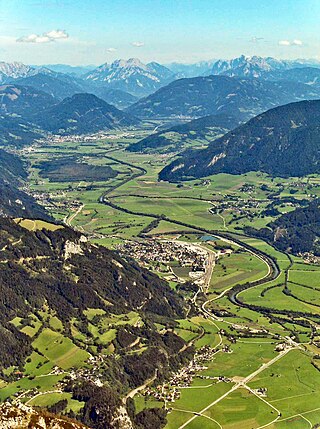
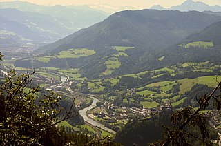
The Enns is a southern tributary of the river Danube in Austria, joining northward at the city of Enns. It forms much of the border between the states of Lower Austria and Upper Austria. The Enns spans 253 kilometres (157 mi), in a flat-J-shape. It flows from its source near the village Flachau, generally eastward through Radstadt, Schladming, and Liezen, then turns north near Hieflau, to flow past Weyer and Ternberg through Steyr, and further north to the Danube at Enns.

The Central Eastern Alps, also referred to as Austrian Central Alps or just Central Alps, comprise the main chain of the Eastern Alps in Austria and the adjacent regions of Switzerland, Liechtenstein, Italy and Slovenia. South of them is the Southern Limestone Alps.

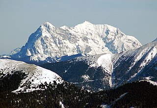
The High Tauern are a mountain range on the main chain of the Central Eastern Alps, comprising the highest peaks east of the Brenner Pass. The crest forms the southern border of the Austrian states of Salzburg, Carinthia and East Tyrol, with a small part in the southwest belongs to the Italian province of South Tyrol. The range includes Austria's highest mountain, the Grossglockner at 3,798 metres (12,461 ft) above the Adriatic.

The Noric Alps is a collective term denoting various mountain ranges of the Eastern Alps. The name derives from the ancient Noricum province of the Roman Empire on the territory of present-day Austria and the adjacent Bavarian and Slovenian area.

The Lower Tauern or Niedere Tauern are a mountain range of the Central Eastern Alps, in the Austrian states of Salzburg and Styria.

The Radstadt Tauern are a subrange of the Central Eastern Alps in Austria. Together with the Schladming Tauern, the Rottenmann and Wölz Tauern and the Seckau Tauern the Radstadt Tauern form the major range of mountains known as the Low Tauern. The mountains are found in the southeast of the Austrian state of Salzburg, between the upper reaches of the Enns and Mur rivers.
The Ennstal Alps, the Alps of the Enns valley, are a mountain range of the Northern Limestone Alps System. They are located primarily in the Austrian state of Styria, and also into the state of Upper Austria.

Radstädter Tauern Pass is a high mountain pass in the Austrian state of Salzburg, connecting the town of Radstadt in the Pongau region with Mauterndorf in Lungau.
The Salzburg Slate Alps are a mountain range of the Eastern Alps, in the Austrian state of Salzburg. Situated within the greywacke zone, they could be regarded either as part of the Northern Limestone Alps or of the Central Eastern Alps.

The Salzkammergut Mountains are a mountain range of the Northern Limestone Alps, located in the Austrian states of Salzburg and Upper Austria. They are named after the Salzkammergut historic region, part of the Hallstatt-Dachstein / Salzkammergut Cultural Landscape UNESCO World Heritage Site.

The Glockner Group is a sub-group of the Austrian Central Alps in the Eastern Alps, and is located in the centre section of the High Tauern on the main chain of the Alps.

The Rax-Schneeberg Group is a mountain range in the Northern Limestone Alps on the Styrian-Lower Austrian border in Austria.

The Tennen Mountains is a small, but rugged, mountain range in the Northern Limestone Alps, which lies in front of the Eastern Alps for its entire length. It is a very heavily karstified high plateau, about 60 km² in area, with many caves. The range is located in Austria in the district of Salzburg near Bischofshofen.

The Ankogel Group is a sub-group of the Central Eastern Alps. Together with the Goldberg Group, the Glockner Group, the Schober Group, the Kreuzeck Group, the Granatspitze Group, the Venediger Group, the Villgraten Mountains and the Rieserferner Group it forms the mountain range of the Hohe Tauern.

The Grimming is an isolated peak in the Dachstein Mountains of Austria and one of the few ultra-prominent mountains of the Alps.

The Goldberg Group is a sub-group of the Hohe Tauern mountain range within the Central Eastern Alps. It is located in Austria, in the states of Salzburg and Carinthia. Its highest peak is the Hocharn, 3,254 m (AA). Other well known summits are the Hoher Sonnblick, with its observatory at 3,106 m above sea level (AA), and the Schareck at 3,123 m above sea level (AA)

The Schladming Tauern are a subrange of the Austrian Central Alps within the Eastern Alps. Together with the Radstadt Tauern, the Rottenmann and Wölz Tauern and the Seckau Tauern the Schladming Tauern form the major range known as the Low Tauern. The mountains are located in Austria in the federal states of Salzburg and Styria. Its highest peak, at 2,862 m is the Hochgolling.
The Nock Mountains are the westernmost and highest mountain range of the Gurktal Alps in Austria, spread over parts of the federal states of Carinthia, Salzburg and Styria. Their appearance is characterised by numerous dome-like and grass-covered summits (Nocken). Their highest peak is the Eisenhut in Styria which reaches an elevation of 2,441 m (8,009 ft) AA.