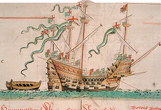
The Mary Rose was a carrack in the English Tudor navy of King Henry VIII. She was launched in 1511 and served for 34 years in several wars against France, Scotland, and Brittany. After being substantially rebuilt in 1536, she saw her last action on 19 July 1545. She led the attack on the galleys of a French invasion fleet, but sank off Spithead in the Solent, the strait north of the Isle of Wight.

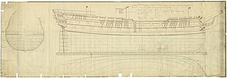
HMS Erebus was a Hecla-class bomb vessel constructed by the Royal Navy in Pembroke dockyard, Wales, in 1826. The vessel was the second in the Royal Navy named after Erebus, the personification of darkness in Greek mythology.

HMS Colossus was a 74-gun third-rate ship of the line of the Royal Navy. She was launched at Gravesend on 4 April 1787 and lost on 10 December 1798. During her years of service she participated in the Battle of Groix, the Battle of Cape St Vincent, and the Battle of the Nile. While carrying wounded from the latter, she was wrecked at the Isles of Scilly. The wreck is a Protected Wreck managed by Historic England.
Red Bay is a fishing village in Labrador, notable as a significant underwater archaeological site in the Americas. Between 1530 and the early 17th century, it was a major Basque whaling area. Several whaling ships, both large galleons and small chalupas, sank there, and their discovery led to the designation of Red Bay in 2013 as a UNESCO World Heritage Site.
The Rooswijk was a ship belonging to the VOC that, according to recent, non-contemporary, news reports, sank in 1740. The wreck is a Protected Wreck managed by Historic England.

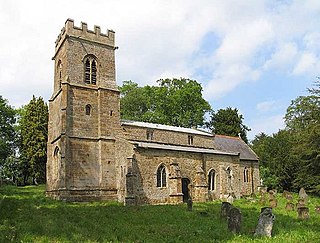
Thenford is a village and civil parish about 5 miles (8 km) northwest of the market town of Brackley in West Northamptonshire, England, and 4 miles (6.4 km) east of Banbury in nearby Oxfordshire. The 2001 Census recorded the parish population as 74. At the 2011 Census the population of the village remained less than 100 and is included in the civil parish of Middleton Cheney.

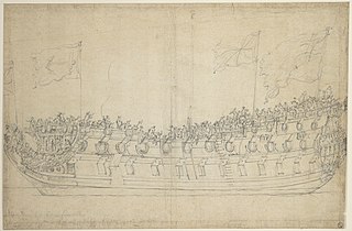
HMS Stirling Castle was a 70-gun third-rate built at Deptford Dockyard, in 1678/79. She was in active commission for the War of the English Succession, fighting in the Battles of Beachy Head and Barfleur. HMS Stirling Castle underwent a rebuild at Chatham Dockyard in 1699. She was in the Cadiz operation in 1702. The ship was wrecked on the Goodwin Sands off Deal on 27 November 1703. The remains are now a Protected Wreck managed by Historic England.
St Anthony or Santo António was a Portuguese carrack that foundered in Gunwalloe Bay, Cornwall, in 1527 en route from Lisbon to Antwerp. She had a mixed cargo including copper and silver ingots. The wreck was recorded historically, because the salvage of the cargo was the subject of an international dispute that led to a Court of Star Chamber, but the location of the wreck was unknown until 1981. The wreck is designated under the Protection of Wrecks Act and is managed by Historic England.
Cattewater Wreck is a wooden three-masted, skeleton-built vessel, one of many ships that have wrecked in Cattewater, Plymouth Sound, England. This wreck is close to the entrance of Sutton Harbour, its name is still unknown but it is believed to be from the 16th century. It is a Protected Wreck managed by Historic England.
The Diamond was a three-masted square rigger, built in New York City in 1823. She was one of the first ships to operate a regular service for passenger and cargo between Britain and the United States. She sank en route to Liverpool from New York on 2 January 1825 in Cardigan Bay. The alleged wreck site was identified in 2000 and was designated under the Protection of Wrecks Act 1973 on 1 April 2002, the first such designation by the National Assembly for Wales. However, the identification has since been called into question.

Langdon Bay is a bay in east Kent, England. It is two miles east of the town of Dover, and is named after the nearby villages of Langdon, East Langdon and West Langdon. The cliffs around it are known as the Langdon Cliffs. A prominent zig-zag path down the cliff-face is visible from the sea and connects with the National Trust path by means of a step ladder. An additional means of exit from the beach being a return on foot to St Margaret's Bay. At the far western end is a restricted area of the Port of Dover, and occasionally walkers will be escorted out by the Dover Port Police.
The Australian Netherlands Committee on Old Dutch Shipwrecks (ANCODS) is an organization tasked with maintaining and allocating artefacts from 17th and 18th century Dutch shipwrecks off the coast of Western Australia. It was founded in 1972 by the Agreement between Australia and the Netherlands Concerning Old Dutch Shipwrecks.
The remains of an unknown wreck were discovered on Church Rocks, off Teignmouth in 1975. The site was designated under the Protection of Wrecks Act on 3 August 1977. The wreck is a Protected Wreck managed by Historic England.
The Erme Estuary wreck is a shipwreck site containing the remains of potentially more than one wreck that was discovered in 1990 on Mary Reef in the Erme Estuary in Dorset. The site was designated under the Protection of Wrecks Act on 1 May 1991. The wreck is a Protected Wreck managed by Historic England.
The remains of an unknown armed cargo vessel dating to the sixteenth to seventeenth century were identified off Dunwich, Suffolk, England in 1993. The site was designated under the Protection of Wrecks Act on 12 July 1994. The wreck is a Protected Wreck managed by Historic England.

The remains of a late sixteenth or early seventeenth century carrack was discovered in Yarmouth Roads, Isle of Wight, England in 1984. The site was designated under the Protection of Wrecks Act on 9 April 1984. The wreck is a Protected Wreck managed by Historic England.

The Rill Cove Wreck is an underwater wreck of a 16th-century Spanish cargo ship lying off the coast of Rill Cove, west of Kynance Cove, in Cornwall, England, UK.

The remains of a wreck carrying cargo of Middle Bronze Age weapons was found in 1977 off Moor Sand, Gammon Head, South Hams, Devon, England. The site was designated under the Protection of Wrecks Act on 14 February 1978. The wreck is a Protected Wreck managed by Historic England
The remains of an eighteenth- to nineteenth-century cargo vessel were discovered in the South Edinburgh Channel, Outer Thames Estuary, northwest of Margate, Kent, England, in 1976. The site was designated under the Protection of Wrecks Act on 29 April 1977. The wreck is a Protected Wreck managed by Historic England.


