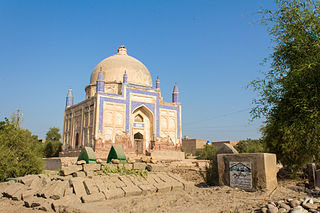
Ratodero is the capital of Ratodero Taluka, a sub-division of Larkana District in the Sindh province of Pakistan. Situated some 28 km from the district capital Larkana. Since the independence of Pakistan, the city is known for its sweet products and handmade caps known as Sindhi topi. At present the principal trade of the town is that of paddy and rice, with many rice mills located here.

Larkana District is a district of the Sindh province of Pakistan. Its largest city is Larkana, which sits on the banks of the Indus River. It is the home district of the influential Bhutto family.

Dadu District, is a district of Sindh Province, Pakistan. With headquarters the city of Dadu, the district was created in 1931 by merging Kotri and Mahal Kohistan tehsils from Karachi District and Mehar, Khairpur Nathan Shah, Dadu, Johi and Sehwan tehsils from Larkana District. In 2004, several talukas in the south were split off to create the new Jamshoro District. Its boundary touches with four districts of Sindh i.e. Jamshoro, Naushahro Feroze, Shaheed Benazirabad and Kamber Shahdadkot.

Jacobabad District is a district in the province of Sindh, Pakistan. According to 2023 Census population of Jacobabad District is 1,174,097 It is located in the north of Sindh, by the provincial boundary with Balochistan. Its headquarters is the town of Jacobabad, which was founded by General John Jacob in 1847.

Qambar Shahdadkot District is a district of Sindh, Pakistan, originally named after Shahdad Khan Khuhawar the official founder. District Qambar Shahdadkot, with headquarters at Qambar, was established on 13 December 2004.

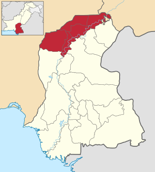
Larkana Division is an administrative division of the Sindh Province of Pakistan. It was created in 1980 by bifurcation of Sukkur Division. In 2000 abolished by General Pervaiz Musharraf rule but Sindh government restored it again on 11 July 2011. CNIC code of Larkana Division is 43.
Larkana is the fourth largest city in Sindh Province, Pakistan. It is located in Larkana District and is a thickly populated city which is growing rapidly. In August 2000, Larkana celebrated its hundredth year of existence.

The Sind Division was the name of an administrative division of British India located in Sindh.

Kahuta Tehsil is one of the seven tehsils (subdivisions) of Rawalpindi District in the Punjab province of Pakistan. The neighbouring tehsil of Kallar Sayedan used to be part of Kahuta, but was later created as separate tehsil. The name Kahuta was derived from "Koh" a local medicinal tree and "Boota".
Ratodero Tehsil is a tehsil, located in the Larkana District in the Sindh province of Pakistan. It is about 28 km from the district capital Larkana. Before the partition of India, the city had a special reputation for its sweet products.
Pir Bakhsh is a village and union council, an administrative subdivision, of Ratodero Taluka in the Sindh province of Pakistan. It is located at 27°45'0N 68°19'60E and lies to the south-east of Ratodero
Haripur Tehsil is a tehsil located in Haripur District, Khyber Pakhtunkhwa, Pakistan. The tehsil is administratively subdivided into 37 Union Councils.

Jacobabad Tehsil is an administrative subdivision (tehsil) of Jacobabad District, Sindh, Pakistan. It is subdivided into 15 Union Councils, 8 of which comprise the capital Jacobabad

Mehar Taluka is an administrative subdivision (taluka) of Dadu District of Hyderabad Division in the Sindh province of Pakistan.According to 2023 Pakistani census Mehar Taluka had 520,559 population, Located on coordinates 27° 10' 41.682'' N67° 49' 25.0104'' E

Hyderabad City Tehsil is an administrative subdivision (tehsil) of Hyderabad District in the Sindh province of Pakistan. Hyderabad district is subdivided into 4 talukas, the Urban area around the capital Hyderabad is part of Hyderabad City Taluka.

Kulachi Tehsil is a tehsil located in Dera Ismail Khan District, Khyber Pakhtunkhwa, Pakistan.
Samaro is a tehsil in the Sindh province of Pakistan. The town is the headquarters of a tehsil of Umarkot District.
Sialkot, is a tehsil located in Sialkot District, Punjab, Pakistan. It is administratively subdivided into 52 Union Councils.
Sanghar Taluka is an administrative subdivision (tehsil) of Sanghar District in the Sindh province of Pakistan, the city of Sanghar is the district headquarter of district Sanghar.
Kalyan taluka is a taluka of the Thane district of Maharashtra in Konkan division. It is located between 19°4' and 19°24'N. and 73°1' and 73°24'E with an area of 276 square miles (710 km2). The capital is the city of Kalyan.


