Laurel is a town in Sussex County, Delaware, United States. The population was 3,708 at the 2010 census. Laurel is part of the Salisbury, Maryland-Delaware Metropolitan Statistical Area. It once hosted the Laurel Blue Hens of the Eastern Shore Baseball League.

Laurel is a city in and the second county seat of Jones County, Mississippi, United States. As of the 2010 census, the city had a population of 18,540. It is located northeast of Ellisville, the first county seat, which contains the first county courthouse. Laurel has the second county courthouse, as there are two judicial districts in Jones County. Laurel is the headquarters of the Jones County Sheriff's Department, which administers in the county.

The Casselman River is a 56.5-mile-long (90.9 km) tributary of the Youghiogheny River in western Maryland and Pennsylvania in the United States.

Yellow Creek State Park is a Pennsylvania state park on 2,981 acres (1,206 ha) in Brush Valley and Cherryhill Townships, Indiana County, Pennsylvania in the United States. The park encompasses parts of Yellow Creek and Little Yellow Creek. The old Kittanning Path goes through the parkland. The park was established in 1963. An additional 159 acres (64 ha) of developed land were purchased in 1982. Yellow Creek Lake, a 720-acre (290 ha) man-made lake, was built in 1969 by an earth and rock dam on Yellow Creek. Yellow Creek State Park is between the boroughs of Ebensburg and Indiana on U.S. Route 422.

Pine Grove Furnace State Park is a protected Pennsylvania area that includes Laurel and Fuller Lakes in Cooke Township of Cumberland County. The Park accommodates various outdoor recreation activities, protects the remains of the Pine Grove Iron Works (1764), and was the site of Laurel Forge (1830), Pine Grove Park (1880s), and a brick plant (1892). The Park is 8 miles (13 km) from exit 37 of Interstate 81 on Pennsylvania Route 233.

Laurel Mountain State Park is a 493-acre (200 ha) Pennsylvania state park in Ligonier Township, Westmoreland County and Jenner Township, Somerset County, Pennsylvania in the United States.

Laurel Hill State Park is a 3,935-acre (1,592 ha) Pennsylvania state park in Jefferson and Middlecreek Townships, Somerset County, Pennsylvania in the United States. Laurel Hill Lake is a 63-acre (25 ha) man-made lake with a dam that was constructed during the Great Depression by the young men of CCC camps SP-8-PA and SP-15-PA. Laurel Hill State Park is 8 miles (13 km) from Interstate 76 just off Pennsylvania Route 31 near Bakersville and on Pennsylvania Route 653 near Trent.
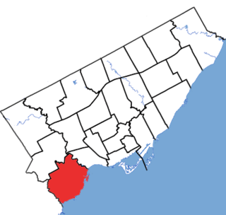
Etobicoke—Lakeshore is a provincial electoral district in Toronto, Ontario, Canada. It elects one member to the Legislative Assembly of Ontario.
The Philadelphia Classic was a golf tournament on the Nationwide Tour. It ran from 1995 to 1997. In 1995 and 1996 it was played at Philmont Country Club in Huntingdon Valley, Pennsylvania. In 1997 it was played at Laurel Creek Country Club in Mt. Laurel, New Jersey.

Laurel Township is one of thirteen townships in Franklin County, Indiana. As of the 2010 census, its population was 1,634.

Little Seneca Lake is a reservoir located near the Boyds community in Montgomery County, Maryland.

Laguna Canyon is the name of a canyon that cuts through the San Joaquin Hills in southern Orange County, California, in the United States, directly south of the city of Irvine. The canyon runs from northeast to southwest, and is drained on the north side by tributaries of San Diego Creek and on the south by Laguna Canyon Creek. It is deeper and more rugged on the southwestern end near Laguna Beach.
Laurel Run is a 4.5-mile-long (7.2 km) tributary stream of Georges Creek in Allegany County, Maryland. The creek rises about 3 miles (4.8 km) northwest of Lonaconing and empties into Georges Creek north of Barton.
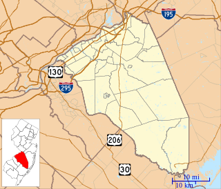
Rancocas Woods is an unincorporated community located within Mount Laurel Township in Burlington County, New Jersey, United States.

Tomkins Mountain is a mountain in the North Carolina High Country, near the community of Deep Gap. The majority of the mountain is within the Blue Ridge Parkway. Its elevation reaches 4,075 feet (1,242 m) and it also marks the corner between Ashe, Watauga, and Wilkes counties.

Laurel Creek is an unincorporated community and coal town in Fayette County, West Virginia, United States.