
The Chippewa River is a stream in the U.S. state of Michigan that runs 91.8 miles (147.7 km) through the central Lower Peninsula. The Chippewa is a tributary of the Tittabawassee River and is thus part of the Saginaw River drainage basin. The river is named after the Chippewa people.
Carp River is a 40.2-mile-long (64.7 km) river in Chippewa and Mackinac counties in the U.S. state of Michigan. 21.7 miles (34.9 km) of the river were added to the National Wild and Scenic Rivers System in 1992.
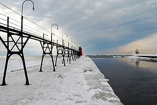
Black River is a 4.2-mile-long (6.8 km) river in the southwest part of the U.S. state of Michigan that empties into Lake Michigan in South Haven at 42°24′08″N86°17′04″W, where it discharges past the South Pier Lighthouse. The river takes its name from the dark brown color of its water, which is caused by suspended sediments and organic materials picked up along its course. The river supports a variety of wildlife including trout, snapping turtles, leeches, and many other varieties of flora and fauna. The Black River watershed encompasses 287 square miles (740 km2) across two counties and 13 townships.

Laurel Township is one of thirteen townships in Franklin County, Indiana. As of the 2010 census, its population was 1,634.

Clear Lake Township is one of twelve townships in Steuben County, Indiana, United States. As of the 2010 census, its population was 799 and it contained 928 housing units. It is the north easternmost township in the state.

The Pine River is a 103-mile-long (166 km) river in the Lower Peninsula of the U.S. state of Michigan. The Pine River is a tributary of the Chippewa River and is thus part of the Saginaw River drainage basin.

Tomkins Mountain is a mountain in the North Carolina High Country, near the community of Deep Gap. The majority of the mountain is within the Blue Ridge Parkway. Its elevation reaches 4,075 feet (1,242 m) and it also marks the corner between Ashe, Watauga, and Wilkes counties.
Rich Mountain is a mountain located in the North Carolina High Country, northwest of the town of Boone. Its elevation reaches 4,741 feet (1,445 m).

Sycamore Creek is a tributary of the Red Cedar River in the state of Michigan in the United States. The stream is 26.5 miles (42.6 km) long and drains an area of 106.1 square miles (275 km2) on the central Lower Peninsula, in and around the city of Lansing. Via the Red Cedar River, it is part of the watershed of the Grand River, which flows to Lake Michigan. Via Lake Michigan and the Great Lakes system, it is part of the larger watershed of the St. Lawrence River.

Mud Lake is a small lake north-northwest of Davenport Center in Delaware County, New York on the border with Otsego County, New York. It drains north via an unnamed creek that flows into the Schenevus Creek.
