
The Harz[haːɐ̯ts] is a Mittelgebirge that has the highest elevations in Northern Germany and its rugged terrain extends across parts of Lower Saxony, Saxony-Anhalt, and Thuringia. The name Harz derives from the Middle High German word Hardt or Hart, Latinized as Hercynia. The Brocken is the highest summit in the Harz with an elevation of 1,141.1 metres (3,744 ft) above sea level. The Wurmberg is the highest peak located entirely within the state of Lower Saxony.
Goslar is a district in Lower Saxony, Germany. It is bounded by the districts of Göttingen, Northeim, Hildesheim and Wolfenbüttel, the city of Salzgitter, and by the states of Saxony-Anhalt and Thuringia (Nordhausen).

Langelsheim is a town in the district of Goslar, in Lower Saxony, Germany.
The Innerste is a river in Lower Saxony, Germany. It is a right tributary of the Leine river and 101 km (63 mi) in length.
The Innerste Uplands is a landscape region up to 359 m high and covering an area of over 900 km² in the northern part of the German Central Uplands. It lies within the eastern part of the Weser-Leine Uplands in Lower Saxony (Germany).
The Langelsheim–Altenau (Oberharz) railway was a railway line, that ran through the Upper Harz in Central Germany. It was also called the Upper Harz Railway or Harz Railway. It was built in order to enable the Magdeburg-Halberstadt Railway Company to access the mines in the Harz mountains.
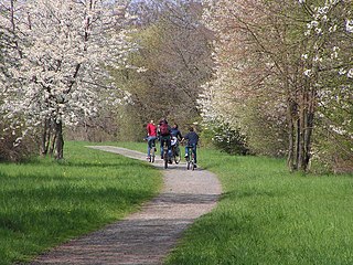
The Weser-Harz-Heide Cycle Route, which is Lower Saxony route no. 5, is a 397 km long-distance cycle path that runs from Hann. Münden, the source of the Weser, over the Harz mountains into the Lüneburg Heath in North Germany.
The Hildesheim Forest is a range of hills up to 359 m above sea level (NN) in the district of Hildesheim in the German state of Lower Saxony.
The Grane is a river of Lower Saxony, Germany. It is a right tributary of the Innerste river near Goslar.

Radau is a river of Lower Saxony, Germany. It is right tributary of the Oker. It rises in the Harz range, leaves the mountains at Bad Harzburg, and discharges into the Oker near Vienenburg.

The Innerste Dam is a dam on the Innerste river, which lies near Langelsheim and Wolfshagen in the Harz mountains. It was built between 1963 and 1966 and belongs to the Harzwasserwerke. Its purposes are the supply of drinking water, flood protection, water flow regulation and hydroelectric power generation. The average annual discharge through the Innerste Dam is 60 million m³.
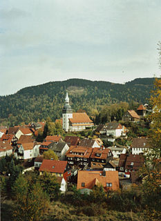
The formerly free mining town (Bergstadt) of Lautenthal in Germany is a state-recognised, climatic spa with around 1,570 inhabitants and has been part of the borough of Langelsheim since 1972.

The Upper Harz refers to the northwestern and higher part of the Harz mountain range in Germany. The exact boundaries of this geographical region may be defined differently depending on the context. In its traditional sense, the term Upper Harz covers the area of the seven historical mining towns (Bergstädte) - Clausthal, Zellerfeld, Andreasberg, Altenau, Lautenthal, Wildemann and Grund - in the present-day German federal state of Lower Saxony. Orographically, it comprises the Harz catchment areas of the Söse, Innerste and Grane, Oker and Abzucht mountain streams, all part of the larger Weser watershed.
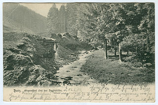
The Zillierbach is a stream in the Harz mountains of central Germany in the state of Saxony-Anhalt. It is about 13 kilometres (8 mi) long. The stream rises on the western side of the Hohneklippen crags and runs initially southwards, then swings northeast at Drei Annen Hohne. South of Drei Annen Hohne it picks up the waters of the Wormsgraben, its main tributary. The Zillierbach supplies the Zillierbach Dam near Elbingerode. In front of the settlement of Voigtstieg it is joined by another two smaller brooks. In the Middle Ages the Zillierbach powered the mills between Voigtstieg and Wernigerode. This section of the valley is still called Mühlental today. In its lower reaches before its mouth the stream is known as the Flutrenne. The stream discharges into the Holtemme at Wernigerode northwest of the West Gate (Westerntor). It drops through a vertical height of almost 400 metres (1,300 ft) from source to mouth.
The Neuekrug-Hahausen–Goslar railway is a double-tracked, non-electrified main line in Lower Saxony in central Germany. The line, which runs along the northern edge of the Harz mountains, begins in Goslar and forms a junction with the Brunswick–Kreiensen railway to Seesen and Kreiensen at Neuekrug-Hahausen. Because the branch-off station is passed through nowadays without stopping, it is often called the Goslar–Seesen railway. It is often described in the local area as the North Harz Line (Nordharzstrecke) but the term may cause confusion. The most important, and now the only, intermediate station is Langelsheim.
The Heber is a hogback ridge, relatively small in area and up to 313.5 metres high, in the Lower Saxon Hills within the districts of Goslar, Northeim and Hildesheim in the German state of Lower Saxony.
The Harplage is a hill range, up to 290 metres high, located west-northwest of the Harz in the southeast of the German state of Lower Saxony.

The Dehnenkopf in the Harz Mountains of central Germany is a summit about 775 m above sea level (NN) near Torfhaus in the unincorporated area of Harz in the county of Goslar in Lower Saxony.

The Hildesheim–Goslar railway is a 53 kilometre long, double-track and non-electrified main line in the northern Harz foothills in the German state of Lower Saxony. It serves mainly to connect with the tourist region in the northern Harz with Hildesheim and Hanover. It is served by the HarzExpress, running between Halle, Halberstadt, Goslar and Hannover Hauptbahnhof. The most important station and junction of the line is Salzgitter-Ringelheim station.
The Vienenburg–Langelsheim railway was a nearly 18-kilometer-long railway along the northern edge of the Harz in the German state of Lower Saxony. It was mainly used for freight traffic. It was opened in 1875, but it lost its importance with the closure of a line connecting to the east as a result of the division of Germany after the Second World War and it is now closed and dismantled.
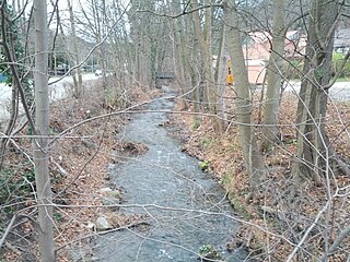
 Laute in the east of Lautenthal
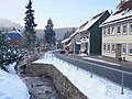 Laute in the middle of Lautenthal
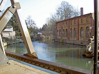
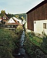
 Former railway bridge over the Laute which discharges into the Innerste (in the foreground)

