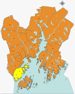
Oddernes is a borough in the municipality of Kristiansand in Vest-Agder county, Norway. The borough covers eastern Kristiansand on the east side of the Topdalsfjorden and the Varodd Bridge. The borough includes the former municipalities of Randesund and Tveit. There was a municipality of Oddernes from 1838 until 1965, but its boundaries were very different from those of the present-day borough.

Hånes is a district in the city of Kristiansand in Vest-Agder county, Norway. It has a population of about 4,000 (2014). Hånes is a part of the borough of Oddernes and it borders the districts of Søm and Randesund to south, the district of Tveit to north, the municipality of Lillesand to east, and the Topdalsfjorden to west. Hånes Church is located in this district.
Hannevika or Hannevig / Hannevik is a neighbourhood in the city of Kristiansand in Vest-Agder county, Norway. It is located in the borough of Grim and in the district of Tinnheia. The neighborhood is located along the European route E39 highway and the start of Norwegian County Road 456. Hannevika is a large industrial area. Glencore and Hennig-Olsen Iskremfabrikk are the two largest industries located there. Hannevika is located southeast of Eigevannskollen, northeast of Kartheia, and south of Kolsberg.

Møvik or Møvig is a neighbourhood in the city of Kristiansand in Vest-Agder county, Norway. The neighborhood is located in the borough of Vågsbygd and in the district of Voiebyen. It's located in the southeast part of the borough along the shore. It lies north of Spinneren and Krooden, southwest of Ternevig, and south of Voie.

Nordtjønnåsen is a neighbourhood in the city of Kristiansand in Vest-Agder county, Norway. It is located in the borough of Vågsbygd and in the district of Vågsbygd. The neighborhood is located in the northwestern corner of the district, south of Slettheia and west of Hasselbakken.

Rona is a neighborhood in the city of Kristiansand in Vest-Agder county, Norway. It is a part of the Oddernes borough and the district of Søm. The neighbourhood is next to European route E18, and spans the Indre Rona strait between Drangsvatna lake and the Topdalsfjorden. The neighborhood of Strømsdalen lies to the north and Strømme lies to the south. The closest school is Strømme Elementary school. All local bus lines goes through Rona.

Strømsdalen is a neighbourhood in the city of Kristiansand in Vest-Agder county, Norway. It is a part of the Oddernes borough and the district of Søm. The neighborhood is next to the European route E18 highway, just southwest of Vigvoll and north of Stromme. The closest school is Strømme Elementary school. All local bus lines bound to Oddernes goes through Strømsdalen. There is a bank and a pizza restaurant at Strømsdalen, other than that Rona is the closest to a centrum.

Vigvoll is a neighborhood in the city of Kristiansand in Vest-Agder county, Norway. It is a part of the Oddernes borough and the district of Hånes. The neighborhood lies north of the European route E18 highway, west of the Norwegian National Road 41, and east of the Topdalsfjorden. Vigvoll skole is the only junior high at Hånes. Bus line M2 goes though Vigvoll continuing to Hånes, Voiebyen, or Sørlandsparken. It includes a small shopping area known locally as Hånni.

Grovikheia is a neighbourhood in the city of Kristiansand in Vest-Agder county, Norway. It is a part of the borough of Oddernes and in the district of Hånes. It is located along the Norwegian National Road 41 and it is north of the Hånni neighborhood and northwest of Lauvåsen. The name Grovikheia comes from the cove Grovika.

Eg is a neighbourhood in the city of Kristiansand in Vest-Agder county, Norway. It is the only neighborhood in the borough that is located outside of the downtown city centre of Kristiansand. The main hospital for all of Southern Norway, Sørlandet Hospital Kristiansand, is located on the north side of Eg. Eg is located between the river Otra and the Baneheia park.
Marvika or Marvik is a neighbourhood in the city of Kristiansand in Vest-Agder county, Norway. The neighbourhood is located in the southeast part of the borough of Lund and the district of Gimlekollen. The neighborhood of Oddemarka lies to the northwest of Marvika.
Fiskåtangen or Fiskå is a neighbourhood and small peninsula in the city of Kristiansand in Vest-Agder county, Norway. It is located in the borough of Vågsbygd and in the district of Slettheia. The islands of Svensholmen and Bragdøya lie to the southeast off the coast of Fiskåtangen. The neighborhood is located to the west of Kjerrheia and north of Lumber. Fiskåtangen has the only junior high for the district of Slettheia. Fiskåtangen has a large industrial area serving Vågsbygd and Kristiansand. The local newspaper Fædrelandsvennen was headquartered at Fiskå before it relocated to Kvadraturen in the summer of 2015.

Gimle is a neighbourhood in the city of Kristiansand in Vest-Agder county, Norway. It's located in the borough of Lund. It is located near the neighborhoods of Oddemarka and Presteheia. The neighborhood of Kjøita lies to the southwest and the neighborhood of Marvika lies to the southeast.
Frikstad is a neighbourhood in the city of Kristiansand in Vest-Agder county, Norway. It's located in the borough of Oddernes and in the district of Randesund. Randesund Church is located at Frikstad. The neighborhoods of Holte and Tømmerstø lie to the southwest and the neighborhood of Kongshavn lies to the southeast.
Løvika is a neighbourhood in the city of Kristiansand in Vest-Agder county, Norway. The neighborhood is located in the borough of Vågsbygd and in the district of Voiebyen. It is located on the northeastern part of the island of Andøya. Løvika is east of Voie and northeast of Ternevig.
Skyllingsheia is a neighbourhood in the city of Kristiansand in Vest-Agder county, Norway. It is located in the borough of Vågsbygd and in the district of Vågsbygd. Skyllingsheia is north of the neighborhood of Auglandsbukta, south of Lumber, and east of central Vågsbygd.
Slettheitoppen or Øvre Slettheia is a neighbourhood in the city of Kristiansand in Vest-Agder county, Norway. It is located in the borough of Vågsbygd and in the district of Slettheia. The neighborhood lies west of Trane and northwest of Nedre Slettheia. The Øvre Slettheia skole is an elementary school in the neighbourhood.

Hamresanden is a 3-kilometre (1.9 mi) long beach in the municipality of Kristiansand in Vest-Agder county, Norway. The sandy beach is located at Hamre in the district of Tveit, along the Topdalsfjorden at the mouth of the river Topdalselva. It is located near Kristiansand Airport, Kjevik. Hamresanden goes from Grovikheia in Hånes to Ve.
Bellevue is a neighbourhood in the city of Kristiansand in Vest-Agder county, Norway. It is located in the borough of Grim and in the district of Grim. Bellevue is southeast of Idda. The European route E18 highway runs along the east side of the neighborhood and the Norwegian National Road 9 runs just north of the neighborhood. National Archival Services of Norway for Southern Norway is located in Bellevue.