Related Research Articles

Arunachal Pradesh is a state in Northeastern India. It was formed from the erstwhile North-East Frontier Agency (NEFA) region, and became a state on 20 February 1987. It borders the states of Assam and Nagaland to the south. It shares international borders with Bhutan in the west, Myanmar in the east, and a disputed border with China in the north at the McMahon Line. Itanagar is the state capital of Arunachal Pradesh. Arunachal Pradesh is the largest of the Seven Sister States of Northeast India by area. Arunachal Pradesh shares a 1,129 km border with China's Tibet Autonomous Region.

Northeast India is the easternmost region of India representing both a geographic and political administrative division of the country. It comprises eight states – Arunachal Pradesh, Assam, Manipur, Meghalaya, Mizoram, Nagaland, Tripura and Sikkim.

Itanagar is the capital and largest town of the Indian state of Arunachal Pradesh. The seat of Arunachal Pradesh Legislative Assembly, the seat of government of Arunachal Pradesh, and the seat of Gauhati High Court permanent bench at Naharlagun are all in Itanagar. Being the hub of all the major economic bases, Itanagar along with the adjacent town of Naharlagun comprising the administrative region of Itanagar Capital Complex Region stretching from the Itanagar Municipal limit at Chandranagar Town extended till Nirjuli Town, is a major junction of Cultural, economic, fashion, education and recreational activities.

The Mishmi or Deng people of Tibet and Arunachal Pradesh are an ethnic group comprising mainly three tribes: Idu Mishmi ; Digaro tribe, and Miju Mishmi. The Mishmis occupy the northeastern tip of the central Arunachal Pradesh in Upper and Lower Dibang Valley, Lohit and Anjaw Districts. The three sub-divisions of the tribe emerged due to the geographical distribution, but racially all the three groups are of the same stock. The Idu are also known as Yidu Lhoba in Tibet and often referred as Chulikatas in Assam. The Idus are primarily concentrated in the Upper Dibang Valley and Lower Dibang Valley district and parts of the northern part of Lohit district of Arunachal Pradesh in India. Taraon, also called Digaru Mishmis, are distributed in the hill and the foothills between the Dibang, Digaru and the Lohit rivers. Kamans are also known as the Miju Mishmis; they live between the Lohit and the Kambang rivers in the foothills and in the Mishmi Hills on both sides of the Lohit river right up to the frontiers to Rima. There are around 30,000 of them in Arunachal Pradesh.

Changlang district (Pron:/tʃæŋˈlæŋ/) is located in the Indian state of Arunachal Pradesh, located south of Lohit district and north of Tirap district. Naga people reside here. As of 2011 it is the second most populous district of Arunachal Pradesh, after Papum Pare. It has become one of the major districts in the area owing to the presence of crude oil, coal and mineral resources other than tourism and hydropower.
Tirap district (Pron:/tɪˈɹæp/) is a district located in the southeastern part of the state of Arunachal Pradesh in India. It shares a state border with Assam, an international border with Myanmar and a district border with Changlang and Longding.

Lohit is an administrative district in the state of Arunachal Pradesh in India. The district headquarters is located at Tezu. As of 2011 it is the third most populous district of Arunachal Pradesh, after Papum Pare and Changlang.

West Siang is an administrative district in the state of Arunachal Pradesh in India.

Mon district (Pron:/mɒn/) is a district of Nagaland, a state in India. It is the third-largest district in Nagaland in terms of area. The district has a population of 250,260 people. Mon Town is the headquarters of the district.
Lazu may refer to several places in Romania:

Anjaw District (Pron:/ˈændʒɔ:/) is an administrative district in the state of Arunachal Pradesh in north-east India. It was created district in 2004, by splitting off from the Lohit district under the Arunachal Pradesh Re-organization of Districts Amendment Act. The district borders China on the north. Hawai, at an altitude of 1296 m above sea level, is the district headquarters, located on the banks of the Lohit River, a tributary of the Brahmaputra River. It is the easternmost district in India. The furthest villages towards the border with China are Dong, Walong, Kibithu and Kaho.

The Lower Dibang Valley district (Pron:/dɪˈbæŋ/) is an administrative district in the state of Arunachal Pradesh in northeastern India. It is the tenth least populous district in the country.
Nocte is a Northern Naga language of northeastern India. Alternate names include Borduria, Jaipuria, Mohongia, Namsangia, Nocte, Nokte, and Paniduria (Ethnologue).
Yumsem Matey is a politician from Lazu Village, Tirap Dist. Arunachal Pradesh, state in India. He is member of Arunachal Pradesh Assembly from Khonsa West in Tirap district. He belong to Indian National congress. First Graduate from OLLO Community, in the year 1992–93, from Government College, Itanagar, Arunachal Pradesh. Served as District Adult Education Officer (DAEO) in Changlang, Changlang District, Arunachal Pradesh.
Vijaynagar is the most remote town and circle headquarters in the Changlang district, Arunachal Pradesh, India.

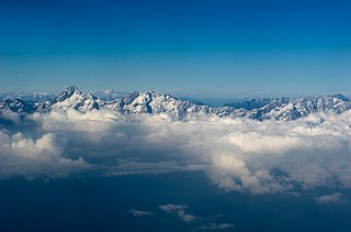
Arunachal Pradesh is land of peanuts in the foothills of the Himalayas in northeast India. It is spread over an area of 83,743 km2 (32,333 sq mi). 98% of the geographical area is land out of which 80% is forest cover; 2% is water. River systems in the region, including those from the higher Himalayas and Patkoi and Arakan Ranges, eventually drain into the Brahmaputra River.
Palin is one of the 60 assembly constituencies of Arunachal Pradesh a north east state of India. It is part of Arunachal East Lok Sabha constituency.
The Ollo tribe are one of the Naga tribes that mostly resides in Arunachal Pradesh, India and some in Naga Self-Administered Zone in Myanmar. They inhabit 12 villages under Lazu circle in Tirap district. However, due to lack of official recognition from Government of Arunachal Pradesh they are considered a sub-tribe of Nocte tribe.
Bameng Legislative Assembly constituency is one of the 60 Legislative Assembly constituencies of Arunachal Pradesh state in India.
Longding-Pumao Legislative Assembly constituency is one of the 60 Legislative Assembly constituencies of Arunachal Pradesh state in India.
References
- ↑ "Lazu village" . Retrieved 26 October 2015.
Coordinates: 26°55′09″N95°30′13″E / 26.91912°N 95.50351°E
| | This article about a location in the Indian state of Arunachal Pradesh is a stub. You can help Wikipedia by expanding it. |