Le Taillefer

Last updated
Le Taillefer
Taillefer lac.jpg
Highest point
Elevation 2,857 m (9,373 ft)
Prominence 1,490 m (4,890 ft) [1]
Coordinates 45°02′22″N5°55′27″E / 45.03944°N 5.92417°E / 45.03944; 5.92417 Coordinates: 45°02′22″N5°55′27″E / 45.03944°N 5.92417°E / 45.03944; 5.92417 [2]
Geography
Alps location map.png
Red triangle with thick white border.svg
Le Taillefer
Parent range Dauphiné Alps
Climbing
First ascent 1848 by Loupot

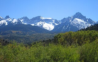
Le Taillefer is a mountain in the Dauphiné Alps, culminating at a height of 2,857 m (9,373 ft). It is located south-east of Grenoble, and is the highest mountain in the Taillefer Massif.

Dauphiné Alps mountain range

The Dauphiné Alps are a group of mountain ranges in southeastern France, west of the main chain of the Alps. Mountain ranges within the Dauphiné Alps include the Massif des Écrins, Belledonne, the Taillefer range and the mountains of Matheysine.

Grenoble Prefecture and commune in Auvergne-Rhône-Alpes, France

Grenoble is a city in southeastern France, at the foot of the French Alps where the river Drac joins the Isère. Located in the Auvergne-Rhône-Alpes region, Grenoble is the capital of the department of Isère and is an important European scientific centre. The city advertises itself as the "Capital of the Alps", due to its size and its proximity to the mountains.

Related Research Articles

Sangre de Cristo Range mountain range

The Sangre de Cristo Range, called the East Range locally in the San Luis Valley, is a high, rugged and narrow mountain range of the Rocky Mountains in southern Colorado in the United States, running north and south along the east side of the Rio Grande Rift. The mountains extend southeast from Poncha Pass for about 75 mi (121 km) through south-central Colorado to La Veta Pass, approximately 20 mi (32 km) west of Walsenburg, and form a high ridge separating the San Luis Valley on the west from the watershed of the Arkansas River on the east. The Sangre de Cristo Range rises over 7,000 ft (2,100 m) above the valleys and plains to the west and northeast.

Fourteener Wikimedia list article

In the mountaineering parlance of the Western United States, a fourteener is a mountain peak with an elevation of at least 14,000 feet. There are 96 fourteeners in the United States, all west of the Mississippi River. Colorado has the most (53) of any single state; Alaska is in second place with 29. Many peak baggers try to climb all fourteeners in the contiguous United States, one particular state, or another region.

Southern Rocky Mountains major subregion of the Rocky Mountains of North America

The Southern Rocky Mountains are a major subregion of the Rocky Mountains of North America located in the southeastern portion of the U.S. state of Wyoming, the central and western portions of Colorado, the northern portion of New Mexico, and extreme eastern portions of Utah. The Southern Rocky Mountains are also commonly known as the Southern Rockies, and since the highest peaks are located in the State of Colorado, they are sometimes known as the Colorado Rockies, although many important ranges and peaks rise in the other three states. The Southern Rockies include the highest mountain ranges of the Rocky Mountains and include all 30 of the highest major peaks of the Rockies.

Mountain peaks of Canada Wikimedia list article

This article comprises three sortable tables of major mountain peaks of Canada.

References

  1. "Le Taillefer -peakbagger.com". peakbagger.com. Retrieved 18 January 2015.
  2. Source : Géoportail avec carte IGN à l'échelle 1:25000