Leesi

Last updated
Leesi
Village
Leesi kylatee.jpg
CountryFlag of Estonia.svg  Estonia
County Harju County
Parish Kuusalu Parish
Time zone UTC+2 (EET)
  Summer (DST) UTC+3 (EEST)

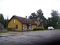
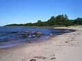
Leesi is a village in Kuusalu Parish, Harju County in northern Estonia, [1] on the territory of Lahemaa National Park. It is located on the Juminda Peninsula.

Related Research Articles

Port Royal, Annapolis County, Nova Scotia

Port Royal is a toponym for a rural intersection on the north bank of the Annapolis Basin about 8 km (5.0 mi) from the town of Annapolis Royal in Annapolis County, Nova Scotia, Canada. It has no legal status in local government. It is the site of the Port-Royal National Historic Site, a replica of an Acadian settlement that existed from 1605 until its destruction by the English in 1613.

Kuusalu Parish Municipality of Estonia in Harju County

Kuusalu Parish is a rural municipality in northern Estonia, the largest in Harju County. After joining with the adjacent Loksa Parish in 2005, the municipality has now a population of 6,863 and covers an area of 707.97 km2 (273.35 sq mi). The population density is 9.7 inhabitants per km2.

Grotenburg-Stadion

The Grotenburg-Stadion is a multi-use stadium in Krefeld, Germany. It is used mostly for football matches and hosts the home matches of KFC Uerdingen 05. The stadium has a capacity of 34,500 and was built in 1927.

Ağın Place in Elazığ, Turkey

Ağın is a town and district of Elazığ Province of Turkey. The mayor is Yılmaz Serttaş Nationalist Movement Party (MHP). The population of the town is 1844 as of 2010.

Underwood, Indiana Unincorporated community in Indiana, United States

Underwood is an unincorporated community in Monroe Township, Clark County, Indiana, United States.

East Baltimore Midway is a neighborhood in the Eastern district of Baltimore, Maryland. Its boundaries are the south side of 25th Street, the east side of Greenmount Avenue, the west side of Harford Road, and the north side of North Avenue.

Młyny, Kuyavian-Pomeranian Voivodeship Village in Kuyavian-Pomeranian Voivodeship, Poland

Młyny is a village in the administrative district of Gmina Strzelno, within Mogilno County, Kuyavian-Pomeranian Voivodeship, in north-central Poland. It lies approximately 5 kilometres (3 mi) south-east of Strzelno, 19 km (12 mi) east of Mogilno, 55 km (34 mi) south-west of Toruń, and 59 km (37 mi) south of Bydgoszcz.

WZWB Radio station in Kenova, West Virginia

WZWB is a radio station broadcasting a sports talk format. The station is an affiliate of Fox Sports Radio. For all programming other than local sporting events, it is a simulcast of WIRO in nearby Ironton, Ohio. Prior to its current format, the station broadcast a Christian religious format known as Joy Radio and was, until January 2007, simulcast with WZZW of Milton, West Virginia.

Juan Perez Sound is a sound off the east coast of Moresby Island in the Queen Charlotte Islands of British Columbia, Canada. It is named for Juan José Pérez Hernández, usually known as Juan Pérez, who was among the first European explorer in the region.

Majewo-Kolonia Settlement in Warmian-Masurian Voivodeship, Poland

Majewo-Kolonia is a settlement in the administrative district of Gmina Milejewo, within Elbląg County, Warmian-Masurian Voivodeship, in northern Poland. It lies approximately 4 kilometres (2 mi) east of Milejewo, 19 km (12 mi) north-east of Elbląg, and 76 km (47 mi) north-west of the regional capital Olsztyn.

Donja Peščanica Village in Nišava, Serbia

Donja Peščanica is a village in the municipality of Aleksinac, Serbia. According to the 2002 census, the village has a population of 122 people.

Kamenica (Aleksinac) Village in Nišava, Serbia

Kamenica is a village in the municipality of Aleksinac, Serbia. According to the 2002 census, the village has a population of 103 people.

Aïn Tagourait Commune and town in Tipaza Province, Algeria

Ain Tagourait is a town and commune in Tipaza Province in northern Algeria.

Ankum is an unincorporated community located in Brunswick County, in the U.S. state of Virginia.

Kafr Laha town in Homs, Syria

Kafr Laha is a town in the Homs Governorate north of Homs in northern Syria. In 2004 it had a population of 20,041 according to the Central Bureau of Statistics of Syria. Its inhabitants are predominantly Sunni Muslims. It is the largest town in the Houla region. Nearby localities include Tallaf to the northeast, Tell Dahab to the north, Aqrab to the northwest, Qarmas and Maryamin to the west, al-Taybah al-Gharbiyah to the southwest and Taldou to the southeast.

The Rivers State Waste Management Agency (RIWAMA) is a government of Rivers State body responsible for the enhancement of the environment with the aim of achieving positive and substantial change in living conditions as well as reducing diseases or health problems in the state. It was created in 2013 by the Rivers State House of Assembly and was assented by the state governor in July 2014. Prior to this, the agency had functioned as "Rivers State Environmental Sanitation Authority (RSESA)" which originally was formed in 1983 to tackle municipal waste and other related issues.

The Dasht-e Khash, also Dasht-e Khash or Dasht-e Khāsh. is a desert in Afghanistan's Nimruz Province. The desert is adjacent to the Dasht-e Margo. It is located at 620 m above sea level.

Lime Kiln Mountain is a long ridge in Taney County in the Ozarks of southern Missouri. The ridge reaches an elevation of 1,330 feet (410 m) at 36°36′13″N92°53′22″W. US Route 160 traverses the ridgeline from Rueter in the southeast to Hilda in the northwest for a distance of approximately 7.5 mi (12.1 km). Cane Creek runs roughly parallel to the ridge along the northeast.

Palaeoxonodon is an extinct genus of Cladotherian mammal from the Middle Jurassic of England and Scotland.

Blessing, Ohio Unincorporated community in Ohio, United States

Blessing is an unincorporated community in Jefferson Township, Fayette County, Ohio, United States. It is located at 39°42′09″N83°36′13″W.

References

  1. "X-GIS(4) Portal". xgis.maaamet.ee. Retrieved 24 July 2021.

Coordinates: 59°36′13″N25°30′00″E / 59.60361°N 25.50000°E / 59.60361; 25.50000