Narva is a municipality and city in Estonia. It is located in the Ida-Viru County, at the eastern extreme point of Estonia, on the west bank of the Narva river which forms the Estonia–Russia international border. With 53,626 inhabitants Narva is Estonia's third largest city after capital Tallinn and Tartu.

Harju County, is one of the fifteen counties of Estonia. It is situated in Northern Estonia, on the southern coast of the Gulf of Finland, and borders Lääne-Viru County to the east, Järva County to the southeast, Rapla County to the south, and Lääne County to the southwest. The capital and largest city of Estonia, Tallinn, is situated in Harju County. Harju County is the largest county in Estonia in terms of population, as almost half (45%) of the Estonia's population lives in Harju County.

Lahemaa National Park is a park in northern Estonia, 70 kilometers east from the capital Tallinn. The Gulf of Finland is to the north of the park and the Tallinn-Narva highway (E20) is to the south. Its area covers 747 km2. It was the first area to be designated a national park of the former Soviet Union. It is the largest park in Estonia and one of Europe's biggest national parks. Its charter calls for the preservation, research and promotion of North-Estonian landscapes, ecosystems, biodiversity and national heritage.

Kadrina Parish is a rural municipality in Lääne-Viru County, northern Estonia. It covers an area of 329.26 km² and has a population of 5,156. The parish has had its current borders since 2005, when Saksi Parish was dissolved and Kiku, Pariisi and Salda villages were merged to Kadrina Parish, the larger part of Saksi Parish was added to Tapa Parish.

European route E20 is a part of the United Nations International E-road network. It runs roughly west–east through Ireland, the United Kingdom, Denmark, Sweden, Estonia, and Russia.

The Battle of Narva Bridgehead was the campaign that stalled the Soviet Estonian operation in the surroundings of the town of Narva for six months. It was the first phase of the Battle of Narva campaign fought at the Eastern Front during World War II, the second phase being the Battle of Tannenberg Line.

The Battle of Narva was a World War II military campaign, lasting from 2 February to 10 August 1944, in which the German Army Detachment "Narwa" and the Soviet Leningrad Front fought for possession of the strategically important Narva Isthmus.
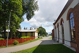
Aegviidu is a borough in Anija Parish, Harju County, Estonia, most known for its picturesque surroundings and hiking trails.

Anija Parish is a rural municipality in the eastern part of Harju County, Estonia.

Kuusalu Parish is a rural municipality in northern Estonia, the largest in Harju County. After joining with the adjacent Loksa Parish in 2005, the municipality has now a population of 6,863 and covers an area of 707.97 km2 (273.35 sq mi). The population density is 9.7 inhabitants per km2.
Kehra is a town in Anija Parish, Harju County, Estonia, most known for its pulp and paper mill.

Lasnamäe is the most populous administrative district of Tallinn, the capital of Estonia. The district's population is about 119,000, the majority of which is Russian-speaking. Local housing is mostly represented by 5–16 stories high panel blocks of flats, built in the 1970–1990s.
The Estonian Open Air Museum is a life-sized reconstruction of an 18th-19th century rural/fishing village, which includes church, tavern, schoolhouse, several mills, a fire station, twelve farmyards and net sheds. Furthermore, it includes a recently opened 20th century Soviet kolkhoz apartment building, and a prefabricated modern wooden house from 2019. The site spans 72 hectares of land and along with the farmyards, old public buildings are arranged singularly and in groups in a way that represents an overview of Estonian vernacular architecture of the past two centuries from across Estonia.

Rakvere Parish is a rural municipality of Estonia, in Lääne-Viru County. Rakvere municipality surrounds the city of Rakvere and is located in north east Estonia. The shape of the municipality resembles to a butterfly. Rakvere Parish is one of the smallest local governments in Estonia in terms of population, being the 54th largest local government.

This is a sub-article to Leningrad–Novgorod Offensive and Battle of Narva.
This is a sub-article to Battle of Narva (1944).
The Narva offensive was an operation conducted by the Soviet Leningrad Front. It was aimed at the conquest of the Narva Isthmus from the German army detachment "Narwa". At the time of the operation, Joseph Stalin, the supreme commander of the Soviet Armed Forces, was personally interested in taking Estonia, viewing it as a precondition to forcing Finland out of the war.
Valgejõe is a village in Kuusalu Parish, Harju County, in northern Estonia. It is located on the crossing of the Tallinn–Narva road and the Valgejõgi River.
Tallinn-Narva maantee is a 212-kilometre-long west-east national main road in Estonia. The road is part of the European route E20. The road forms a major transport west-south transport route between Russia and Europe. The highway starts in Tallinn and passes a number of major Estonian cities and towns, namely Rakvere, Kohtla-Järve, Jõhvi and Sillamäe. The highway ends in Narva on Friendship Bridge, with a border crossing to Russia over the Narva river.