Structure
The organisation’s membership comprises 22,000 young people from a variety of backgrounds, all of whom share an interest in the rural environment. As such, the NFYFC is the largest rural youth organisation of its kind in the UK. The NFYFC’s policies are decided by a National Council, which comprises 120 members and associate members, half of which are elected by the membership to represent their respective county federations.
Within Leicestershire and Rutland Young Farmers there are 11 of the 659 Young Farmers’ Clubs (YFCs) located throughout England and Wales:
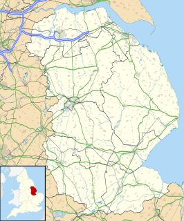
Ashby is a village in Lincolnshire, England. The population of the village is included in the Brumby ward of The North Lincolnshire Unitary Authority.

Enderby is a small town and civil parish in Leicestershire, on the southwest outskirts of the city of Leicester. The parish includes the neighbourhood of St John's, which is east of the village separated from it by the M1 motorway. The 2011 Census recorded the parish's population as 6,314.
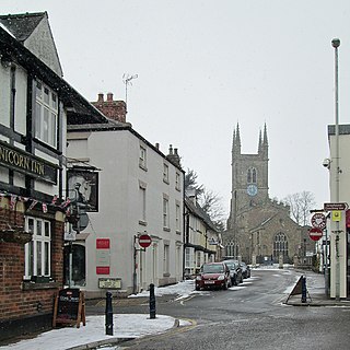
Lutterworth is a market town and civil parish in the Harborough district of Leicestershire, England. The town is located in southern Leicestershire, close to the borders with Warwickshire and Northamptonshire. It is located 6.4 miles north of Rugby, Warwickshire and 12 miles south of Leicester.
Leicestershire and Rutland Young Farmers in turn makes up one fifth of the East Midlands Area of Young Farmers (Derbyshire, Leicestershire, Lincolnshire, Nottinghamshire and Northamptonshire)

The East Midlands is one of nine official regions of England at the first level of NUTS for statistical purposes. It consists of Derbyshire, Leicestershire, Lincolnshire, Northamptonshire, Nottinghamshire and Rutland. The region has an area of 15,627 km2 (6,034 sq mi), with a population over 4.5 million in 2011. There are five main urban centres, Derby, Leicester, Lincoln, Northampton and Nottingham. Others include Boston, Skegness, Chesterfield, Corby, Grantham, Hinckley, Kettering, Loughborough, Mansfield, Newark-on-Trent and Wellingborough.

Derbyshire is a county in the East Midlands of England. A substantial portion of the Peak District National Park lies within Derbyshire, containing the southern extremity of the Pennine range of hills which extend into the north of the county. The county contains part of the National Forest, and borders on Greater Manchester to the northwest, West Yorkshire to the north, South Yorkshire to the northeast, Nottinghamshire to the east, Leicestershire to the southeast, Staffordshire to the west and southwest and Cheshire also to the west. Kinder Scout, at 636 metres (2,087 ft), is the highest point in the county, whilst Trent Meadows, where the River Trent leaves Derbyshire, is its lowest point at 27 metres (89 ft). The River Derwent is the county's longest river at 66 miles (106 km), and runs roughly north to south through the county. In 2003 the Ordnance Survey placed Church Flatts Farm at Coton in the Elms as the furthest point from the sea in Great Britain.

Leicestershire is a landlocked county in the English Midlands. The county borders Nottinghamshire to the north, Lincolnshire to the north-east, Rutland to the east, Northamptonshire to the south-east, Warwickshire to the south-west, Staffordshire to the west, and Derbyshire to the north-west. The border with most of Warwickshire is Watling Street.
Leicestershire and Rutland YFCs current president is Michael Wells, who is supported by Andrew Woodward (the county development officer). The county chairman for 2013/2014 is Rob Kirk of Rearsby YFC who in turn is supported by Greig Farmer, of Market Bosworth YFC.
For information about local Leicestershire clubs contact the county office at Brooksby agricultural college on 01664 434532.

The Borough of Charnwood is a local government district with borough status in the north of Leicestershire, England, which has a population of 166,100 as of the 2011 census. It borders Melton to the east, Harborough to the south east, Leicester and Blaby to the south, Hinckley and Bosworth to the south west, North West Leicestershire to the west and Rushcliffe in Nottinghamshire to the north. It is named after Charnwood Forest, an area which the borough contains much of.

Hinckley and Bosworth is a local government district with borough status in south-western Leicestershire, England, administered by Hinckley and Bosworth Borough Council. Its only towns are Hinckley, Earl Shilton and Market Bosworth. Villages include Barwell, Burbage, Stoke Golding, Groby, Shackerstone and Twycross. The population of the Borough at the 2011 census was 105,078.
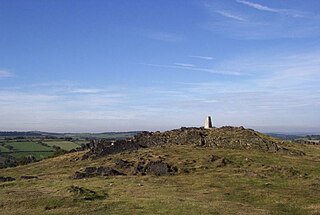
Charnwood Forest is an upland tract in north-western Leicestershire, England, bounded by Leicester, Loughborough and Coalville. The area is undulating, rocky and picturesque, with barren areas. It also has some extensive tracts of woodland; its elevation is generally 600 ft and upwards, the area exceeding this height being about 6,100 acres (25 km2). The highest point, Bardon Hill, is 912 ft. On its western flank lies an abandoned coalfield, with Coalville and other former mining villages, now being regenerated and replanted as part of the National Forest. The M1 motorway, between junctions 22 and 23, cuts through Charnwood Forest.
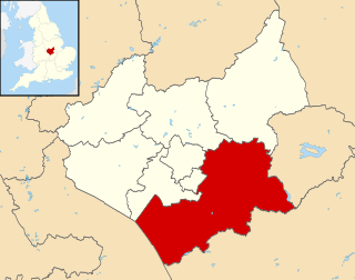
Harborough is a local government district of Leicestershire, England, named after its main town, Market Harborough. Covering 230 square miles (600 km2), the district is by far the largest of the eight district authorities in Leicestershire and covers almost a quarter of the county.
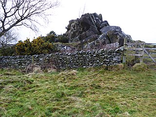
The Leicestershire and Rutland Wildlife Trust (LRWT) is one of 47 wildlife trusts across the United Kingdom. It manages nature reserves in Leicestershire and Rutland, and was founded in 1956 as the Leicestershire and Rutland Trust for Nature Conservation. As of January 2018, it has over 16,000 members, a staff of about 25 and more than 500 volunteers. It is based in Leicester, and is managed by a Council of Trustees which is elected by the members. It is a charity which covers all aspects of nature conservation, and works to protect wild places and wildlife.
YFC may refer to the following:

Bosworth is a constituency represented in the House of Commons of the UK Parliament since 1987 by David Tredinnick of the Conservative Party.

Newtown Linford is a linear village in Leicestershire, England. The population of the civil parish was 1,000 at the 2001 census, including Ulverscroft and increasing to 1,103 at the 2011 census.

Charnwood is a constituency represented in the House of Commons of the UK Parliament since 2015 by Ed Argar of the Conservative Party.
Rearsby is a village and civil parish in the Charnwood district of Leicestershire, England.

Leicestershire County Council is the county council for the English non-metropolitan county of Leicestershire. It was originally formed in 1889 by the Local Government Act 1888. The county is divided into 52 electoral divisions, which return a total of 55 councillors. The council is controlled by the Conservative Party. The leader of the county council is currently Nick Rushton, who was elected to the post in September 2012. The headquarters of the council is County Hall beside the A50 at Glenfield, just outside the city of Leicester in Blaby district.
Rushey Mead Academy, previously known as Rushey Mead School, is a mixed secondary school located in Leicester, Leicestershire, England for students aged 11 to 16. It is part of the Rushey Mead Educational Trust (RMET) which also includes Hamilton Community College. It is the best state-funded secondary school in Leicester and Leicestershire.
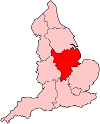
Scouting in East Midlands is about Scouting in the official region of East Midlands. It is largely represented by the Scout Association of the United Kingdom and some Groups of traditional Scouting including the Baden-Powell Scouts' Association.
Rural Youth Europe (RYEurope) is a European Non-Governmental Organisation for rural youth. Founded in 1957, it is an umbrella for European youth organisations working in rural areas. It was established as “European Committee for Young Farmers and 4H Clubs” in Rendsburg, Germany in 1957; the name “Rural Youth Europe” was adopted in 2003.
The Young Farmers' Clubs of Ulster (YFCU) was founded in 1929 by W.S. Armour in Limavady, Northern Ireland. Since its creation, YFCU has grown into an association of 60 local self-governing and youth-led clubs, with a headquarters in Belfast.
Healthcare in Leicestershire is now the responsibility of three Clinical Commissioning Groups covering West Leicestershire, Leicester City and East Leicestershire and Rutland. As far as the NHS is concerned Rutland is generally treated as part of Leicestershire.


