Verden is a Kreis (district) in the centre of Lower Saxony, Germany. Adjoining it are the districts of Osterholz, Rotenburg, Heidekreis, Nienburg and Diepholz, as well as the city of Bremen.

Schaumburg is a district (Landkreis) of Lower Saxony, Germany. It is bounded by the districts of Nienburg, Hanover and Hamelin-Pyrmont, and the state of North Rhine-Westphalia.

Minden-Lübbecke is a Kreis (district) in the northeastern part of North Rhine-Westphalia, Germany. Neighboring districts are Diepholz, Nienburg, Schaumburg, Lippe, Herford, Osnabrück.

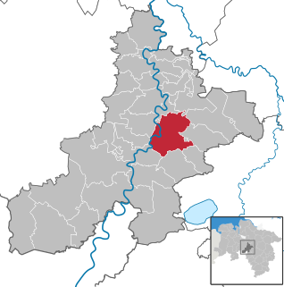
Nienburg is a town and capital of the district Nienburg, in Lower Saxony, Germany.

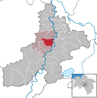
Stolzenau is a municipality in the district of Nienburg, in Lower Saxony, Germany. It is situated on the left bank of the Weser, approx. 20 km southwest of Nienburg, and 25 km northeast of Minden. During the second half of the 20th century, a unit of the Royal Netherlands Air Force was stationed in Stolzenau.

The Bundesstraße 214 is a federal road that runs from Lingen to Brunswick in North Germany.

The Middle Weser Valley is part of the Weser Depression around the River Weser on the North German Plain, extending from the gap of Porta Westfalica to the town of Hoya. It is not a true valley, because it is only bordered by low hills at two points. It lies in the German federal states of Lower Saxony and North Rhine-Westphalia.

The Steinhuder Meer Nature Park, with northwest Germany's largest inland lake, the Steinhuder Meer, at its heart, covers an area of 310 square kilometres (120 sq mi) within the districts of Nienburg and Schaumburg and the region of Hanover. The sponsor of the nature park, founded in 1974, is Hanover Region.

The Weser Depression or Weser Lowlands is the region north of Porta Westfalica in Germany, where the River Weser no longer flows through a valley, but a broad plain consisting of meadows and river terraces.

The Calenberg Land is a historic landscape southwest of Hanover in Germany, roughly formed by the countryside between the Leine and the Deister hills. The name of this region comes from the Principality of Calenberg ruled the area during the Middle Ages with its seat at Calenberg Castle near Pattensen.
The Middle Weser Region includes, in its fullest sense, the land along the Middle Weser between Minden and Bremen. It lies within the federal states of North Rhine-Westphalia, Lower Saxony and Bremen. However, the term is often used just to refer to the Lower Saxon part, because of the different political development of the three states and the cooperative associations formed in Lower Saxony some years ago. The Lower Saxon part of the Middle Weser Region forms the geographical heart of this state. In the centre of the Middle Weser Region are the towns of Minden, Nienburg/Weser and Verden (Aller). In the extreme north, the city of Bremen, which is not part of Lower Saxony, has a very important influence on that area of Lower Saxony surrounding it.

The Lower Saxon Asparagus Road is a tourist route in North Germany that confers recognition of the asparagus as a delicacy in the region. The vegetable is grown in the areas between Brunswick and Lüneburg, between Bremen, Cloppenburg and Vechta, and from Nienburg/Weser via Hoya to Soltau.

The Road of Weser Renaissance is a well-known tourist route in North Germany. As a cultural route it links famous architectural monuments of the Weser Renaissance period in the 16th and early 17th centuries.

The County of Wölpe was the territorial lordship of a noble family in the Middle Ages in the Middle Weser Region near Nienburg/Weser which folded in 1302. The seat of the counts of Wölpe was the castle site at Erichshagen-Wölpe on the Wölpe stream in the borough of Nienburg in north Germany. The castle itself no longer exists.
The Rahden-Diepenau Geest is a natural region in the extreme northeast of North Rhine-Westphalia and in the neighbouring state of Lower Saxony in north Germany. It includes the overwhelmingly gently rolling geest between the Lübbecker Lößland to the south, the Diepholz Moor Depression to the north, the Middle Weser Valley to the east and the western Wiehen Hills and Bersenbrück Land to the west. The Rahden-Diepenau Geest is part of the Dümmer Geest Depression and thus belongs to the North German Plain, although they include foothills of the Central Uplands in the shape of the Stemmer Berge.
Bad Rehburg is a former spa resort in the Rehburg Hills in central Germany. Today Bad Rehburg is a village in the borough of Rehburg-Loccum in the south of the district of Nienburg/Weser in Lower Saxony. The village lies at an elevation of 85 m above NN and has around 800 inhabitants.

The 3rd (Weser-Leine) Armoured Brigade was a brigade in the German Army that was disbanded in 1994. It was headquartered in Nienburg in north Germany. The Brigade's centre of gravity was in eastern Lower Saxony. Its last brigade commander was Colonel Friedrich-Johann von Krusenstiern.
The Dümme Geest Lowland is a natural region unit of the 3rd level in northwest Germany that mainly extends over southwestern Lower Saxony with a small area over the border in North Rhine-Westphalia. Its uniqueness consists in the very varied juxtaposition of different landscape elements of the Northern Lowlands of which the Dümmer Geest Lowland is a part.


