Balge

Last updated
Balge
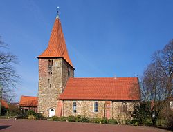
St.-Bartholomaus-Kirche in Balge IMG 0011.jpg
Church in Balge
Wappen-balge.png
Location of Balge within Nienburg/Weser district
Balge in NI.svgHoyaHusumLeeseLiebenauNienburgWarpe
Germany adm location map.svg
Red pog.svg
Balge
Lower Saxony location map.svg
Red pog.svg
Balge
Coordinates: 52°43′10″N09°11′11″E / 52.71944°N 9.18639°E / 52.71944; 9.18639 Coordinates: 52°43′10″N09°11′11″E / 52.71944°N 9.18639°E / 52.71944; 9.18639
Country Germany
State Lower Saxony
District Nienburg/Weser
Municipal assoc. Weser-Aue
Subdivisions10
Government
   Mayor Barbara König-Meyer (SPD)
Area
  Total33.07 km2 (12.77 sq mi)
Elevation
23 m (75 ft)
Population
 (2020-12-31) [1]
  Total1,723
  Density52/km2 (130/sq mi)
Time zone UTC+01:00 (CET)
  Summer (DST) UTC+02:00 (CEST)
Postal codes
31609
Dialling codes 04257, 05021 oder 05022
Vehicle registration NI

Balge is a municipality in the district of Nienburg, in Lower Saxony, Germany, located on the Weser river. The community belongs to the Samtgemeinde Weser-Aue which consists of six municipalities including Balge.

Contents

History

On March 1, 1974 the community of Balge, Blenhorst, Bötenberg, Buchhorst, Holzbalge, Mehlbergen and Sebbenhausen were merged to form a new municipality called Blenhorst. The name was officially changed to Balge on January 23, 1976. [2]

Politics

The local council of governance consists of eleven women counsellors. Including:

Barbara King-Meyer (SPD) is honorary mayor from the community of Balge [3]

Culture and Sites of Interest

Sites

Sports

The sports club in Balge (SV Sebbenhausen / Balge), [6] sponsors several gun clubs, and two marching bands from individual districts.

Economy and Infrastructure

Education

Noteworthy Person

Heinrich Löhmann - (1933 Siebbenhausen). Farmer and author of "Kindheit Auf dem Dorf, Jungend in wechselvoller Zeit" [8]

Related Research Articles

Heidekreis District in Lower Saxony, Germany

Heidekreis is a district (Landkreis) in Lower Saxony, Germany. It is bounded by the districts of Harburg, Lüneburg, Uelzen, Celle, Hanover, Nienburg, Verden and Rotenburg.
Nienburg, Lower Saxony Town in Lower Saxony, Germany

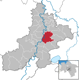
Nienburg is a town and capital of the district Nienburg, in Lower Saxony, Germany.

Ganderkesee Municipality in Lower Saxony, Germany

Ganderkesee is a municipality in Oldenburg district, in Lower Saxony, Germany.

Schwarmstedt Municipality in Lower Saxony, Germany

Schwarmstedt is a municipality in the Heidekreis in Lower Saxony, Germany. It is situated near the confluence of the rivers Aller and Leine, approx. 20 km south of Bad Fallingbostel, and 30 km east of Nienburg. Further districts of the municipality are

Rehburg-Loccum Town in Lower Saxony, Germany

Rehburg-Loccum is a town 50 km north west of Hanover in the district of Nienburg in Lower Saxony, Germany.

Lohne, Germany Town in Lower Saxony, Germany

Lohne (Oldenburg) is a town in the district of Vechta, in Lower Saxony, Germany. It is located approximately 8 km south-west of Vechta. The town lies on the A1 freeway between Bremen and Osnabrück.

Bruchhausen-Vilsen Municipality in Lower Saxony, Germany

Bruchhausen-Vilsen is a municipality in the Diepholz district, in Lower Saxony, Germany. It is situated 38 km (24 mi) southeast of Bremen. The nearby communities of Berxen, Bruchhöfen, Bruchmühlen, Dille, Gehlbergen, Heiligenberg, Homfeld, Nenndorf, Riethausen, Stapelshorn, Wöpse, Oerdinghausen, Scholen, Weseloh, Süstedt and Engeln all belong to Bruchhausen-Vilsen. Bruchhausen-Vilsen is also the seat of the Samtgemeinde Bruchhausen-Vilsen.

Tostedt Municipality in Lower Saxony, Germany

Tostedt is a municipality in the district of Harburg, in Lower Saxony, Germany. It is the central administration of the collective municipality which consists of 9 joint communities.
Eystrup Municipality in Lower Saxony, Germany

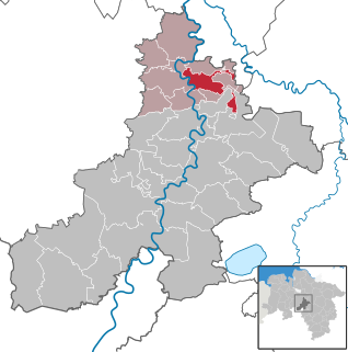
Eystrup is a municipality in the district of Nienburg, in Lower Saxony, Germany. It is situated on the right bank of the Weser, approx. 15 km north of Nienburg, and 15 km south of Verden. Eystrup was the seat of the former Samtgemeinde Eystrup.
Hoya, Germany Town in Lower Saxony, Germany

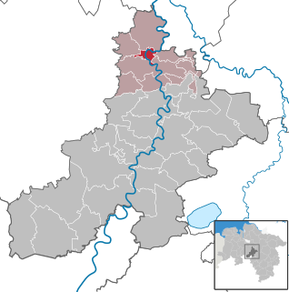
Hoya is a town in the District of Nienburg, in Lower Saxony, Germany. It is situated on the left and right bank of the Weser, approx. 20 km north of Nienburg, and 15 km southwest of Verden.

Landesbergen Municipality in Lower Saxony, Germany

Landesbergen is a municipality in the district of Nienburg, in Lower Saxony, Germany. It is situated on the right bank of the Weser, approx. 10 km southwest of Nienburg, and 35 km northeast of Minden.

Liebenau, Lower Saxony Municipality in Lower Saxony, Germany

Liebenau is a municipality in the district of Nienburg, in Lower Saxony, Germany. It is situated on the left bank of the Weser, approx. 10 km southwest of Nienburg, and 40 km northeast of Minden.
Marklohe Municipality in Lower Saxony, Germany

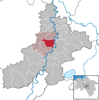
Marklohe is a municipality in Lower Saxony, Germany.

Steimbke Municipality in Lower Saxony, Germany

Steimbke is a municipality in the district Nienburg, in Lower Saxony, Germany. It is situated approximately 12 km east of Nienburg, and 40 km northwest of Hanover, in a swamp and heathland, whereas the Blindesee takes centre stage.

Bodenfelde Municipality in Lower Saxony, Germany

Bodenfelde is a municipality in the district of Northeim, in Lower Saxony, Germany. It is situated on the right bank of the Weser, approx. 35 km north of Kassel, and 30 km northwest of Göttingen at the southwest border of the Solling-Vogler Nature Park.

Stöckse Municipality in Lower Saxony, Germany

Stöckse is a municipality in the district of Nienburg, in Lower Saxony, Germany. It is situated in the forest "Krähe" between Langendamm and Steimbke.

Norheim Municipality in Rhineland-Palatinate, Germany

Norheim is an Ortsgemeinde – a municipality belonging to a Verbandsgemeinde, a kind of collective municipality – in the Bad Kreuznach district in Rhineland-Palatinate, Germany. It belongs to the Verbandsgemeinde of Rüdesheim, whose seat is in the like-named town. Norheim is a state-recognized tourism community (Fremdenverkehrsort). and a winegrowing village.

Lower Saxon Mill Road Holidays street in Lower Saxony

The Lower Saxon Mill Road is a holiday route that guides visitors to watermills and windmills in the north German state of Lower Saxony and thus links the interests of historic monument conservation with those of the tourist industry.
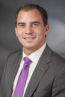
Maik Beermann German politician

Maik Beermann is a German politician Christian Democratic Union (CDU) who served as a member of the German Bundestag from 2013 to 2021.
References

  1. Landesamt für Statistik Niedersachsen, LSN-Online Regionaldatenbank, Tabelle A100001G: Fortschreibung des Bevölkerungsstandes, Stand 31. Dezember 2020.
  2. Statistisches Bundesamt, ed. (1983), Historisches Gemeindeverzeichnis für die Bundesrepublik Deutschland. Namens-, Grenz- und Schlüsselnummernänderungen bei Gemeinden, Kreisen und Regierungsbezirken vom 27. 5. 1970 bis 31. 12. 1982 (in German), Stuttgart und Mainz: W. Kohlhammer, pp. 199 und 200, ISBN   3-17-003263-1
  3. Konstituierende Sitzung des Rates der Gemeinde Balge
  4. Wormuth, Ruediger (2013). Muehlen in Niedersachsen und Bremen, Die Mittelweserregion, Landkreise Diepholz und Nienburg/Weser. Petersberg: Pappband. pp. 167, 168. ISBN   978-3-86568-885-9.
  5. "Mühle - Hof Benther Mühle". Archived from the original on 2016-07-13. Retrieved 2016-07-12.
  6. Website of the SV Sebbenhausen/Balge e.V. 1972
  7. Website of Kindergartens in Balge
  8. "Kindheit auf dem Dorf. Großdruck: Jugend in wechselvoller Zeit 1933-1950". Kindheit auf dem Dorf. Großdruck: Jugend in wechsel voller Zeit 1933-1950.