

The Lengefeld Lime Works (German : Kalkwerk Lengefeld) was a limestone mine southwest of Lengefeld in the Saxon town of Pockau-Lengefeld in the Ore Mountains. In 2016, the mine was closed. [1]


The Lengefeld Lime Works (German : Kalkwerk Lengefeld) was a limestone mine southwest of Lengefeld in the Saxon town of Pockau-Lengefeld in the Ore Mountains. In 2016, the mine was closed. [1]
The Lengefeld deposit is located not far from the B 101 road, in the wood between the Heinzebank and Pockau. The only element of economic value is dolomitic marble, which is categorized lithostratigraphically as part of the Raschau Formation within the Keilberg Group. The material immediately surrounding the deposit comprises Lower Cambrian rock of the Raschau sequence, about 530 to 540 million years old. Feldspar-bearing muscovite mica-schist forms the basis of this sequence in which thin lenses of amphibolite are interspersed. The stratum of dolomitic marble has an average thickness of 50 to 90 metres. Host rocks include garnet-bearing and quartzitic muscovite mica-schist as well as interleaved strata of quartzite schist (Quarzitschiefer). As a result of the Variscan mountain building the once compact body of marble was split into five blocks known as the Altes Lager ("Old Deposit"), Neues Lager ("New Deposit), Tiefes Lager ("Deep Deposit"), Lößnitz-Lager ("Lößnitz Deposit") and Weißer Ofen ("White Kiln"). [2]
The mining of lime from this deposit was first mentioned in a deed of enfeoffment dated 1528. This was a result of lease agreements or was a fiscal deed produced under the direction of the Royal Saxon Forestry Offices. In 1567, the existence of a quarry and two kilns is recorded in a deed of sale by the Barony of Rauenstein to Prince-Elector Augustus. [3] [4]
The rated quantity of lime produced per firing was 280 tons for one of the kilns, and 260 tons for the others. Lime from Lengefeld was used inter alia by the architect (Baumeister), Hans Irmisch, for the construction of Freudenstein Castle in Freiberg. [3]
In the final years of the 17th century, the Scheibenberg pastor and chronicler, Christian Lehmann, praised the production of lime around Lengefeld:
In 2016, the company Geomin closed the mine, because the deposits are exhausted. The processing plant remains in operation for the other quarry of the company in Hammerunterwiesenthal. [1]

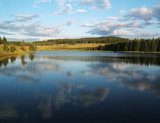
The Ore Mountains lie along the Czech–German border, separating the historical regions of Bohemia in the Czech Republic and Saxony in Germany. The highest peaks are the Klínovec in the Czech Republic at 1,244 metres (4,081 ft) above sea level and the Fichtelberg in Germany at 1,215 metres (3,986 ft).

Ancient Egyptian art refers to art produced in ancient Egypt between the 6th millennium BC and the 4th century AD, spanning from Prehistoric Egypt until the Christianization of Roman Egypt. It includes paintings, sculptures, drawings on papyrus, faience, jewelry, ivories, architecture, and other art media. It was a conservative tradition whose style changed very little over time. Much of the surviving examples comes from tombs and monuments, giving insight into the ancient Egyptian afterlife beliefs.

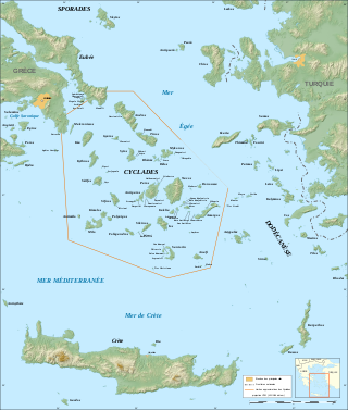
The Cyclades are Greek islands located in the southern part of the Aegean Sea. The archipelago contains some 2,200 islands, islets and rocks; just 33 islands are inhabited. For the ancients, they formed a circle around the sacred island of Delos, hence the name of the archipelago. The best-known are, from north to south and from east to west: Andros, Tinos, Mykonos, Naxos, Amorgos, Syros, Paros and Antiparos, Ios, Santorini, Anafi, Kea, Kythnos, Serifos, Sifnos, Folegandros and Sikinos, Milos and Kimolos; to these can be added the little Cyclades: Irakleia, Schoinoussa, Koufonisi, Keros and Donoussa, as well as Makronisos between Kea and Attica, Gyaros, which lies before Andros, and Polyaigos to the east of Kimolos and Thirassia, before Santorini. At times they were also called by the generic name of Archipelago.

SAG/SDAG Wismut was a uranium mining company in East Germany during the time of the Cold War. It produced a total of 230,400 tonnes of uranium between 1947 and 1990 and made East Germany the fourth largest producer of uranium ore in the world at the time. It was the largest single producer of uranium ore in the entire sphere of control of the USSR. In 1991 after German reunification it was transformed into the Wismut GmbH company, owned by the Federal Republic of Germany, which is now responsible for the restoration and environmental cleanup of the former mining and milling areas. The head office of SDAG Wismut / Wismut GmbH is in Chemnitz-Siegmar.

The history of the architecture of Leipzig extends from the Middle Ages to the 21st century. Numerous typical buildings and valuable cultural monuments from different eras are still preserved or have been rebuilt. Leipzig, Germany, begins its architectural history with several buildings in the Romanesque style. An example of Gothic architecture in Leipzig is the late Gothic hall vault of the Thomaskirche (1482/1496). In the early modern period, the Old Town Hall was expanded in the Renaissance style. The city experienced the peak of urban design and artistic development from around 1870 to 1914 with historicism, Reformarchitektur and Art Nouveau. Numerous trade fair palaces, commercial buildings, representative buildings such as the Imperial Court Building and the new town hall and the arcade galleries known for the city were built. After the First World War, Leipzig became known for its neoclassicism. During the air raids on Leipzig in World War II, large parts of the city center, which was rich in historic buildings, were destroyed. This was followed in the post-war period by (socialist) neoclassicism and modernism.

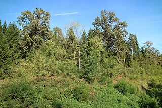
The Kaiserwald is a forest area in the Austrian province of Styria, a few kilometers south-southwest of the provincial capital of Graz. Its geological location, the Kaiserwald Terrace, is a clay-covered glacial gravel plateau above the Grazer field. The clay cap, which in the past enabled a local brick industry, provides a characteristic groundwater hydrology. Botanically, it is a mixed forest with pines and oaks as the dominant trees, providing a habitat for a wide variety of animal species and serving as a princely forest for centuries. The area is also significant for its numerous Roman burial mounds.

Rittersgrün is a district of the municipality of Breitenbrunn/Erzgeb. in the Saxon Erzgebirge district. The scattered settlement with around 1600 inhabitants grew up around several hammer mills, which operated on the course of the Pöhlwasser from the 15th to the 19th century and were supplied with ore from numerous surrounding mines. Due to its location on an important Erzgebirge pass, the settlement was repeatedly plundered by passing mercenaries during the Thirty Years' War. After the decline of the hammer mill industry in the middle of the 19th century, the village's economy was dominated by cardboard and sawmills. In 2007, Rittersgrün was incorporated into Breitenbrunn/Erzgeb. Today, Rittersgrün is primarily known as an excursion and winter sports resort. The main attractions include the Saxon Narrow Gauge Railway Museum and a well-developed network of hiking trails.