Lengenfeld, Austria

Last updated
Lengenfeld
Lengenfeld Krems.JPG
General view of Lengenfeld
AUT Lengenfeld COA.png
Austria adm location map.svg
Red pog.svg
Lengenfeld
Location within Austria
Coordinates: 48°28′N15°35′E / 48.467°N 15.583°E / 48.467; 15.583 Coordinates: 48°28′N15°35′E / 48.467°N 15.583°E / 48.467; 15.583
Country Austria
State Lower Austria
District Krems-Land
Government
   Mayor Christian Kopetzky (SPÖ)
Area
[1]
  Total15.01 km2 (5.80 sq mi)
Elevation
315 m (1,033 ft)
Population
 (2018-01-01) [2]
  Total1,412
  Density94/km2 (240/sq mi)
Time zone UTC+1 (CET)
  Summer (DST) UTC+2 (CEST)
Postal code
3552
Area code 02719
Website www.lengenfeld.at

Lengenfeld is a town in the district of Krems-Land in the Austrian state of Lower Austria.

Population

Historical population
YearPop.±%
19711,188    
19811,186−0.2%
19911,216+2.5%
20011,373+12.9%
20111,448+5.5%
20211,422−1.8%

Related Research Articles

Wolfurt Place in Vorarlberg, Austria

Wolfurt is a municipality in the western Austrian state of Vorarlberg.

Gutenstein, Austria Place in Lower Austria, Austria

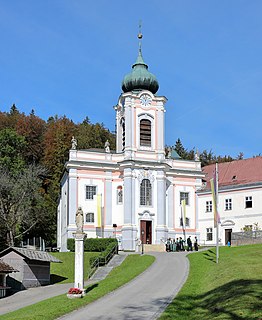
Gutenstein is a market town in Wiener Neustadt-Land in the Austrian state of Lower Austria.

Nenzing Place in Vorarlberg, Austria

Nenzing is a market town in the district of Bludenz in the Austrian state of Vorarlberg.

Bildstein Place in Vorarlberg, Austria

Bildstein is a municipality in the district of Bregenz in the Austrian state of Vorarlberg.

St. Valentin Place in Lower Austria, Austria

St. Valentin is the most westerly town in the district of Amstetten in Lower Austria in Austria.

Herzogenburg Place in Lower Austria, Austria

Herzogenburg is a town in the district of Sankt Pölten-Land in the Austrian state of Lower Austria.

Traismauer is a municipality in the district of Sankt Pölten-Land in Lower Austria, Austria. It was established by the Romans, probably on a location of prior settlements. Some Roman buildings survive to this day.

Bludesch Place in Vorarlberg, Austria

Bludesch is a municipality in the district of Bludenz in the Austrian state of Vorarlberg.

Bürs Place in Vorarlberg, Austria

Bürs is a municipality in the district of Bludenz in the Austrian state of Vorarlberg.

Dalaas Place in Vorarlberg, Austria

Dalaas is a municipality in the district of Bludenz in the Austrian state of Vorarlberg.

Lorüns Place in Vorarlberg, Austria

Lorüns is a municipality in the district of Bludenz in the Austrian state of Vorarlberg.

Ludesch Place in Vorarlberg, Austria

Ludesch is a municipality in the district of Bludenz in the Austrian state of Vorarlberg.

Raggal Place in Vorarlberg, Austria

Raggal is a municipality in the district of Bludenz in the Austrian state of Vorarlberg.

Silbertal Place in Vorarlberg, Austria

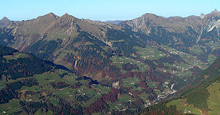
Silbertal is a municipality in the district of Bludenz in the Austrian state of Vorarlberg.

Sonntag, Austria Place in Vorarlberg, Austria

Sonntag is a municipality in the district of Bludenz in the Austrian state of Vorarlberg.

Stallehr Place in Vorarlberg, Austria

Stallehr is a municipality in the district of Bludenz in the Austrian state of Vorarlberg.

Höchst, Austria Place in Vorarlberg, Austria

Höchst is a municipality in the district of Bregenz in the Austrian state of Vorarlberg.

Koblach Place in Vorarlberg, Austria

Koblach is a municipality in the district of Feldkirch in the Austrian state of Vorarlberg.

Schwanenstadt Place in Upper Austria, Austria

Schwanenstadt is a town in the district of Vöcklabruck in the Austrian state of Upper Austria.

Bad Waltersdorf Place in Styria, Austria

Bad Waltersdorf is a municipality in the district of Hartberg-Fürstenfeld in Styria, Austria.

References

  1. "Dauersiedlungsraum der Gemeinden Politischen Bezirke und Bundesländer - Gebietsstand 1.1.2018". Statistics Austria. Retrieved 10 March 2019.
  2. "Einwohnerzahl 1.1.2018 nach Gemeinden mit Status, Gebietsstand 1.1.2018". Statistics Austria. Retrieved 9 March 2019.