Related Research Articles

Crouch End railway station is a former station in the Crouch End area of north London. It was located between Stroud Green station and Highgate station on Crouch End Hill just north of its junction with Hornsey Lane. The station building was located on the road bridge over the railway but only small parts remain of the structure today.

Lennoxtown is a town in East Dunbartonshire council area and the historic county of Stirlingshire, Scotland at the foot of the Campsie Fells, which are just to the north. The town had a population of 4,094 at the 2011 UK Census.

Thorntonhall railway station is a railway station in the village of Thorntonhall, South Lanarkshire, Scotland. The station is managed by ScotRail and is on the Glasgow South Western Line, 8+1⁄2 miles (13.7 km) south of Glasgow Central.

Strathblane is a village and parish in the registration county of Stirlingshire, situated in the southwestern part of the Stirling council area, in central Scotland. It lies at the foothills of the Campsie Fells and the Kilpatrick Hills on the Blane Water, 12 miles (19 km) north of Glasgow, 14 miles (23 km) east-southeast of Dumbarton, and 20 miles (32 km) southwest of Stirling. Strathblane is a dormitory village for Greater Glasgow, and has a total resident population of 1,811.
The Glasgow to Aberfoyle Line was a railway line in Scotland, built in stages, leaving the Edinburgh and Glasgow Railway near Lenzie. Tourist traffic was a dominant part of the motivation for building the line, and road tours to the Trossachs from Aberfoyle formed a significant part of the traffic.

Sandon railway station was a railway station opened by the North Staffordshire Railway to serve the village of Sandon, Staffordshire, England.
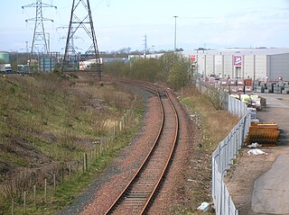
Riccarton and Craigie was an unopened railway station serving the village of Riccarton and the distant hamlet of Craigie, both in East Ayrshire, Scotland. Built in 1902 and originally just called Riccarton, it was renamed in 1905.
Milton of Campsie is a village formerly in the county of Stirlingshire, but now in East Dunbartonshire, Scotland roughly 10 miles (16 km) north of Glasgow. Nestling at the foot of the Campsie Fells, it is neighboured by Kirkintilloch and Lennoxtown.
The Strathendrick and Aberfoyle Railway was a railway line in Scotland.

The Blane Valley Railway was a railway line in Scotland to the east of Glasgow. It is now closed. In 1891 the railway company was absorbed by the North British Railway, which had operated the line and been a major shareholder from the start. When NBR took over the line was in a poor state. The goods shed was inadequate for the amount of traffic, the only crane was too small and siding accommodation was deficient. There was considerable potential for the transportation of cattle in the area but there were no facilities in place. Capital was invested and the line transformed. The locomotives were cleaned and the stations given a makeover. Close attention was given to the cleanliness of staff and the neatness of their uniforms. The railway was the only means of transport for the people living in the area and was a source of much pride. In 1923 following the grouping it became part of London and North Eastern Railway. Following nationalisation in 1947, it was taken over by British Railways. Unable to compete in the face of road competition, the line was closed to passengers in 1951 and closed completely in 1959.

Dumgoyne railway station served the village of Killearn, Stirling, Scotland from 1867 to 1951 on the Blane Valley Railway.
Killearn railway station served the village of Killearn, Stirling, Scotland from 1882 to 1951 on the Blane Valley Railway.

Blanefield railway station served the village of Blanefield, Stirling, Scotland from 1867 to 1959 on the Blane Valley Railway.
Strathblane railway station served the village of Strathblane, Stirling, Scotland from 1867 to 1951 on the Blane Valley Railway.
Campsie Glen railway station served the village of Clachan of Campsie, East Dunbartonshire, Scotland from 1867 to 1951 on the Blane Valley Railway; the village was in Stirlingshire during the period of operation of the station.
Lennoxtown railway station served the town of Lennoxtown, Dunbartonshire, Scotland from 1848 to 1881 on the Blane Valley Railway.
Fenay Bridge and Lepton railway station served the villages of Lepton and Fenay Bridge, West Riding of Yorkshire, England, from 1867 to 1965 on the Kirkburton Branch.
Killay railway station served the suburb of Killay, in the historical county of Glamorganshire, Wales, from 1867 to 1964 on the Llanelly Railway.
Hownes Gill railway station served the town of Consett, County Durham, England, from 1845 to 1858 on the Stanhope and Tyne Railway.
Melling railway station served the village of Melling, Lancashire, England, from 1867 to 1952 on the Furness and Midland Joint Railway.