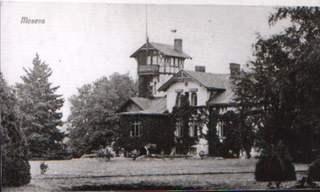
Szczepów is a village in the administrative district of Gmina Żukowice, within Głogów County, Lower Silesian Voivodeship, in south-western Poland. Prior to 1945 it was in Germany. It lies approximately 8 kilometres (5 mi) west of Żukowice, 14 km (9 mi) west of Głogów, and 101 km (63 mi) north-west of the regional capital Wrocław.
Hyōgo Station is a railway station in Hyōgo-ku, Kobe, Hyōgo Prefecture, Japan, operated by the West Japan Railway Company.

Milewo is a village in the administrative district of Gmina Nowe, within Świecie County, Kuyavian-Pomeranian Voivodeship, in north-central Poland. It lies approximately 5 kilometres (3 mi) north-west of Nowe, 32 km (20 mi) north-east of Świecie, 71 km (44 mi) north of Toruń, and 76 km (47 mi) north-east of Bydgoszcz.

Aleksandrowo is a village in the administrative district of Gmina Brześć Kujawski, within Włocławek County, Kuyavian-Pomeranian Voivodeship, in north-central Poland. It lies approximately 8 kilometres (5 mi) north of Brześć Kujawski, 13 km (8 mi) west of Włocławek, and 44 km (27 mi) south-east of Toruń.

Annopol Mały is a village in the administrative district of Gmina Czerniewice, within Tomaszów Mazowiecki County, Łódź Voivodeship, in central Poland. It lies approximately 4 kilometres (2 mi) north-west of Czerniewice, 19 km (12 mi) north of Tomaszów Mazowiecki, and 47 km (29 mi) east of the regional capital Łódź.

Laskowiec is a village in the administrative district of Gmina Zduńska Wola, within Zduńska Wola County, Łódź Voivodeship, in central Poland. It lies approximately 13 kilometres (8 mi) north-west of Zduńska Wola and 46 km (29 mi) west of the regional capital Łódź.

Zborowskie is a village in the administrative district of Gmina Zduńska Wola, within Zduńska Wola County, Łódź Voivodeship, in central Poland. It lies approximately 13 kilometres (8 mi) north-west of Zduńska Wola and 46 km (29 mi) west of the regional capital Łódź.

Wilczoruda-Parcela is a village in the administrative district of Gmina Pniewy, within Grójec County, Masovian Voivodeship, in east-central Poland. It lies approximately 14 kilometres (9 mi) west of Grójec and 43 km (27 mi) south-west of Warsaw.

Grabina is a village in the administrative district of Gmina Łąck, within Płock County, Masovian Voivodeship, in east-central Poland. It lies approximately 4 kilometres (2 mi) north-east of Łąck, 9 km (6 mi) south of Płock, and 96 km (60 mi) west of Warsaw.
Gładczyn is a village in the administrative district of Gmina Zatory, within Pułtusk County, Masovian Voivodeship, in east-central Poland.
Morzyczyn-Włóki is a village in the administrative district of Gmina Sadowne, within Węgrów County, Masovian Voivodeship, in east-central Poland.

Mieleszyn is a village in Gniezno County, Greater Poland Voivodeship, in west-central Poland. It is the seat of the gmina called Gmina Mieleszyn. It lies approximately 17 kilometres (11 mi) north-west of Gniezno and 50 km (31 mi) north-east of the regional capital Poznań.

Józefowo is a village in the administrative district of Gmina Babiak, within Koło County, Greater Poland Voivodeship, in west-central Poland. It lies approximately 3 kilometres (2 mi) north of Babiak, 19 km (12 mi) north of Koło, and 120 km (75 mi) east of the regional capital Poznań.
Zalesie is a village in the administrative district of Gmina Ostrów Wielkopolski within Ostrów Wielkopolski County, Greater Poland Voivodeship in west-central Poland.
Brzozów is a village in the administrative district of Gmina Gubin, within Krosno Odrzańskie County, Lubusz Voivodeship, in western Poland, close to the German border.

Marianowo is a settlement in the administrative district of Gmina Międzyrzecz, within Międzyrzecz County, Lubusz Voivodeship, in western Poland. It lies approximately 7 kilometres (4 mi) north-east of Międzyrzecz, 41 km (25 mi) south-east of Gorzów Wielkopolski, and 61 km (38 mi) north of Zielona Góra.

Mazanki is a village in the administrative district of Gmina Zalewo, within Iława County, Warmian-Masurian Voivodeship, in northern Poland.

Suchlica is a village in the administrative district of Gmina Dębno, within Myślibórz County, West Pomeranian Voivodeship, in north-western Poland. It lies approximately 7 kilometres (4 mi) south of Dębno, 32 km (20 mi) south-west of Myślibórz, and 83 km (52 mi) south of the regional capital Szczecin.

Crestomere is an unincorporated community in central Alberta in Ponoka County, located on Highway 53, 45 kilometres (28 mi) north of Red Deer.
Mathiasberg is a hill of Brandenburg, Germany.


