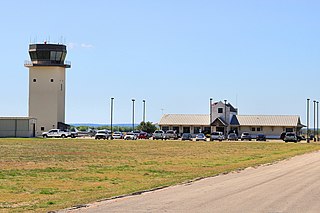
Robert Gray Army Airfield is a military joint-use airport that operates alongside Killeen–Fort Hood Regional Airport. The airport is based inside the south end of the Fort Hood Military Reservation, six nautical miles southwest of the central business district of Killeen, Texas, in unincorporated Bell County.
Lancaster Regional Airport is two miles south of Lancaster, in Dallas County, Texas. Formerly Lancaster Airport, the National Plan of Integrated Airport Systems for 2011–2015 categorized it as a general aviation reliever airport.

New Braunfels National Airport is a public use airport in Guadalupe County, Texas, United States. It is owned by the city of New Braunfels and located four nautical miles east of its central business district. Formerly known as New Braunfels Regional Airport, it is included in the National Plan of Integrated Airport Systems for 2011–2015, which categorized it as a general aviation facility.

Scholes International Airport at Galveston is three miles southwest of Galveston, in Galveston County, Texas, United States. The National Plan of Integrated Airport Systems for 2011–2015 categorized it as a reliever airport.

TSTC Waco Airport is a public use airport located eight nautical miles northeast of the central business district of Waco, a city in McLennan County, Texas, United States. Before 1968, it was known as James Connally Air Force Base. The airport is owned by Texas State Technical College. It is included in the National Plan of Integrated Airport Systems for 2021–2025, which categorized it as a general aviation facility.
Lida Junction Airport is a public use airport located 14 nautical miles south of the central business district of Goldfield, in Esmeralda County, Nevada, United States. The airport is owned by the United States Bureau of Land Management.

Naval Outlying Landing Field Summerdale is an uncontrolled military use airport located in Summerdale, a town in Baldwin County, Alabama, United States. It is under the operational control of NAS Whiting Field and is used for flying training.
Georgetown Executive Airport is in Williamson County, Texas, three miles north of Georgetown. The FAA's National Plan of Integrated Airport Systems for 2023–2027 categorized it as a reliever airport.
Jaffrey Airport–Silver Ranch is a public use airport in Cheshire County, New Hampshire, United States. It is owned by the Jaffrey Municipal Airport Development Corp. and is located one nautical mile (1.85 km) southeast of the central business district of Jaffrey, New Hampshire. It is included in the Federal Aviation Administration (FAA) National Plan of Integrated Airport Systems for 2017–2021, in which it is categorized as a general aviation facility.
Littlefield Municipal Airport is three miles west of Littlefield, in Lamb County, Texas.
Decatur Municipal Airport is a city-owned public airport two miles (3.7 km) north of Decatur, in Wise County, Texas.

Magnolia Municipal Airport is three miles southeast of Magnolia, in Columbia County, Arkansas.
Livingston Municipal Airport is a city-owned, public-use airport located five nautical miles southwest of the central business district of Livingston, a city in Polk County, Texas, United States. According to the FAA's National Plan of Integrated Airport Systems for 2009–2013, it is categorized as a general aviation facility.

Bruce Brothers Huntsville Regional Airport, also known as Huntsville Municipal Airport, is a city-owned, public-use airport located two nautical miles (4 km) northwest of the central business district of Huntsville, a city in Walker County, Texas, United States. It is included in the National Plan of Integrated Airport Systems for 2011–2015, which categorized it as a general aviation facility.

Milwrick Flying "M" Airport is a privately owned, public use airport located three nautical miles (6 km) northeast of the central business district of Lincoln, a village in Alcona County, Michigan, United States. It was formerly known as Flying "M" Ranch Airport.
Pronger Bros. Ranch Airport is a privately owned, public use airport located eight nautical miles southwest of the central business district of Stratford, in Sherman County, Texas, United States.
Cluck Ranch Airport is a privately owned, public use airport in Sherman County, Texas, United States. It is located 17 nautical miles southwest of the central business district of Gruver, a city in Hansford County.
Glen Beicker Ranch Airport is a privately owned, public use airport located 10 nautical miles east of the central business district of Seguin, a city in Guadalupe County, Texas, United States.
Plateau Sky Ranch Airport is a privately owned, public use airport located one nautical mile (2 km) northwest of the central business district of Edinburg, in Saratoga County, New York, United States.
Lazy G Bar Ranch Airport is a privately owned public airport in Decatur, Wise County, Texas, United States, located approximately 5 nautical miles (9.3 km) northeast of the central business district. The airport has no IATA or ICAO designation.


