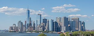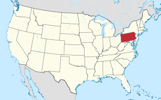
The Mid-Atlantic is a region of the United States located in the overlap between the Northeastern and Southeastern states of the United States. Its exact definition differs upon source, but the region typically includes Delaware, the District of Columbia, Maryland, New Jersey, New York, Pennsylvania, Virginia, and West Virginia with other sources including or excluding other states or areas in the Northeast and Southeast. The region has its origin in the Middle Colonies of the 18th century, its states being among the Thirteen Colonies of pre-revolutionary British America. As of the 2020 census, the region had a population of 60,783,913, representing slightly over 18% of the nation's population.

The Middle Colonies were a subset of the Thirteen Colonies in British America, located between the New England Colonies and the Southern Colonies. Along with the Chesapeake Colonies, this area now roughly makes up the Mid-Atlantic states.

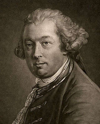
Thomas Pownall was a British colonial official and politician. He was governor of the Province of Massachusetts Bay from 1757 to 1760, and afterwards sat in the House of Commons from 1767 to 1780. He travelled widely in the North American colonies prior to the American Revolutionary War, opposed Parliamentary attempts to tax the colonies, and was a minority advocate of colonial positions until the Revolution.

Events from the year 1755 in Canada.
Thomas Godfrey was a glazier and self-taught mathematician and astronomer in the Pennsylvania Colony, who invented the octant in 1730. A similar octant was also independently invented about the same time by John Hadley in London with Hadley receiving the greater share of the credit for development.

Christ Church Burial Ground in Philadelphia is an important early-American cemetery. It is the final resting place of Benjamin Franklin and his wife, Deborah. Four other signers of the Declaration of Independence are buried here, Benjamin Rush, Francis Hopkinson, Joseph Hewes, and George Ross. Two additional signers of the Declaration of Independence, James Wilson and Robert Morris, are buried at Christ Church just a few blocks away.
Thomas Holme (1624–1695) was the first surveyor general of the colonial-era Province of Pennsylvania. He laid out the first and original plan for the city of Philadelphia. Holme was a member of the Valiant Sixty, a group of early leaders and activists in the Religious Society of Friends, known as the Quakers.

The Boston Gazette (1719–1798) was a newspaper published in Boston, in the British North American colonies. It was a weekly newspaper established by William Brooker, who was just appointed Postmaster of Boston, with its first issue released on December 21, 1719. The Boston Gazette is widely considered the most influential newspaper in early American history, especially in the years leading up to and into the American Revolution. In 1741 the Boston Gazette incorporated the New-England Weekly Journal, founded by Samuel Kneeland, and became the Boston-Gazette, or New-England Weekly Journal. Contributors included: Samuel Adams, Paul Revere, Phyllis Wheatley.

The Mitchell Map is a map made by John Mitchell (1711–1768), which was reprinted several times during the second half of the 18th century. The map, formally titled A map of the British and French dominions in North America &c., was used as a primary map source during the Treaty of Paris for defining the boundaries of the newly independent United States. The map remained important for resolving border disputes between the United States and Canada as recently as the 1980s dispute over the Gulf of Maine fisheries. The Mitchell Map is the most comprehensive map of eastern North America made during the colonial era. Its size is about 6.5 feet (2.0 m) wide by 4.5 feet (1.4 m) high.
Joshua Fisher was a prominent Philadelphia merchant involved in transatlantic trade and mapmaking as applied to nautical charts. He made the first nautical chart of the Delaware River and Delaware Bay, and established the first merchant packet line between London and Philadelphia.
William Coleman was a merchant, lawyer, municipal official, and judge in colonial Philadelphia.
Corson Inlet is a narrow strait on the southern coast of New Jersey in the United States.

William Goddard was an early American patriot, publisher, printer and postal inspector. Born in New London, Connecticut, Goddard lived through the American Revolution and American Revolutionary War, during which he opposed British rule of the colonies through his actions and publications. He was a major figure in the development of the colonial postal system, which became the U.S. Post Office after the American Revolution.
Townsends Inlet is an inlet connecting Townsend Sound with the Atlantic Ocean in Cape May County, New Jersey.
Cape May Inlet is an inlet in southeastern Cape May County, New Jersey.

Turtle Gut Inlet was an inlet located in what is now Wildwood Crest, in Cape May County, New Jersey, United States.

James Turner was an American silversmith and engraver, active in Boston and Philadelphia.

Kuskusky, also known as the Kuskuskies Towns, Kuskuskie Towns, or Kuskuskies' Indian Town, with a wide variety of other spellings, were several Native American communities inhabited near New Castle, Mahoning, and Edinburg, Pennsylvania, and Youngstown, Ohio, during the mid-18th century. It was not one town, but three or four contiguous towns of the Mingoes, Lenape, and Seneca, located along the Beaver River, at and above the junction of its east and west branches, the Mahoning River and the Shenango River. It is usually referred to in the plural.

Shannopin's Town, or Shannopintown, was an 18th-century Lenape (Delaware) town located within the site of modern-day Pittsburgh, Pennsylvania, along the Allegheny River, approximately two miles east from its junction with the Monongahela River. In the early 1700s, British colonial settlers began spreading into western Pennsylvania, forcing Lenape and other American Indian tribes to move further west, settling in the Ohio Country. Shannopin's Town was one of several communities established in western Pennsylvania in the 1720s. The town was largely abandoned during the construction of Fort Duquesne in 1754, although a small community still existed when General John Forbes' troops arrived in September 1758. The community was gone by the time construction on Fort Pitt was started in 1759.


