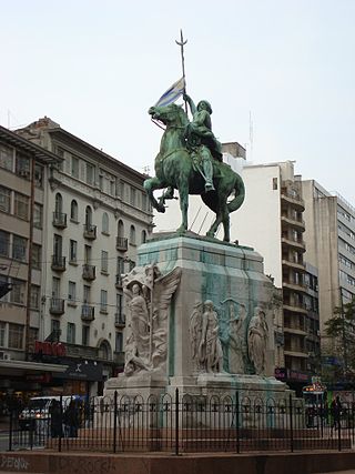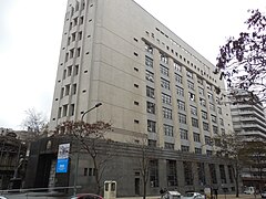
Montevideo is the capital and largest city of Uruguay. According to the 2011 census, the city proper has a population of 1,319,108 in an area of 201 square kilometers (78 sq mi). Montevideo is situated on the southern coast of the country, on the northeastern bank of the Río de la Plata.

José Gervasio Artigas Arnal was a soldier and statesman who is regarded as a national hero in Uruguay and the father of Uruguayan nationhood.

Recoleta is a barrio or neighborhood of Buenos Aires, Argentina, located in the northern part of the city, by the Río de la Plata. The area is perhaps best known to be the home of the distinguished Recoleta Cemetery. It is a traditional upper-class and conservative neighborhood with some of the priciest real estate in the city, known for Paris-style townhouses, lavish former palaces and posh boutiques.

Brazo Oriental is a barrio of Montevideo, the capital of Uruguay. Brazo Oriental is a residential zone located approximately 5 kilometres (3.1 mi) from Montevideo's centre.

ANCAP is a state-owned company in Uruguay. It is involved in the production of petroleum products, Portland cement and alcoholic beverages. It operates Uruguay's single oil refinery at La Teja with a capacity of 50,000-barrel (7,900 m3) per day. ANCAP has a long-term corporate credit rating "BB-" with positive outlook by Standard & Poor's.

Centro is a barrio of Montevideo, Uruguay. Its main axis is 18 de Julio Avenue, and it runs between Plaza Independencia and Ejido St, being the central business district.

Plaza Independencia is the most important city square in Montevideo, Uruguay, laid out in the 19th century in the area occupied by the Citadel of Montevideo. In its center is a monument to General José Gervasio Artigas, and below it, his mausoleum.

Avenida 18 de Julio, or 18 de Julio Avenue, is the most important avenue in Montevideo, Uruguay. It is named after the date on which the country's first Constitution was sworn in, on July 18, 1830.

Artigas Boulevard is a boulevard in Montevideo, Uruguay. It runs from the Rambla at Punta Carretas to the Rambla at Capurro-Bella Vista, going north for about 6.5 kilometers and turning 100° west. It is an important connection road, linking the central barrios of the city, with access to different national routes.

The Rambla of Montevideo is an avenue that goes all along the coastline of Montevideo, Uruguay. At a length of over 22.2 uninterrupted kilometres (13.7 mi), the promenade runs along the Río de la Plata and continues down the entire coast of Montevideo. Since all the southern departments of Uruguay are against either the Río de la Plata or the Atlantic Ocean, they all have ramblas as well. The Rambla is an integral part of Montevidean identity and has been proposed as a World Heritage site.

Tres Cruces is a barrio of Montevideo, Uruguay. Its name means "three crossings", referring to the three major transportation routes which intersect in the area: Avenida 18 de Julio, Bulevar Artigas and Avenida 8 de Octubre. It is also the starting point of Italia Avenue.

Tourism in Uruguay is an important part of the nation's economy.

Aguada is a barrio of Montevideo, Uruguay. Its name indicates water flow and originates from the springs and well it used to have which supplied the original city and the boats with drinking water.

Cordón is a central barrio of Montevideo, Uruguay, located East of the Centro. Its main avenue is 18 de Julio Avenue.

Bella Vista is a barrio of Montevideo, Uruguay and part of the Capurro / Bella Vista composite barrio, with Artigas Boulevard separating the two.

Leonardo Garet is a Uruguayan writer, teacher, and member of the National Academy of Uruguay.

Avenida 8 de Octubre is one of the main thoroughfares of Montevideo, Uruguay, extending 3.5 miles from Tres Cruces at the intersection with 18 de Julio Avenue to Maroñas, where it turns into Camino Maldonado.

Plaza Fabini, or Plaza Ingeniero Juan Pedro Fabini, also known as Plaza del Entrevero, is a square of the Uruguayan capital, Montevideo. It is located on Montevideo's main avenue, 18 de Julio Avenue, in the barrio of Centro and on its north side starts Libertador Avenue.

The State Insurance Bank is a government-owned insurance company in Uruguay. Established on 27 December 1911, it operates under the Ministry of Economy and Finance, and is controlled by the Court of Accounts and the Central Bank. It is an Autonomous State Entity with commercial and social purposes, as a state-owned enterprise with high decentralization.

Democracy Square is a road junction and public space in barrio Tres Cruces of Montevideo, Uruguay.


