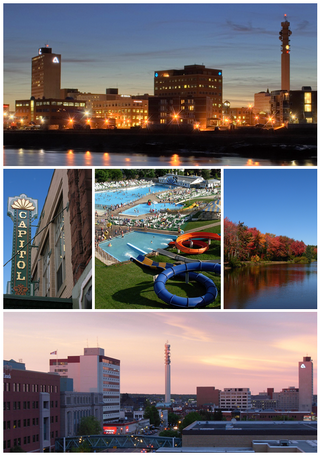
Moncton is the most populous city in the Canadian province of New Brunswick. Situated in the Petitcodiac River Valley, Moncton lies at the geographic centre of the Maritime Provinces. The city has earned the nickname "Hub City" because of its central inland location in the region and its history as a railway and land transportation hub for the Maritimes. As of the 2021 Census, the city had a population of 79,470. The metropolitan population in 2022 was 171,608, making it the fastest growing CMA in Canada for the year with a growth rate of 5.3%. Its land area is 140.67 km2 (54.31 sq mi).

New Brunswick is one of the thirteen provinces and territories of Canada. It is one of the three Maritime provinces and one of the four Atlantic provinces. It is the only province with both English and French as its official languages.

Aroostook County is a county in the U.S. state of Maine along the Canada–U.S. border. As of the 2020 census, the population was 67,105. Its county seat is Houlton, with offices in Caribou and Fort Kent.

Bathurst is the largest City in Northern New Brunswick with a population of 12,157 and the 4th largest metropolitan Area in New Brunswick as defined by Census Canada with a population of 31,387 as of 2021. The City of Bathurst overlooks Nepisiguit Bay, part of Chaleur Bay and is at the estuary of the Nepisiguit River.

Restigouche County is located in north-central New Brunswick, Canada. The county is named for the Restigouche River which flows through the county and is famous for its salmon pools, which have attracted wealthy American and Canadian tourists to the region's summer colonies for decades. Forestry dominates the local economy.
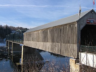
Florenceville-Bristol is an unincorporated community in the northwestern part of Carleton County, New Brunswick, Canada along the Saint John River. It held town status prior to 2023.

Campobello Island is the largest and only inhabited island in Campobello, a civil parish in southwestern New Brunswick, Canada, near the border with Maine, United States. The island's permanent population in 2021 was 949. It is the site of the Roosevelt Campobello International Park and of Herring Cove Provincial Park.

Gagetown is an unincorporated community in Queens County, New Brunswick, Canada. It held village status prior to 2023. It is on the west bank of the Saint John River and is the county's shire town.

The Saint John River is a 673 kilometres (418 mi) long river that flows from Northern Maine into Canada, and runs south along the western side of New Brunswick, emptying into the Atlantic Ocean in the Bay of Fundy. Eastern Canada's longest river, its drainage basin is one of the largest on the east coast at about 55,000 square kilometres (21,000 sq mi).
Dalhousie is an unincorporated community in the town of Heron Bay, New Brunswick, Canada. It held town status prior to 2023. New Brunswick's northernmost point of land is situated in Dalhousie, where the Restigouche River meets Chaleur Bay.
Belledune is a Canadian village that straddles both Restigouche County and Gloucester County, New Brunswick.
Kedgwick is a Canadian incorporated rural community in northern New Brunswick, Canada. On 1 January 2023, Kedgwick annexed a large area including the local service districts of St. Jean Baptiste – Menneval and White's Brook, with parts of two others; revised census figures have not been released.
Hanwell is an incorporated rural community and former local service district within Kingsclear Parish in York County, New Brunswick, Canada. It is located on Route 640 immediately southwest of Fredericton.

New Brunswick is one of Canada's three provinces of the Maritimes, and the only officially bilingual province in the country. The provincial Department of Finance estimates that the province's population in 2006 was 729,997 of which the majority is English-speaking but with a substantial French-speaking minority of mostly Acadian origin.
Route 375 is a 5.4-kilometre (3.4 mi) long east–west secondary highway in the northwest portion of New Brunswick, Canada.

The Regional Municipality of Tracadie is the first and only regional municipality in the province of New Brunswick, Canada.
Limestone is a community in Victoria County, New Brunswick, Canada. Limestone is situated along the Saint John River, between Route 105 and Route 130.

The Canadian province of New Brunswick is divided into 89 local entities, consisting of 77 local governments and 12 rural districts.
