Limpopo WMA, or Limpopo Water Management Area(coded: 1), [1] in South Africa includes the following major rivers: the Limpopo River, Matlabas River, Mokolo River, Lephalala River, Mogalakwena River, Sand River and Nzhelele River and covers the following dams.
South Africa, officially the Republic of South Africa (RSA), is the southernmost country in Africa. It is bounded to the south by 2,798 kilometres (1,739 mi) of coastline of Southern Africa stretching along the South Atlantic and Indian Oceans; to the north by the neighbouring countries of Namibia, Botswana, and Zimbabwe; and to the east and northeast by Mozambique and Eswatini (Swaziland); and it surrounds the enclaved country of Lesotho. South Africa is the largest country in Southern Africa and the 25th-largest country in the world by land area and, with over 57 million people, is the world's 24th-most populous nation. It is the southernmost country on the mainland of the Old World or the Eastern Hemisphere. About 80 percent of South Africans are of Bantu ancestry, divided among a variety of ethnic groups speaking different African languages, nine of which have official status. The remaining population consists of Africa's largest communities of European, Asian (Indian), and multiracial (Coloured) ancestry.
The Limpopo River rises in South Africa, and flows generally eastwards through Mozambique to the Indian Ocean. The term Limpopo is derived from Rivombo (Livombo/Lebombo), a group of Tsonga settlers led by Hosi Rivombo who settled in the mountainous vicinity and named the area after their leader. The river is approximately 1,750 kilometres (1,087 mi) long, with a drainage basin 415,000 square kilometres (160,200 sq mi) in size. The mean discharge measured over a year is 170 m3/s at its mouth. The Limpopo is the second largest river in Africa that drains to the Indian Ocean, after the Zambezi River.
The Matlabas River is a river in Limpopo Province, South Africa. It is a tributary of the Limpopo River. The river's catchment area comprises 3,448 square kilometers. The entire catchment area of the river is located within the Waterberg District Municipality.
The Nwanedi River is a watercourse in Limpopo Province, South Africa. It is a tributary of the Limpopo River flowing east of the Nzhelele, joining the right bank of the Limpopo 58 km east of Musina at the South Africa/Zimbabwe border.
Doorndraai Dam is a buttress type dam on the Sterk River, Mogalakwena River basin, located near Mokopane, Limpopo, South Africa. It was established in 1952 and has been renovated in 1974. Its primary purpose is for municipal and industrial use. The hazard potential is ranked to be high.
Glen Alpine Dam is a combined gravity and earth-fill type dam located on the Mogalakwena River, near Ga-Mankgodi, Bochum Limpopo, South Africa. It was established in 1968 and its main purpose is for irrigation use. The hazard potential of the dam has been ranked as high (3).
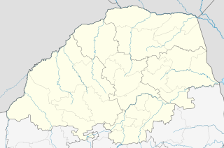
Tertiary drainage regions A41, A42, A50, A61 to A63, A71, A72 and A80.
Water Management Areas (WMAs) are parts of South Africa that are managed by the Water Boards.
Lephalale or Ellisras is a coal mining town in the Limpopo province of South Africa immediately east of the Waterberg Coalfield. The town was established as Ellisras in 1960 and named after Patrick Ellis and Piet Erasmus who settled on a farm there in the 1930s. In 2002, Ellisras was renamed Lephalale by the provincial government of Limpopo, after the main river that crosses the municipality. Lephalale is divided into three main subsections, Ellisras, Onverwacht and Marapong. Lephalale is derived from the setswana language meaning "to flow".
The Olifants River, Lepelle or Obalule is a river in South Africa and Mozambique, a tributary of the Limpopo River. It falls into the Drainage Area B of the Drainage basins of South Africa. The historical area of the Pedi people, Sekhukhuneland, is located between the Olifants River and one of its largest tributaries, the Steelpoort River.
A provincial park is a park administered by one of the provinces of a country, as opposed to a national park. They are similar to state parks in other countries. They are typically open to the public for recreation. Their environment may be more or less strictly protected. Argentina, Belgium, Canada and South Africa are among the countries that have provincial parks.
The Mokolo River is a major watercourse in Limpopo Province of South Africa. This river collects much of the drainage of the Waterberg Massif and discharges it to the Limpopo River. The river's catchment area comprises 8,387 square kilometres (3,238 sq mi).
Limpopo Tourism and Parks Board is a governmental organisation established in 2001 and responsible for maintaining wilderness areas and public nature reserves in Limpopo Province, South Africa.
The Mokolo Dam Nature Reserve or Mokolo Dam Provincial Parkis a protected area of bushveld in the Limpopo province, South Africa. It almost surrounds the Mokolo Dam on the Mokolo River. It is located 32 km south of Lephalale, just northeast of the Marakele National Park and not far from the Lapalala Game Reserve.
Luphephe Dam is an arch type dam located on the Luphephe River, a tributary of the Nwanedi River, part of the Limpopo River basin. It is located 48 km to the SW of Musina, Limpopo, South Africa. It was established in 1964 and it serves mainly for irrigation purposes. The hazard potential of the dam has been ranked high (3).
Mokolo Dam is a rock-fill type dam located on the Mokolo River, near Lephalale, Limpopo, South Africa. It was established in 1980. The Malmanies River and the Bulspruit River, two tributaries of the Mokolo, also enter the dam from its left side. The dam supplies water to Lephalale town. The dam mainly serves for municipal and industrial purposes and its hazard potentials has been ranked high (3).
Mutshedzi Dam is a gravity type dam located on the Mutshedzi River, a tributary of the Nzhelele River. It is located 40 km to the west of Thohoyandou, Limpopo, South Africa. It was established in 1990 and serves mainly for irrigation purposes. The hazard potential of the dam has been ranked significant (2).
Nzhelele Dam is an arch type dam located on the Nzhelele River in Limpopo Province, South Africa. It has a capacity of 55.3 million m3. It was established in 1948. The main purpose of the dam is to serve for irrigation and its hazard potentials has been ranked high (3).
The Crocodile River is a river in South Africa. After its confluence with the Marico River, both rivers form the Limpopo River.
The Marico River or Madikwe is a river in Southern Africa. There are a number of dams in its basin. Groot Marico town is named after the Marico River. After it is joined on its right bank by the Crocodile River it is known as the Limpopo River.
Drainage Basin A, is one of the drainage basins of South Africa. The main river in this system is the Limpopo River. It is subdivided into 9 sub-drainage basins.
The Mogalakwena River is one of the main watercourses in Limpopo Province, South Africa. It is also a major tributary of the Limpopo River.
The Nyl River is a watercourse in Limpopo Province, South Africa. It flows at the head of the Mogalakwena River, being its southernmost tributary or uppermost section. It is located near Mookgophong (Naboomspruit) in the northern part of the Springbok Flats, a particular geological formation.
Nwanedi Provincial Park, is a protected area in the northern part of the Limpopo province of South Africa. It is located about 20 km east of Tshipise and 35 km north of Thohoyandou, to the west of Kruger National Park. The Nwanedi park has an area of about 11,170 Ha and includes a part of the wooded foothills of the Soutpansberg Range. The twin dams, the Nwanedi Dam and the Luphephe Dam, at the confluence of the Nwanedi River and its main tributary, the Luphephe River, are located in the protected area. One of the secrets of the Game Reserve is their spectacular waterfall, known as Tshihovhohovho Falls. The park is well stocked with game, including a fair number of white rhino in its lowveld zone.