
East Godavari is a district in the Coastal Andhra region of Andhra Pradesh, India. Its district headquarters is at Rajamahendravaram.

Nizamabad or Induru is a city in the Indian state of Telangana. It is governed by municipal corporation and is the headquarters of the Nizamabad district. Previously part of Hyderabad State and then Andhra Pradesh state, Nizamabad became a part of the newly formed state of Telangana under the Andhra Pradesh Reorganisation Act, 2014. It is located about 186 kilometres (116 mi) north of the state capital, Hyderabad.
Reddy is a Hindu caste predominantly found in the states of Andhra Pradesh and Telangana in South India. They are classified as a forward caste.

Karimnagar district is one of the 33 districts of the Indian state of Telangana. Karimnagar city is its administrative headquarters. The district shares boundaries with Peddapalli, Jagityal, Sircilla, Siddipet, Jangaon, Hanamkonda district and Jayashankar Bhupalapally districts.

Kurnool district is one of the eight districts in the Rayalaseema region of the Indian state of Andhra Pradesh after the districts are reorganised in April 2022. It is located in the north western part of the state and is bounded by Nandyal district in the east, Anantapur district in the south, Raichur district of Karnataka in the northwest, Bellary district of Karnataka in the west, and Jogulamba Gadwal district of Telangana in the north. It has a population of 2,271,686 based on the 2011 census. The city of Kurnool is the headquarters of the district.

Mahabubnagar district also known as Palamuru district is a district in the Indian state of Telangana. Mahabubnagar is the district headquarters which is popularly known as Palamoor. The district shares boundaries with Narayanapet, Vikarabad, Rangareddy, Nagarkurnool, Wanaparthy and Jogulamba Gadwal districts. The district was formed during the period of the 6th Nizam of Hyderabad State – Nawab Mir Mahbub Ali Khan and hence named after him.

Nizamabad district is a district located in the north-western region of the Indian state of Telangana. The city of Nizamabad is the district headquarters. The district share boundaries with Jagtial, Sircilla, Nirmal, Kamareddy districts and with Nanded district of the state boundary of Maharashtra.

Ranga Reddy district is a district in the Indian state of Telangana. The district headquarters is located at Kongara Kalan Village, Ibrahimpatnam Mandal,. The district was named after the former deputy chief minister of the United Andhra Pradesh, K. V. Ranga Reddy. The district shares boundaries with Nalgonda, Yadadri Bhuvanagiri, Hyderabad, Medchal–Malkajgiri, Nagarkurnool, Mahabubnagar, Sangareddy and Vikarabad districts.
Bavojigudem is a village located 13 km from Maripeda, the Mandal headquarters, in Jayashankar Bhupalpally district, Andhra Pradesh, India. The neighbouring villages are Venkampadu, Neelukurti, and Giripuram. Previously this village was under the control of the neighbouring village panchayat, Neelukurthi. 15 years ago, the village has got a separate panchayat. The name of the sarpanch is Smt Baby Rani. The prominent people of the village are Sri K Karunakar reddy, M Kesava rao, D Hanumanthu. Recently village tank is repaired and 2 crops are assured in this village.
Appikatla is a village in Bapatla district of the Indian state of Andhra Pradesh. It is located in Bapatla mandal of Tenali revenue division.
Chebrolu is a village in Guntur district of the Indian state of Andhra Pradesh. It is the headquarters of Chebrolu mandal in Tenali revenue division. It was once a Buddhist site and territorial capital of Kakatiya dynasty. The Archaeological excavations revealed Buddhist artefacts of Satavahana and Ikshavaku period.

Navipet is a Mandal in Nizamabad district in the state of Telangana in India Navipet is top mandal in Nizamabad district Which has good market value for crops and small revenue business. Navipet lies on Nizamabad Bhainsa main road. Navipet is famous for weekly goats market.

Madugula is a village in Anakapalli district in the state of Andhra Pradesh in India. It was also known as Vaddadi or Vaddadimadugula and was founded by the rulers of the Matsya dynasty. Later, it merged into the kingdom of Nandapur–Jeypore and during the British Raj it remained an independent Zamindari for sometime. Later, in 1915 the zamindaris of Madugula and Pachipenta were purchased by Maharaja Vikram Dev III and they became a part of Jeypore Samasthanam and were governed by the Maharaja of Jeypore until 1947.

What is Common Era? Which is Common in Era? There is time period which was divided into two. i.e., Before Christ (BC) and Anno Domini (AD).
Amruthalur is a village in Guntur district of the Indian state of Andhra Pradesh. It is the headquarters of Amruthaluru mandal in Tenali revenue division. The village forms a part of Andhra Pradesh Capital Region and is under the jurisdiction of APCRDA.
Damaragidda panchayat village in Narayanpet district, Telangana. The village of Damaragidda is the only village in the gram panchayat. The mandal is in the Narayanpet Assembly Constituency and Mahabubnagar Loksabha Constituency.

Papannapet is a village in Medak district of Telangana, India. It is bounded by Shankarampet-A, Tekmal, Kulcharam and Medak mandals of Medak district and Nizamabad district. Papannapet has an average elevation of 445 metres (1463 ft).
Damergidda is a panchayat village in Ranga Reddy district, Telangana, India. It falls under Chevella mandal, and is the only village in the gram panchayat.

Adilabad district is a district in the northern area of Telangana, India. It is known as the gateway district to South and Central India. The district's headquarters is the town of Adilabad.
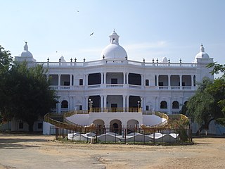
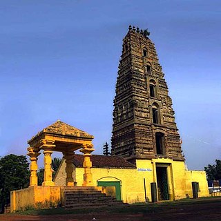
Wanaparthy Samsthanam or Raja of Wanaparthy was a vassal of the Nizam of Hyderabad. He controlled the feudatory of Wanaparthy. It was one of the three important samsthanams in Telangana, the other two being Gadwal Samsthanam and Jatprole Samsthanam.

