Severe storms in Australia refers to the storms, including cyclones, which have caused severe damage in Australia.

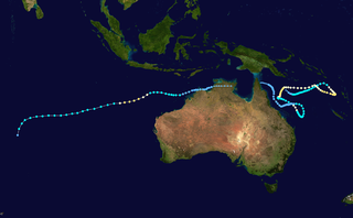
The 1969–70 Australian region cyclone season was an above-average tropical cyclone season. It ran from 1 November 1969 to 30 April 1970. The regional tropical cyclone operational plan also defines a "tropical cyclone year" separately from a "tropical cyclone season", with the "tropical cyclone year" for this season lasting from 1 July 1969 to 30 June 1970.

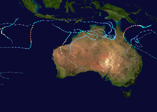
The 1971–72 Australian region cyclone season was a very active tropical cyclone season.

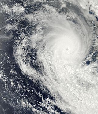
Severe Tropical Cyclone Ului was one of the fastest intensifying tropical cyclones on record, strengthening from a tropical storm to a Category 5 equivalent cyclone within a 30-hour span in March 2010. Throughout Queensland, Australia, infrastructural damage from the storm amounted to A$20 million (US$18 million) and agricultural losses reached A$60 million (US$54 million).

The 1983–84 Australian region cyclone season was the most active season on record. It officially started on 1 November 1983, and officially ended on 30 April 1984.

The 1985–86 Australian region cyclone season was an above average tropical cyclone season. It officially started on 1 November 1985, and officially ended on 30 April 1986.

Severe Tropical Cyclones Katrina and Victor–Cindy were a long-lived pair of related tropical cyclones, which moved around the coast of northeastern Australia during parts of January and February 1998, before eventually moving into the southern Indian Ocean. Katrina was the fourth tropical cyclone and named storm of the 1997–98 Australian region cyclone season; Victor–Cindy was the seventh tropical cyclone and named storm of the 1997–98 Australian region cyclone season; after moving into the South-West Indian Ocean, Victor–Cindy became the fifth tropical cyclone and the fourth named storm of the 1997–98 South-West Indian Ocean cyclone season. Katrina developed on 1 January and meandered within the Coral Sea between the Queensland coast and Vanuatu for the next three weeks, before degenerating into a remnant low near Far North Queensland on 25 January. After its decay, the remnants of Katrina moved westward over Cape York Peninsula and the Gulf of Carpentaria, before regenerating into Cyclone Victor on February 8, after which the system moved through the Northern Territory and into the Indian Ocean, over the course of the next week. Upon reaching the Indian Ocean on 16 February, the system was named "Cindy" by Mauritius, before eventually dissipating on 19 February.

Severe Tropical Cyclone Aivu was a powerful late-season tropical cyclone that caused extensive damage across parts of Queensland, Australia in April 1989.

Severe Tropical Cyclone Rewa affected six countries and caused 22 deaths on its 28-day journey across the South Pacific Ocean in December 1993 and January 1994. Cyclone Rewa developed from a tropical disturbance on 28 December south of Nauru. After forming, Rewa moved southwest through the Solomon Islands, crossing the 160th meridian east from the South Pacific basin into the Australian region. The cyclone began to strengthen steadily and turned southward, paralleling the eastern Australian coast through 31 December. Rewa reached its initial peak intensity as a Category 4 tropical cyclone on 2 January. It maintained this intensity for about 12 hours before an increase in wind shear induced its weakening by 3 January. The cyclone turned southeastward and moved back into the South Pacific basin on 4 January, before it passed over New Caledonia between 5–6 January. After affecting New Caledonia, Rewa weakened to a tropical depression and turned northwestward before re-entering the Australian basin on 10 January.

The 2013–14 Australian region cyclone season was a slightly below-average tropical cyclone season, with 10 tropical cyclones occurring within the Australian region. It officially started on 1 November 2013, and ended on 30 April 2014. The regional tropical cyclone operational plan defines a "tropical cyclone year" separately from a "tropical cyclone season"; the "tropical cyclone year" began on 1 July 2013 and ended on 30 June 2014.

Severe Tropical Cyclone Fran was the third tropical cyclone within four weeks to impact Vanuatu in 1992. Fran formed on 4 March and then gradually intensified, with winds reaching gale-force on 5 March, and hurricane-force a few days later. Few days later, Cyclone Fran reached severe tropical cyclone status near Vanuatu, and also became a powerful Category 5-equivalent on the Saffir–Simpson Hurricane Scale. The storm weakened somewhat due to land interaction, but briefly re-intensified after moving away from land. Fran gradually weakened over the next several days over less favorable conditions. Meanwhile, the storm passed north of New Caledonia. Eventually, as a Category 2 system on the Australian scale, Fran made landfall on Queensland on 16 March. Afterwards, Cyclone Fran turned towards the southeast and eventually headed back out to sea, eventually dissipating the next day. On Efate, over 130 houses lost roofs. Along Queensland, two rivers sustained major flooding, but no deaths were attributed to this cyclone. Total damage from the system was AU$8–10 million. Moderate damage was also reported in Fiji. In New Caledonia, the storm brought flooding and landslides.

Severe Tropical Cyclone Beni was an intense tropical cyclone that affected four countries, on its 18-day journey across the South Pacific Ocean during January and February 2003. The system originally developed during 19 January as a weak tropical disturbance within the monsoon trough, to the northeast of the Santa Cruz Islands. Over the next few days the system gradually developed further before it was classified as a tropical cyclone and named Beni during 24 January.

Severe Tropical Cyclone Drena was a powerful tropical cyclone that caused significant damage throughout New Zealand. A tropical depression formed on January 2, 1997. After crossing Vanuatu and emerging into the Coral Sea, the storm began to intensify, and by January 6, had attained peak intensity. After attaining peak intensity, Drena began to weaken. Cyclone Drena later brushed New Caledonia, bringing some damage. After transitioning into an extratropical cyclone on January 9, Drena brought impact to New Zealand. Damage totaled to $6.7 million and 3 people were killed. Roughly 140 people were evacuated after 44 homes were flooded. After the season, Drena was retired.

Severe Tropical Cyclone Namu was considered to be one of the worst tropical cyclones to impact the Solomon Islands on record, after it caused over 100 deaths within the island nations. It was first noted as a weak tropical depression to the north of the Solomon Islands during May 15, 1986. Over the next couple of days, the storm steadily intensified while meandering. After briefly moving west, the storm attained Category 2 intensity on the Australian intensity scale on May 18, as it moved through the island chain on the next day. Cyclone Namu attained peak intensity of 150 km/h (90 mph). After retaining its peak intensity for a day, Namu turned south and weakened steadily. By May 21, the winds of Cyclone Namu had been reduced to only 80 km/h (50 mph). Continuing to weaken, Namu turned east and dissipated on May 22, away from the island chain.

Severe Tropical Cyclone Joy struck Australia in late 1990, causing the third highest floods on record in Rockhampton, Queensland. This cyclone began as a weak tropical low near the Solomon Islands, and initially moved westward. On 18 December, it was named Joy, becoming the 2nd named storm of the 1990–91 Australian region cyclone season. After turning southwest, Joy developed a well-defined eye and strengthened to maximum sustained winds of 165 km/h (103 mph) while approaching Cairns in Far North Queensland. Brushing the city with strong winds, the cyclone soon weakened and turned southeast. Joy later curved back southwest, making landfall near Townsville, Queensland on 26 December. It dissipated the next day; remnant moisture continued as torrential rainfall over Queensland for two weeks.

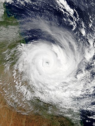
Severe Tropical Cyclone Ita was the strongest tropical cyclone in the Australian region by central pressure since George in 2007, and by wind speed since Monica in 2006. The system was first identified over the Solomon Islands as a tropical low on 1 April 2014, and gradually moved westward, eventually reaching cyclone intensity on 5 April. On 10 April, Ita intensified rapidly into a powerful Category 5 system on the Australian Scale, but it weakened to a Category 4 system in the hours immediately preceding landfall the following day. At the time of landfall at Cape Flattery at 12 April 22:00 (UTC+10), the cyclone's Dvorak intensity was approximately T5.0, consistent with a weak Category 4 system, and considerably lower than the T6.5 observed when the system was at its peak intensity. Meteorologists noted the system had, at that time, begun an eyewall replacement cycle; as a result, the system was considerably less powerful than various intensity scales had predicted. As a result, Ita's impact on terrain was lessened.

Severe Tropical Cyclone Debbie in 2017 was the strongest tropical cyclone to strike Queensland since Marcia in 2015, and was the costliest tropical cyclone in Australia since Yasi in 2011. Forming as a tropical low on 23 March, the low gradually intensified into a named tropical cyclone on 25 March. After steadily strengthening offshore to a Category 4 system, Debbie eventually made landfall near Airlie Beach, at 12:40 AEST on 28 March. Afterwards, Debbie rapidly weakened into a tropical low by late 28 March, but continued to travel south, causing significant damage and flooding in the populous areas of South East Queensland and Northern Rivers. In total, the storm caused A$3.5 billion (US$2.67 billion) in damage and fourteen deaths across Australia, primarily as a result of extreme flooding. This makes Debbie the deadliest cyclone to hit Australia since Fifi in 1991.
The following is a list of all reported tropical cyclones within the Australian region between 90°E and 160°E, after the start of World War II in September 1939 and before the start of the satellite era during the 1969–70 Season.
The following is a list of all reported tropical cyclones within the Australian region between 90°E and 160°E in the 1950s.


