
The Metropolitan Borough of Solihull is a metropolitan borough in West Midlands county, England. It is named after its largest town, Solihull, from which Solihull Metropolitan Borough Council is based. For Eurostat purposes it is a NUTS 3 region and is one of seven boroughs or unitary districts that comprise the "West Midlands" NUTS 2 region. Much of the large residential population in the north of the borough centres on the communities of Castle Bromwich, Fordbridge, Kingshurst, Marston Green and Smith's Wood as well as the town of Chelmsley Wood. In the south are the towns of Solihull and Shirley, and the large villages of Knowle, Dorridge, Meriden and Balsall Common.

A civil parish is a subnational entity, forming the lowest unit of local government in England. There are 21 civil parishes in the ceremonial county of West Midlands, most of the county being unparished; Dudley, Sandwell, Walsall and Wolverhampton are completely unparished. At the 2001 census, there were 89,621 people living in the parishes, accounting for 3.5 per cent of the county's population.
Bickenhill is a small village in the civil parish of Bickenhill and Marston Green, in the Solihull district, in the county of the West Midlands, England, on the eastern fringe of the West Midlands conurbation. Bickenhill is home to Birmingham Airport. Bickenhill is also a ward. It is in the historic county of Warwickshire.

Hockley Heath is a large village and civil parish in the Arden area mostly within the Metropolitan Borough of Solihull, West Midlands, England, incorporating the hamlet of Nuthurst, with a history dating back to the year 705 AD as a wood owned by Worcester Cathedral. The parish, known as Nuthurst cum Hockley Heath, is to the south of the West Midlands conurbation, 12 miles (19 km) southeast of Birmingham 5.5 miles (8.9 km) from Solihull town centre and 12.5 miles (20.1 km) north of Stratford-upon-Avon. The village forms part of the border with Warwickshire and the District of Stratford-on-Avon to the south, with some parts of the village on either side of the border. According to the 2001 census, the parish had a population of 6,771, being measured at the 2011 Census as 2,038.

Dickens Heath is a large modern village and civil parish within the Metropolitan Borough of Solihull in the English county of West Midlands incorporating the much older hamlet of Whitlocks End. It was previously part of the civil parish of Hockley Heath, and borders Cheswick Green and Tidbury Green in Solihull, as well as Hollywood in Worcestershire.

Kingfisher Country Park is a country park in Britain. It is situated in East Birmingham, West Midlands. Initially designated as Project Kingfisher by Birmingham City Council, the park was formally declared a country park in July 2004. The country park is located along an 11 km stretch of the River Cole from Small Heath (Birmingham) to Chelmsley Wood (Solihull) at the M6 motorway. It is a Local Nature Reserve.
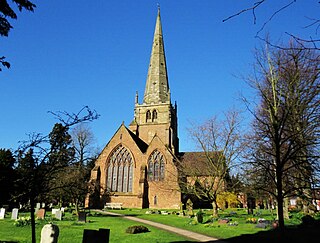
Solihull is a market town and the administrative centre of the wider Metropolitan Borough of Solihull in West Midlands County, England. The town had a population of 126,577 at the 2021 Census. Solihull is situated on the River Blythe in the Forest of Arden area. Solihull's wider borough had a population of 216,240 at the 2021 Census.

Elmdon is a suburban village within the Metropolitan Borough of Solihull in the county of West Midlands, England. The population of this Solihull Ward at the 2011 census was 12,067.

Warstock is a district within the city of Birmingham, UK, in the southernmost suburbs roughly 1 km east of the A435 and within the ward of Highter's Heath. The area lies within the B14 postcode and is contiguous with Yardley Wood to the north-east, Solihull Lodge to the south-east and Highter's Heath to the south-west. Kings Heath lies to the north-west.
Yardley Wood is an area of Birmingham, United Kingdom, covering the easternmost quadrant of postcode area B14, and is located across the wards of Billesley and Highter's Heath in the south of the city.
Elmdon Heath is an area of Solihull, West Midlands, United Kingdom. It lies within the historic county of Warwickshire. It is located to the north of the town centre, at a distance of approximately one mile. It is primarily residential, though there are a few shops, a garage, a community centre a secondary school, a primary school and a church centre.

The 2008 Solihull Metropolitan Borough Council election took place on 1 May 2008 to elect members of Solihull Metropolitan Borough Council in the West Midlands, England. One third of the council was up for election and the Conservative Party gained overall control of the council from no overall control.

The 2010 Solihull Metropolitan Borough Council election took place on 6 May 2010 to elect members of Solihull Metropolitan Borough Council in the West Midlands, England. One third of the council was up for election and the council stayed under no overall control.

The 2000 Solihull Metropolitan Borough Council election took place on 4 May 2000 to elect members of Solihull Metropolitan Borough Council in the West Midlands, England. One third of the council was up for election and the Conservative Party gained overall control of the council from no overall control.

Elmdon Park is a park and local nature reserve in Elmdon, Solihull, West Midlands. It was established in 1944 when the house and grounds of the derelict Elmdon Hall were bought up by the then Solihull Urban District Council. The house was used by the Home Guard during the war years, but the building subsequently became derelict, suffering from a rotten staircase and roof, and was demolished in 1956.
Major's Green is a village in the Wythall parish of Bromsgrove district and is the northeastern-most settlement in the county of Worcestershire, England.
The 2022 Solihull Metropolitan Borough Council election took place on 5 May 2022 to elect members of Solihull Metropolitan Borough Council. This was on the same day as other local elections. 17 of the 51 seats were up for election.