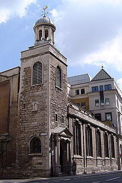
List of buildings that survived the Great Fire of London

Last updated

Central London in 1666, with the burnt area shown in pink. Great Fire of London Map.png
Central London in 1666, with the burnt area shown in pink.

This is a list of buildings that survived the Great Fire of London in 1666 and are still standing along with their listed grade.

GradeCriteria [1]
IBuildings of exceptional interest.
II*Particularly important buildings of more than special interest.
IIBuildings of national importance and special interest.
NameLocationTypeDateGrid ref.

Geo-coordinates

ImageGrade
41–41 Cloth Fair Cloth Fair House1597–1614 Cloth Fair 20130324 153.jpg II*
74–75 Long Lane Long Lane House1598II
229 Strand Strand Townhouse1625II*
All Hallows-by-the-Tower Byward Street Church1658 51°30′34″N0°04′46″W / 51.5094°N 0.0794°W / 51.5094; -0.0794 AllHallowsByTheTowerChurch.jpg I
The Guildhall Gresham Street City Hall1411 51°30′57″N0°05′31″W / 51.5159°N 0.092°W / 51.5159; -0.092 Guildhall, Londres, Inglaterra, 2014-08-11, DD 139.JPG I
The Hoop and Grapes Aldgate High StreetPublic HouseLate 17th century 51°30′51″N0°04′27″W / 51.51421°N 0.074177°W / 51.51421; -0.074177 Hoop and Grapes, Aldgate, EC3 (2581221888).jpg II*
The Old Curiosity Shop Portsmouth StreetShop1567 OldCuriosityShop.JPG II*
The Olde Wine Shades Martin LanePublic House1663 The Olde Wine Shades in Martin Lane - geograph.org.uk - 1715526.jpg II
Prince Henry's Room Fleet Street Townhouse1610 51°30′50″N0°6′39″W / 51.51389°N 0.11083°W / 51.51389; -0.11083 17 Fleet Street London.jpg II*
Saint Andrew Undershaft Saint Mary Axe Church1532 51°30′49.18″N0°4′52.72″W / 51.5136611°N 0.0813111°W / 51.5136611; -0.0813111 Church of St Andrew Undershaft 20130324 012.JPG I
Saint Bartholomew's GatehouseWest SmithfieldGatehouse1595 St Bartholomew-the-Great 06.JPG II*
Saint Etheldreda's Church Ely Place Church1290 51°31′07″N0°06′27″W / 51.5187°N 0.1074°W / 51.5187; -0.1074 St etheldredas church exterior.jpg I
Saint Giles-without-Cripplegate Fore Street Church1394, 1545 and 1682 51°31′7.38″N0°5′38.55″W / 51.5187167°N 0.0940417°W / 51.5187167; -0.0940417 StGilesCripplegate.jpg I
Saint Helen's Bishopsgate Great St Helen'sChurch12th century 51°30′53″N0°04′54″W / 51.5148°N 0.0818°W / 51.5148; -0.0818 St Helens Bishopsgate.jpg I
Saint Katharine Cree Leadenhall Street Church1631 (tower from 1504) 51°30′48.28″N0°4′44.88″W / 51.5134111°N 0.0791333°W / 51.5134111; -0.0791333 St katherine cree exterior.jpg I
Saint Olave Hart StreetChurch1450 51°30′39.04″N0°4′46.88″W / 51.5108444°N 0.0796889°W / 51.5108444; -0.0796889 St Olave Church.jpg I
The Staple Inn High Holborn Inn of Chancery1585 51°31′04.68″N0°06′40.28″W / 51.5179667°N 0.1111889°W / 51.5179667; -0.1111889 Staple Inn, London, UK - 20050821.jpg I
The Seven Stars Carey Street Public House1602 51°30′54″N0°06′49″W / 51.514950°N 0.11360747°W / 51.514950; -0.11360747 The Seven Stars in Carey Street - geograph.org.uk - 884355.jpg II
The Tower of London St Katharine's & WappingCastle1078 51°30′29″N00°04′34″W / 51.50806°N 0.07611°W / 51.50806; -0.07611 Tower of London viewed from the River Thames.jpg I

See also

References

  1. Listed Buildings, Historic England , retrieved 30 March 2017