
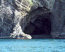
This is a list of notable caves in Jamaica. There are over 1,000 cave systems in the island of Jamaica. [1]
This is a list of notable caves in Jamaica. There are over 1,000 cave systems in the island of Jamaica. [1]
The full list of Jamaican caves (as of 2020) can be found on the Jamaica Caves Organisation website or as of 1997 in the book Jamaica Underground. [7]

A sinkhole is a depression or hole in the ground caused by some form of collapse of the surface layer. The term is sometimes used to refer to doline, enclosed depressions that are also known as shakeholes, and to openings where surface water enters into underground passages known as ponor, swallow hole or swallet. A cenote is a type of sinkhole that exposes groundwater underneath. Sink, and stream sink are more general terms for sites that drain surface water, possibly by infiltration into sediment or crumbled rock.

Saint Ann is the largest parish in Jamaica. It is situated on the north coast of the island, in the county of Middlesex, roughly halfway between the eastern and western ends of the island. It is often called "the Garden Parish of Jamaica" on account of its natural floral beauty. Its capital is Saint Ann's Bay. Saint Ann comprises New Seville, the first Spanish settlement in Jamaica.

Saint Elizabeth, one of Jamaica's largest parishes, is located in the southwest of the island, in the county of Cornwall. Its capital, Black River, is located at the mouth of the Black River, the widest on the island.

Trelawny is a parish in the county of Cornwall in northwest Jamaica. Its capital is Falmouth. It is bordered by the parishes of Saint Ann in the east, Saint James in the west, and Saint Elizabeth and Manchester in the south. Trelawny is known for producing several Olympic sprinters.

The Parish of Manchester is a parish located in west-central Jamaica, in the county of Middlesex. Its capital, Mandeville, is a major business centre. Its St. Paul of the Cross Pro-Cathedral is the episcopal see of the Latin Catholic Diocese of Mandeville.

Cockpit Country is an area in Trelawny and Saint Elizabeth, Saint James, Saint Ann, Manchester and the northern tip of Clarendon parishes, mostly within the west-central side, of Jamaica. The land is marked by lush, montane forests and steep-sided valleys and hollows, as deep as 120 metres (390 ft) in places, separated by conical hills and ridges.
The Jamaican Caves Organisation (JCO) is an all-volunteer caving organisation devoted to the preservation, exploration and documentation of caves in Jamaica. It is currently the only non-profit group in Jamaica dedicated to education, research and advocacy about caves.
Dunn's Hole is a large chamber cave in Trelawny Parish, Jamaica. It consists of a very large chamber approximately 200 metres long, 100 metres wide and 80 metres high, located at the bottom of a 200-metre pit. It is the largest known underground chamber in Jamaica. The main chamber contains a large stalagmite approximately 8 metres high.
Windsor Great Cave is a 3,000 metres (9,800 ft) long cave in Trelawny Parish on the north coast of Jamaica. The land external to the main entrance is owned by the WWF (UK), and access is often denied by the Windsor Research Centre who act as their proxy.

Coffee River Cave is a large river cave in Manchester Parish in west-central Jamaica. It is 2,800 metres (9,200 ft) in length and at an elevation of 250 metres (820 ft).
Gourie Cave is a large river cave in Manchester Parish in west-central Jamaica. At 3505 meters it is the longest cave known in the island. It is susceptible to flooding.
At nearly 200 metres, Smokey Hole Cave in Manchester, Jamaica is the deepest known cave in the island.
Hutchinson's Hole is a large pit cave named after the 18th century serial killer Lewis Hutchinson, who used the sinkhole to dispose of bodies. Its depth is approximately 98 metres (322 ft), with a cave entrance some 5 by 3 metres widening to approximately 18 by 25 metres at the bottom.
At 186 metres (610 ft), Morgans Pond Hole in Manchester Parish, Jamaica is the second deepest known cave in the island.
Mouth Maze Cave is a large, labyrinthine river cave in Trelawny, Jamaica. It is the only exit of the Mouth River from a small valley which, during intense rainfall, becomes flooded as the flow backs up. Because of this it can only safely be visited in very dry periods.
Bad Hole Cave is an impressively large rising cave in the Cockpit Country of Jamaica. This is a limestone karst region that is very rich in caves.
Belmont Cave is a white limestone dry cave in the Cockpit Country of Jamaica. It is also known as Drip Cave, being a single cave with two close entrances.
Carambie Cave is a large, relatively dry, white limestone cave in Trelawny Parish, Jamaica. It is believed that it may have been used by Taíno people although no evidence of their presence has been found. It does contain historical graffiti dating back to 1821.
Long Mile Cave, sometimes known locally as Pick'ny Mama Cave or Hell's Gate Cave, is a palaeontological and palaeoanthropological site in the Cockpit Country of north-western Jamaica.