Related Research Articles

Highland is a council area in the Scottish Highlands and is the largest local government area in the United Kingdom. It was the 7th most populous council area in Scotland at the 2011 census. It shares borders with the council areas of Aberdeenshire, Argyll and Bute, Moray and Perth and Kinross. Their councils, and those of Angus and Stirling, also have areas of the Scottish Highlands within their administrative boundaries.
Raasay, sometimes the Isle of Raasay, is an island between the Isle of Skye and the mainland of Scotland. It is separated from Skye by the Sound of Raasay and from Applecross by the Inner Sound. It is famous for being the birthplace of Gaelic poet Sorley MacLean, an important figure in the Scottish Renaissance.

Island single malts are the single malt Scotch whiskies produced on the islands around the perimeter of the Scottish mainland. The islands are not recognised in the Scotch Whisky Regulations as a distinct whisky producing region, but are considered to be part of the Highland region. Islay is itself recognised as a distinct whisky producing region.
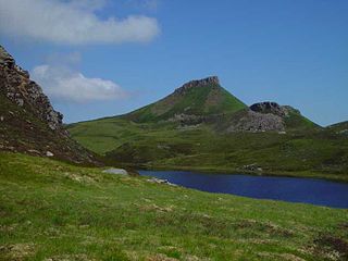
Rona, sometimes called South Rona to distinguish it from North Rona, is an inhabited island in the Inner Hebrides. It lies between the Sound of Raasay and the Inner Sound just north of the neighbouring island of Raasay and east of the Trotternish peninsula of Skye. It has a total area of 930 hectares (3.6 sq mi) and a population of 3.
Clan MacLeod is a Highland Scottish clan associated with the Isle of Skye. There are two main branches of the clan: the MacLeods of Harris and Dunvegan, known in Gaelic as Sìol Tormoid and the Clan MacLeod of Lewis Assynt and Raasay, known in Gaelic as Sìol Torcaill. Both branches claim descent from Leòd, a Norse-Gael who lived in the 13th century.
Clan MacNeacail, sometimes known as Clan MacNicol, is a Scottish clan long associated with the Isle of Skye. Tradition states that, early in its history, the clan held the Isle of Lewis, as well as extensive territory on the north-western mainland. The earliest member of the clan on record is one 14th century John "mak Nakyl", who is recorded amongst Edward I of England's powerful West Highland supporters during the Wars of Scottish Independence. John Barbour's 1375 epic, The Brus, suggests that by 1316, the clan had switched allegiance to Robert I, and made a decisive intervention in the new theatre of Anglo-Scottish conflict in Ireland. The marriage of an heiress to the MacLeods of Lewis brought a severe loss of lands and power in the following generation, forcing the clan chiefs to relocate to the surviving estates on Skye. However, the MacNeacails retained local significant influence: serving, according to tradition, as members of the Council of the Lords of the Isles and as custodians of the cathedral church of the Western Isles at Snizort. In the 17th century, members of the clan began to Anglicise their surname from the Scottish Gaelic MacNeacail to various forms, such as Nicolson. Today the English variants of the Gaelic surname are borne by members of the clan as well as members of unrelated Scottish families, including the Lowland Clan Nicolson.

Isay is an uninhabited island in the Inner Hebrides of the west coast of Scotland. It lies in Loch Dunvegan, 1 kilometre (1,100 yd) off the northwest coast of the Isle of Skye. Two smaller isles of Mingay and Clett lie nearby. The name originated from the Old Norse ise-øy meaning porpoise island. The island of Lampay is due south. The area of Isay is 60 hectares.
Ross, Cromarty and Skye was a constituency of the House of Commons of the Parliament of the United Kingdom from 1983 to 1997. The constituency elected one Member of Parliament (MP) by the first-past-the-post system of election.
Clan MacKinnon is a Highland Scottish clan from the islands of Mull and Skye, in the Inner Hebrides.

Portree High School is a state co-educational comprehensive school in Portree, Isle of Skye in Scotland. As of 2020, the school enrols 494 pupils and employs 80 teachers and support staff. The school's catchment area draws from 15 primary schools across Skye and neighbouring Raasay. The school also has a hostel with boarding provisions for a small number of pupils who live in more remote areas of the island.
A clachan is a small settlement or hamlet on the island of Ireland, the Isle of Man and Scotland. Though many were originally kirktowns, today they are often thought of as small villages lacking a church, post office, or other formal building. It is likely that many date to medieval times or earlier – a cluster of small single-storey cottages of farmers and/or fishermen, invariably found on poorer land. They were often related to the rundale system of farming.
Clan MacLeod of The Lewes, commonly known as Clan MacLeod of Lewis, is a Highland Scottish clan, which at its height held extensive lands in the Western Isles and west coast of Scotland. From the 14th century up until the beginning of the 17th century there were two branches of Macleods: the MacLeods of Dunvegan and Harris ; and the Macleods of the Isle of Lewis. In Gaelic the Macleods of Lewis were known as Sìol Thorcaill, and the MacLeods of Dunvegan and Harris were known as Sìol Thormoid.

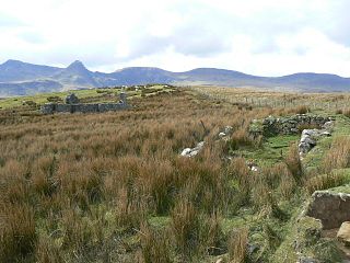
Camustianavaig is a crofting township on the island of Skye in Scotland. It is located on the shores of the Sound of Raasay, 5 kilometres southeast of Portree. The Lòn Bàn watercourse flows from Loch Fada to "An Eas Mhòr" below which it is named "Allt Ósglan" and discharges into the sea at Camas Tianabhaig. The stream forms the boundary between the township and Conordan to the south. Ósglan itself is the land on the right bank of Allt Ósglan.
Lealt is a crofting township, on the western coastline of the Sound of Raasay on the Trotternish peninsula of Skye, in the Highlands of Scotland and the council area of Highland. The Lealt River which gives its name to Lealt, passes through on the way to the Sound of Raasay.

The Isle of Skye, or simply Skye, is the largest and northernmost of the major islands in the Inner Hebrides of Scotland. The island's peninsulas radiate from a mountainous hub dominated by the Cuillin, the rocky slopes of which provide some of the most dramatic mountain scenery in the country. Although Sgitheanach has been suggested to describe a winged shape, no definitive agreement exists as to the name's origins.

Inverness-shire or the County of Inverness, is a historic county in Scotland. It is named after Inverness, its largest settlement, which was also the county town. Covering much of the Highlands and some of the Hebrides, it is Scotland's largest county by land area. It is generally rural and sparsely populated, containing only three towns which held burgh status, being Inverness, Fort William and Kingussie. The county is crossed by the Great Glen, which contains Loch Ness and separates the Grampian Mountains to the south-east from the Northwest Highlands. The county also includes Ben Nevis, the highest mountain in both Scotland and the United Kingdom.
George Rainy was a Scottish merchant, slave owner and land owner.
References
- ↑ Richards, Eric (2008). "Answers and Questions". The Highland Clearances: People, Landlords and Rural Turmoil. Edinburgh: Birlinn Ltd.