This article includes a list of general references, but it lacks sufficient corresponding inline citations .(November 2022) |
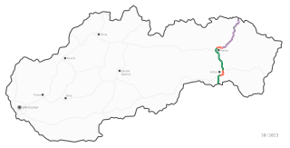
The list of Class I roads in Slovakia contains an overview of all communications that are categorized as Class I roads.
| Route name | sign | Route | Length [km] |
|---|---|---|---|
| I/2 | | Holíč – Malacky – Bratislava – Hungarian border at Rusovce | 100 |
| I/9 | | Czech border at Drietoma – Trenčín – Prievidza – Žiar nad Hronom Former portion of I/50 | 114 |
| I/10 | | Czech border at Bumbálka – Bytča | 30 |
| I/11 | | Czech border at Svrčinovec – Čadca – Žilina | 37 |
| I/11A | | Čadca bypass Portion of D3 motorway | 5 |
| I/11b | | Čadca | 1 |
| I/12 | | Svrčinovec – Polish border at Skalité | 15 |
| I/13 | | Veľký Meder – Hungarian border at Medveďov | 12 |
| I/14 | | Banská Bystrica – Turčianske Teplice | 22 |
| I/15 | | Vranov nad Topľou – Stropkov | 49 |
| I/16 | | Zvolen – Lučenec – Rožňava – Košice Former portion of I/50 | 197 |
| I/17 | | Hungarian border at Milhosť – Košice Former portion of I/68 | 18 |
| I/18 | | Žilina – Vrútky – Ružomberok – Poprad – Prešov – Vranov nad Topľou – Michalovce Originally began at Bumbálka, but this section became the new I/10, a portion of the current I/61 and the new I/60 in 2015. | 304 |
| I/19 | | Košice – Michalovce – Ukrainian border at Vyšné Nemecké Former portion of I/50 | 90 |
| I/20 | | Košice – Prešov Former portion of I/68 | 24 |
| I/21 | | Lipníky – Svidník – Polish border at Vyšný Komárnik | 59 |
| I/35 | | Galanta – Sereď | 8 |
| I/49 | | Czech border at Lysá pod Makytou – Púchov – Beluša | 27 |
| I/49A | | Dolné Kočkovce – Púchov Portion of R6 expressway | 5 |
| I/50 | | Czech border at Drietoma – Ukrainian border at Vyšné Nemecké Decommissioned on 1 August 2015. The Drietoma–Ladomerská Vieska section became the new I/9, the Ladomerská Vieska–Šášovské Podhradie section became a portion of current I/65, the Zvolen–Košice section became the new I/16, and the Košice–Vyšné Nemecké section became the new I/19. | 403 |
| I/51 | | Czech border at Holíč – Trnava ; Nitra – Hontianske Nemce – Banská Štiavnica – Hronská Breznica | 200 |
| I/54 | | Czech border at Moravské Lieskové – Nové Mesto nad Váhom | 16 |
| I/57 | | Czech border at Horné Srnie – Dubnica nad Váhom | 12 |
| I/59 | | Banská Bystrica – Ružomberok – Dolný Kubín – Polish border at Trstená | 114 |
| I/60 | | Žilina ring road | 6.5 |
| I/61 | | Austrian border west of Bratislava – Bratislava – Senec – Trnava – Piešťany – Nové Mesto nad Váhom – Trenčín – Považská Bystrica – Žilina | 191 |
| I/61A | | Beluša | 2 |
| I/62 | | Senec – Sereď – Šoporňa | 37 |
| I/63 | | Bratislava – Dunajská Streda – Komárno – Štúrovo – Hungarian border | 148 |
| I/64 | | Hungarian border – Komárno – Nové Zámky – Nitra – Prievidza – Žilina | 213 |
| I/64A | | Rajeckých Teplíc bypass | 1 |
| I/64b | | Bytčica | |
| I/64C | | Road I/64 – Road I/64b | |
| I/64d | | Topoľčiani – Krušovice | |
| I/65 | | Nitra – Zlaté Moravce – Čaradice ; Hronský Beňadik – Nová Baňa; Žarnovica – Žiar nad Hronom – Turčianske Teplice – Martin – Vrútky | 125 |
| I/65D | | Martin bypass | 7 |
| I/66 | | Hungarian border at Šahy – Zvolen – Banská Bystrica – Brezno – Vernár – Poprad – Spišská Belá – Polish border at Tatranská Javorina | 244 |
| I/66A | | Poprad bypass | 3.64 |
| I/67 | | Hungarian border at Kráľ – Tornaľa ; Rožňava – Pusté Pole Originally continued to Tatranská Javorina, but this (along with I/67A) became a portion of I/66 in 2015. | 61 |
| I/68 | | Polish border at Mníšek nad Popradom – Stará Ľubovňa – Prešov Originally continued to the Hungarian border at Milhosť, but this section was split off to the new I/17 and I/20 in 2015. | 80 |
| I/69 | | Kováčová – Banská Bystrica | 13 |
| I/70 | | Párnica – Dolný Kubín | 18 |
| I/71 | | Lučenec – Hungarian border at Šiatorská Bukovinka | 26 |
| I/72 | | Rimavská Sobota – Brezno ; Podbrezová – Liptovský Hrádok | 105 |
| I/73 | | Lipníky – Svidník – Polish border at Vyšný Komárnik Decommissioned on 1 August 2015 and renumbered to I/21. | 59 |
| I/74 | | Strážske – Humenné – Ukrainian border at Ubľa | 60 |
| I/74A | | Humenné inner bypass | 3 |
| I/74B | | Humenné inner bypass | 0.1 |
| I/75 | | Sládkovičovo – Galanta – Šaľa – Nové Zámky – Veľký Krtíš – Lučenec | 200 |
| I/75A | | Galanta bypass | 9 |
| I/76 | | Štúrovo – Hronský Beňadik | 75 |
| I/77 | | Spišská Belá – Stará Ľubovňa – Bardejov – Svidník | 115 |
| I/77A | | Čirč – Polish border | 0.1 |
| I/78 | | Oravský Podzámok – Námestovo – Polish border at Oravská Polhora | 44 |
| I/79 | | Vranov nad Topľou – Trebišov – Slovenské Nové Mesto – Čierna | 90 |
| I/79A | | Slovenské Nové Mesto – Hungarian border | 0.4 |
| I/80 | | I/68 in Presov – D1 motorway in Presov Decommissioned on 1 October 2020 and absorbed into I/68. | 1.8 |
Transport in Slovakia is possible by rail, road, air, or rivers. Slovakia is a developed Central European country with a well-developed rail network (3,662 km) and a highway system (854 km). The main international airport is the M. R. Štefánik Airport in the capital, Bratislava. The most important waterway is the river Danube, which is used by passenger, cargo, and freight ships. The two most important harbours in Slovakia are Komarno harbour and Bratislava harbour.
Numbered highways in Canada are split by province, and a majority are maintained by their province or territory transportation department. With few exceptions, all highways in Canada are numbered. Nonetheless, every province has a number of highways that are better known locally by their name rather than their number. Some highways have additional letters added to their number: A is typically an alternate route, B is typically a business route, and other letters are used for bypass (truck) routes, connector routes, scenic routes, and spur routes. The territory of Nunavut has no highways.
A routenumber, designation or abbreviation is an identifying numeric designation assigned by a highway authority to a particular stretch of roadway to distinguish it from other routes and, in many cases, also to indicate its classification, general geographical location and/or orientation. The numbers chosen may be used solely for internal administrative purposes; however, in most cases they are also displayed on roadside signage and indicated on maps.
The road hierarchy categorizes roads according to their functions and capacities. While sources differ on the exact nomenclature, the basic hierarchy comprises freeways, arterials, collectors, and local roads. Generally, the functional hierarchy can more or less correspond to the hierarchy of roads by their owner or administrator.
A bypass is a road or highway that avoids or "bypasses" a built-up area, town, or village, to let through traffic flow without interference from local traffic, to reduce congestion in the built-up area, and to improve road safety. A bypass specifically designated for trucks may be called a truck route.
Budča is a village and municipality of the Zvolen District in the Banská Bystrica Region of Slovakia.
D4 is a motorway in southwestern Slovakia. The planned highway is commonly referred to as the Bratislava bypass. For decades, there was only a short stretch from Austrian border at Jarovce to the junction with D2, construction of which started in 1996 and was opened in 1998. Construction of various other parts started in the late 2010s, with several openings throughout 2020 and 2021. The extension to the motorway D1 between Bratislava and Senec is underway, in order to connect the southern bypass of Bratislava to the country's main traffic artery. The bypass also intersects with expressway R7, parts of which are already open as well.
R1 is an expressway in Slovakia. It starts near Trnava and ends in Ružomberok and it goes through or around Sereď, Nitra, Zlaté Moravce, Hronský Beňadik, Nová Baňa, Žarnovica, Žiar nad Hronom, Zvolen and Banská Bystrica.
R2 is an expressway in Slovakia, also nicknamed the "southern highway". It starts near Trenčín and ends near Košice. It goes through or around Bánovce nad Bebravou, Prievidza, Žiar nad Hronom, Zvolen, Lučenec, Rimavská Sobota and Rožňava. It is an upgrade, being executed in sections of the Class 1 road I/16, with signage changed to R2 on the completed sections.
R3 is a mostly planned expressway passing through central Slovakia in the north–south direction along the European route E77.
R4 is an expressway in the north–south direction in eastern Slovakia.
R5 is a very short expressway in northwestern Slovakia.
Tesárske Mlyňany is a village and municipality in Zlaté Moravce District of the Nitra Region, in western-central Slovakia.
Diviacka Nová Ves is a village and municipality in Prievidza District in the Trenčín Region of western Slovakia.
Čertovica is a mountain pass in the Low Tatras mountain range in Slovakia. It connects regions of Liptov and Horehronie. With 1,232 metres (4,042 ft) AMSL, it is the highest paved mountain pass in Slovakia. It is open all year round, however, it can be rarely closed during the winter because of the severe weather conditions. The pass was daily crossed by more than 2000 vehicles as of 2005. On the pass is also situated a minor ski resort and a chalet offering accommodation. The pass is also an important starting or endpoint for many hiking trips because it lies in the middle of the range and is close to some of the range's popular summits as the highest Ďumbier and third-highest Chopok.
Highways in Slovakia are divided into motorways and expressways.
Ondrej Rigo was a Slovak serial killer and necrophile who targeted women in Bratislava, Munich and Amsterdam from 1990 to 1992. He served a life sentence until his death for nine murders and one attempted murder in Leopoldov Prison in Slovakia. Rigo was diagnosed with a schizoid personality disorder and an antisocial personality disorder as well as necrophilia, finding pleasure in having intercourse with women with mutilated heads. Rigo remains the Slovak murderer with the highest number of victims and he is also the most prolific serial killer in modern Slovak history.
Highway M08 is the shortest Ukraine international highway. It serves as a loop route bypassing the city of Uzhhorod on the northern (mountainous) side. It is part of European route E50 and European route E58.
The evolution of motorways construction in European countries by total number of kilometers existing in that year. This is a list of the total number of Motorways by country in Europe. It includes motorways, classified as such by the Eurostat and includes countries that are not members of the European Union but geographically are situated in Europe.