
Cape Canaveral is a city in Brevard County, Florida. The population was 9,912 at the 2010 United States Census. It is part of the Palm Bay–Melbourne–Titusville Metropolitan Statistical Area.

Melbourne is a city in Brevard County, Florida, United States. It is located 72 miles (116 km) southeast of Orlando and 175 miles (282 km) northwest of Miami. As of the 2020 Decennial Census, there was a population of 84,678. The municipality is the second-largest in the county by both size and population. Melbourne is a principal city of the Palm Bay – Melbourne – Titusville, Florida Metropolitan Statistical Area. In 1969, the city was expanded by merging with nearby Eau Gallie.

Merritt Island is an island, in Brevard County, Florida, United States, located on the eastern Florida coast, along the Atlantic Ocean. It is also the name of an unincorporated town in the central and southern parts of the island and a census-designated place (CDP).

Eau Gallie is a section of the city of Melbourne, Florida, located on the city's northern side. It was an independent city in Brevard County from 1860 until 1969.
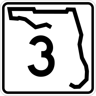
State Road 3, known locally as North Courtenay Parkway, is a north–south road located entirely on Merritt Island, serving as the southern access for the Kennedy Space Center near Cape Canaveral, Florida. The shortest of the one-digit Florida State Roads, its southern terminus is an intersection with SR 520 on Merritt Island, east of Cocoa.

The Melbourne Causeway is located entirely within Brevard County, Florida in the United States. It is composed of three bridges and connects the municipalities of Melbourne and Indialantic across the Indian River Lagoon in Brevard County. The causeway is part of U.S. 192, whose eastern terminus is located approximately 2 miles (3.2 km) east of the bridge, at SR A1A. East of the bridge, the road is known locally as Fifth Avenue. On the western side, the road continues through downtown Melbourne as Strawbridge Avenue. Each July 4, the bridge is closed for a fireworks show.

State Road 404 (SR 404), the Pineda Causeway, is an east–west divided highway currently running from Interstate 95 (I-95) to SR A1A at Patrick Space Force Base, Florida, US. It was opened as a toll road in 1971 and classified as a state road two years later. The tolls were removed in 1990. It was named after Pineda, a former village east of Suntree on U.S. Route 1 (US 1). With interchanges at US 1 (SR 5), South Tropical Trail, and South Patrick Drive (SR 513), the Pineda Causeway is the primary access for Patrick Space Force Base and the southern end of Merritt Island. From US 1 to the eastern terminus, it is part of the Indian River Lagoon Scenic Highway system.

The Eau Gallie Causeway connects Eau Gallie, Florida, with SR A1A near Indian Harbour Beach, across the Indian River Lagoon. Located entirely within the Melbourne city limits, the causeway consists of a main bridge crossing over the Intracoastal Waterway and a relief bridge. The bridge is a key link in SR 518, Eau Gallie Boulevard, of which the causeway is a part.
The Indian River Lagoon Scenic Highway is a 130-mile-long (210 km) scenic byway located in Florida. The highway is a collection of several roads, running north and south along either side of the Indian River Lagoon, connected by other roads running over the Lagoon.
Canaveral Groves is an unincorporated community in Brevard County, Florida, United States. It is a rural area between State Road 528 and Port St. John. The community is part of the Palm Bay–Melbourne–Titusville Metropolitan Statistical Area. There is a lower population density in the southwestern region, with a total of 140 households.

Lotus is a former village in Brevard County, Florida, United States. It is the location of Honeymoon Hill, the highest point on Merritt Island. Only one road runs through the area, CR 3, accessible to the south by Pineda Causeway and from the north via Florida State Road 520.
Brevard County, Florida has transportation available in the usual modes for a coastal county - highways, shipping, and airlines.
The Eau Gallie Historic District is a historic district in Eau Gallie, Florida. It contains several old buildings. It also contains the Eau Gallie Arts District.
Joseph Horatio Wickham (1911-2000) was a prominent Brevard County, Florida politician serving on the County Commission from 1952 to 1964 and from 1972 to 1984. Wickham's most notable achievements were securing rights of way for many of the county's current roadways, and establishing a permanent mosquito control program. One of these roads is Wickham Road.

Space Coast Area Transit is the public transit system serving the communities in Brevard County, Florida.
Brevard County has a county government, municipal governments, and various Florida state and U.S. federal agencies.

The Brevard County Library System is a public library system in Brevard County, Florida that coordinates activities between its member public libraries, which collectively serve Brevard County. It is composed of 17 distinct branches stemming all the way from Mims to Micco, with the central administrative and largest of these libraries being the Catherine Schweinsberg Rood Central Library in Cocoa, Florida. It is governed by a board of trustees appointed and funded by the Brevard County Board of Commissioners. Its missions statement is "Brevard County Libraries enables people of all ages to improve their quality of life by providing information and enrichment through traditional resources and new technology." Its vision statement is "We will be recognized as a Library System that excels in providing efficient, modern, accessible and customer oriented services."
Florida State Road 5054, known locally as Sarno Road, is an east–west highway in central Melbourne, Florida. Its western terminus is at Florida State Road 518, a half mile east of I-95; its eastern terminus is an intersection with Wickham Road and Sarno Road. The road is completely unsigned.
