This article relies largely or entirely on a single source .(February 2008) |
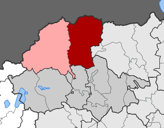
Many inhabited places in Pieria Prefecture of Greece have both Slavic and Greek forms. Some of the forms are identifiably of Greek origin, others of Slavic, yet others of Turkish or more obscure origins. Following the First World War and the Graeco-Turkish War which followed, the Greek government undertook a renaming program to place Greek names first on places with Turkophonic, and later on those with Slavophonic names. [1]
| Slavic name(s) [2] | Current official name other Greek names | Prefecture | Geographic Coordinates | Citation [3] | Population (2001) [4] | Other |
|---|---|---|---|---|---|---|
| Gorna Milea (Горна Милеа) | Ano Milia, Ano Milea (Άνω Μηλιά, Άνω Μηλέα) | Pieria | 40°15′N22°16′E / 40.250°N 22.267°E | p. 268 | ||
| Arbauti (Арбаути) | Sevasti (Σεβαστή) | Pieria | 40°21′N22°33′E / 40.350°N 22.550°E | p. 269 | 736 | |
| Buragja (Бураѓа) | Meliadi (Μελιάδιον) | Pieria | 40°20′N22°21′E / 40.333°N 22.350°E | p. 269 | 214 | |
| Vrijaza (Вријаза) | Vria (Βρία) | Pieria | 40°16′N22°17′E / 40.267°N 22.283°E | p. 269 | 422 | |
| Vromeri (Вромери) | Kallithea (Καλλιθέα) | Pieria | 40°16′N22°35′E / 40.267°N 22.583°E | p. 270 | 2,741 | |
| Vromoskala (Вромоскала) | Paralia (Παραλία) | Pieria | 40°16′N22°36′E / 40.267°N 22.600°E | p. 270 | 1,476 | |
| Vrondu (Вронду) | Vrontou (Βροντού) | Pieria | 40°11′N22°26′E / 40.183°N 22.433°E | p. 270 | 2,081 | |
| Vulchishta, V'lchishta, Volchishta (Вулчишта, В'лчишта, Волчишта) | Livadi, Voultista (Λιβάδιον, Βούλτιστα) | Pieria | 40°30′N22°27′E / 40.500°N 22.450°E | p. 270 | 307 | |
| Desetti Kilometar (Декатон Хилјометрон, Десетти Километар) | Moschochori, Dekaton Chiliometron (Μοσχοχώρι, Μοσχοχώριον, Δέκατον Χιλιόμετρον) | Pieria | 40°16′N22°24′E / 40.267°N 22.400°E | p. 271 | 500 | |
| Drijanitsa (Дријаница) | Moschopotamos (Μοσχοπόταμος) | Pieria | 40°20′N22°19′E / 40.333°N 22.317°E | p. 271 | 809 | |
| Zjazjakon (Зјазјакон) | Lofos (Λόφος) | Pieria | 40°14′N22°23′E / 40.233°N 22.383°E | p. 271 | 1,726 | |
| Izvor (Извор) | Isvoros (Ίσβορος) | Pieria | 40°22′N22°22′E / 40.367°N 22.367°E | p. 271 | ||
| Kalivija Baratinitsis, Kolibi na Bratinitsa (Каливија Баратиницис, Колиби на Братиница) | Exochi, Kalyvia Charadras (Εξοχή, Καλύβια Χαράδρας) | Pieria | 40°21′N22°26′E / 40.350°N 22.433°E | p. 271 | 518 | |
| Kolibi na Variku (Колиби на Варику) | Kalyvia Varikou (Καλύβια Βαρικού) | Pieria | 40°11′N22°34′E / 40.183°N 22.567°E | p. 272 | 38 | |
| Kolibi na Drimitsa (Колиби на Дримица) | Kalyvia Drimitsa (Καλύβια Δριμήτσα) | Pieria | 40°16′N22°25′E / 40.267°N 22.417°E | p. 272 | ||
| Kolibi na Kontariotisa (Колиби на Контариотиса) | Agios Spyridonas, Kalyvia Kontariotissis (Άγιος Σπυρίδων, Καλύβια Κονταριωτίσσης) | Pieria | 40°12′N22°27′E / 40.200°N 22.450°E | p. 272 | 1,558 | |
| Kolibi na Maltrja (Колиби на Малтрја) | Agia Paraskevi, Kalyvia Malathrias (Αγία Παρασκευή, Καλύβια Μαλαθριάς) | Pieria | 40°10′N22°29′E / 40.167°N 22.483°E | p. 272 | ||
| Kalivija na Elafinis, Kolibi na Elafina, Kolibi na Sportlita (Каливија на Елафинис, Колиби на Елафина, Колиби на Спортлита) | Elafos, Kalyvia, Kalyvia Elafinis, Kalyvia Sporlita (Έλαφος, Καλύβια, Καλύβια Ελαφίνης, Καλύβια Σπορλίτα) | Pieria | 40°22′N22°24′E / 40.367°N 22.400°E | p. 272 | 626 | |
| Karje (Карје) | Karyes (Καρυές, Καρυαί) | Pieria | 40°14′N22°18′E / 40.233°N 22.300°E | p. 273 | 222 | |
| Kastanja (Кастања) | Kastania (Καστανέα) | Pieria | 40°27′N22°27′E / 40.450°N 22.450°E | p. 273 | 423 | |
| Katerina (Катерина) | Katerini (Κατερίνη) | Pieria | 40°16′N22°31′E / 40.267°N 22.517°E | p. 274 | 50,510 | Capital of the prefecture |
| Dolna Milea (Долна Милеа) | Kato Milia (Κάτω Μηλιά) | Pieria | 40°15′N22°21′E / 40.250°N 22.350°E | p. 274 | 997 | |
| Keramidi (Керамиди) | Palaio Keramidi (Παλαιόν Κεραμίδιον) | Pieria | 40°19′N22°28′E / 40.317°N 22.467°E | p. 274 | 731 | |
| Kolokurion (Колокурион) | Svoronos (Σβορώνος) | Pieria | 40°16′N22°28′E / 40.267°N 22.467°E | p. 275 | 1,931 | |
| Kunturjotisa (Кунтурјотиса) | Kontariotissa (Κονταριώτισσα) | Pieria | 40°14′N22°28′E / 40.233°N 22.467°E | p. 275 | 1,980 | |
| Kursova, Bejlik (Курсова, Бејлик) | Toxo (Τόξον) | Pieria | 40°20′N22°24′E / 40.333°N 22.400°E | p. 276 | 228 | |
| Libanovo (Либаново) | Aiginio (Αιγίνιο, Αιγίνιον) | Pieria | 40°29′N22°33′E / 40.483°N 22.550°E | p. 276 | 4,280 | |
| Lokova, Lokovo (Локова, Локово) | Petra (Πέτρα) | Pieria | 40°11′N22°20′E / 40.183°N 22.333°E | p. 277 | 120 | |
| Londzhino, Londzhijano (Лонџино, Лонџијано) | Paliampela (Παλιάμπελα) | Pieria | 40°30′N22°30′E / 40.500°N 22.500°E | p. 277 | 266 | |
| Malatrja (Малатрја) | Dion (Δίον) | Pieria | 40°11′N22°30′E / 40.183°N 22.500°E | p. 278 | 1,336 | |
| Manastir Sveti Dionisij (Манастир Свети Дионисиј) | Agios Dionisios Monastery (Μονή Αγίου Διονυσίου) | Pieria | 40°05′N22°26′E / 40.083°N 22.433°E | p. 278 | 26 | |
| Mergjana (Мерѓана) | Meriana (Μεριάνα) | Pieria | 40°20′N22°20′E / 40.333°N 22.333°E | p. 279 | ||
| Milja (Милја) | Milia (Μηλιά) | Pieria | 40°15′N22°18′E / 40.250°N 22.300°E | p. 279 | 429 | |
| Milovo, Miletovo (Милово, Милетово) | Megali Gefyra (Μεγάλη Γέφυρα) | Pieria | 40°32′N22°32′E / 40.533°N 22.533°E | p. 279 | 268 | |
| Morna (Морна) | Skotina (Σκοτεινά) | Pieria | 40°12′N22°15′E / 40.200°N 22.250°E | p. 280 | 47 | |
| Murdzhani (Мурџани) | Palaiometochon (Παλαιομέτοχον) | Pieria | 40°23′N22°24′E / 40.383°N 22.400°E | p. 280 | ||
| Nea Kesarija (Неа Кесарија) | Neokaisareia (Νεοκαισάρεια) | Pieria | 40°16′N22°26′E / 40.267°N 22.433°E | p. 280 | 379 | |
| Nova Purlija (Нова Пурлија) | Neoi Poroi (Νέοι Πόροι) | Pieria | 39°58′N22°39′E / 39.967°N 22.650°E | p. 281 | 691 | |
| Paleonestani (Палеонестани) | Palaiostani (Παλαιοστάνη, Παλαιόστανη) | Pieria | 40°25′N22°28′E / 40.417°N 22.467°E | p. 282 | 564 | |
| Paljani (Палјани) | Sfendami (Σφενδάμιο, Σφενδάμιον) | Pieria | 40°25′N22°33′E / 40.417°N 22.550°E | p. 282 | 1,167 | |
| Pidna (Пидна) | Kitros (Κίτρος) | Pieria | 40°22′N22°35′E / 40.367°N 22.583°E | p. 283 | 1,506 | |
| Pristanishte Litokhoro (Пристаниште Литохоро) | Limenas Litochorou (Λιμήν Λιτοχώρου) | Pieria | 40°09′N22°33′E / 40.150°N 22.550°E | p. 284 | 38 | |
| Purlija (Пурлија) | Poroi (Πόροι) | Pieria | 39°58′N22°36′E / 39.967°N 22.600°E | p. 284 | 21 | |
| Radjani (Радјани) | Ryakia (Ρυάκια) | Pieria | 40°24′N22°24′E / 40.400°N 22.400°E | p. 284 | 598 | |
| Rentini, Retina (Рентини, Ретина) | Ritini (Ρητίνη) | Pieria | 40°17′N22°17′E / 40.283°N 22.283°E | p. 285 | 1,674 | |
| Salonija (Салонија) | Alonia (Αλώνια) | Pieria | 40°23′N22°33′E / 40.383°N 22.550°E | p. 285 | 700 | |
| Salonija Kukos (Салонија Кукос) | Koukkos (Κούκκος) | Pieria | 40°23′N22°31′E / 40.383°N 22.517°E | p. 285 | 523 | |
| Skotina (Скотина) | Ano Skotina, Skotina (Άνω Σκοτίνα, Σκοτίνα) | Pieria | 40°01′N22°33′E / 40.017°N 22.550°E | p. 286 | 0 | |
| Skotinjotika (Скотињотика) | Skotina (Σκοτίνα) | Pieria | 40°01′N22°33′E / 40.017°N 22.550°E | p. 286 | 957 | |
| Skuterna (Скутерна) | Elatochori, Elatousa (Ελατοχώριον, Ελατούσα) | Pieria | 40°19′N22°15′E / 40.317°N 22.250°E | p. 286 | 715 | |
| Solana Pidna (Солана Пидна) | Alyki Kitros (Αλυκή Κίτρος) | Pieria | 40°21′N22°39′E / 40.350°N 22.650°E | p. 287 | ||
| Spi (Спи) | Nea Efesos, Stoupion (Νέα Έφεσος, Στουπείον) | Pieria | 40°14′N22°30′E / 40.233°N 22.500°E | p. 287 | 1,859 | |
| Tokhova (Тохова) | Trilofos, Palaionelini (Τρίλοφος, Παλαιονέληνη) | Pieria | 40°22′N22°28′E / 40.367°N 22.467°E | p. 287 | 620 | |
| Tuzla (Тузла) | Alyki (Αλυκή) | Pieria | 40°21′N22°37′E / 40.350°N 22.617°E | p. 287 | 50 | |
| Turija, Turje (Турија, Турје) | Ganochora (Γανόχωρα) | Pieria | 40°18′N22°30′E / 40.300°N 22.500°E | p. 288 | 667 | |