Glaciers are the jewel of Nepal. There are 3,252 glaciers in Nepal covering a total area of 5,323 km2. This is a list of glaciers of Nepal .

Kangchenjunga, also spelled Kanchenjunga, Kanchanjanghā and Khangchendzonga, is the third-highest mountain in the world. Its summit lies at 8,586 m (28,169 ft) in a section of the Himalayas, the Kangchenjunga Himal, which is bounded in the west by the Tamur River, in the north by the Lhonak River and Jongsang La, and in the east by the Teesta River. It lies in the border region between Nepal and Sikkim state of India, with three of the five peaks, namely Main, Central and South, directly on the border, and the peaks West and Kangbachen in Nepal's Taplejung District.

K2, at 8,611 metres (28,251 ft) above sea level, is the second-highest mountain on Earth, after Mount Everest at 8,849 metres (29,032 ft). It lies in the Karakoram range, partially in the Gilgit-Baltistan region of Pakistan-administered Kashmir and partially in the China-administered Trans-Karakoram Tract in the Taxkorgan Tajik Autonomous County of Xinjiang.

The Himalayas, or Himalaya is a mountain range in Asia, separating the plains of the Indian subcontinent from the Tibetan Plateau. The range has some of the Earth's highest peaks, including the highest, Mount Everest. More than 100 peaks exceeding elevations of 7,200 m (23,600 ft) above sea level lie in the Himalayas.

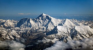
Mount Everest is Earth's highest mountain above sea level, located in the Mahalangur Himal sub-range of the Himalayas. The China–Nepal border runs across its summit point. Its elevation of 8,848.86 m was most recently established in 2020 by the Chinese and Nepali authorities.

The Karakoram is a mountain range in the Kashmir region spanning the border of Pakistan, China, and India, with the northwestern extremity of the range extending to Afghanistan and Tajikistan. Most of the Karakoram mountain range falls under the jurisdiction of Gilgit-Baltistan, which is controlled by Pakistan. Its highest peak, K2, is located in Gilgit-Baltistan. It begins in the Wakhan Corridor (Afghanistan) in the west, encompasses the majority of Gilgit-Baltistan, and extends into Ladakh and Aksai Chin.

The Ruwenzori, also spelled Rwenzori and Rwenjura, or Rwenzururu are a range of mountains in eastern equatorial Africa, located on the border between Uganda and the Democratic Republic of the Congo. The highest peak of the Ruwenzori reaches 5,109 metres (16,762 ft), and the range's upper regions are permanently snow-capped and glaciated. Rivers fed by mountain streams form one of the sources of the Nile. Because of this, European explorers linked the Ruwenzori with the legendary Mountains of the Moon, claimed by the Greek scholar Ptolemy as the source of the Nile. Virunga National Park in eastern DR Congo and Rwenzori Mountains National Park in southwestern Uganda are located within the range.

Makalu is the fifth-highest mountain on Earth, with a summit at an elevation of 8,485 metres (27,838 ft) AMSL. It is located in the Mahalangur Himalayas 19 km (12 mi) southeast of Mount Everest, on the China–Nepal border. One of the eight-thousanders, Makalu is an isolated peak shaped as a four-sided pyramid.

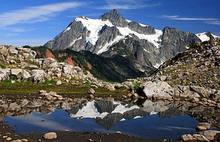
The North Cascades are a section of the Cascade Range of western North America. They span the border between the Canadian province of British Columbia and the U.S. state of Washington and are officially named in the U.S. and Canada as the Cascade Mountains. The portion in Canada is known to Americans as the Canadian Cascades, a designation that also includes the mountains above the east bank of the Fraser Canyon as far north as the town of Lytton, at the confluence of the Thompson and Fraser Rivers.

Nanda Devi is the second-highest mountain in India, after Kangchenjunga, and the highest located entirely within the country. Nanda Devi is the 23rd-highest peak in the world.

Hinduism is the main and largest dharma of Nepal. In 2006, the country declared itself a secular country through democracy, after the abolition of its monarchy. According to the 2021 census, the Hindu population in Nepal is estimated to be around 23,677,744 which accounts for at least 81.19% of the country's population, the highest percentage of Hindus of any country in the world. Vikram Samvat, one of the two official calendars used in Nepal, is a solar Hindu calendar essentially the same to that widespread in North India as a dharmic calendar, and is based on Hindu units of time.

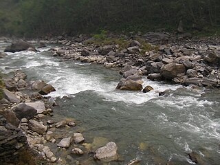
Bhote Koshi in Nepal and Poiqu in Tibet is the name given to the upper course of the Sun Kosi river. It is part of the Koshi River system in Nepal.
John Roskelley is an American mountain climber and author. He made first ascents and notable ascents of 7,000-meter and 8,000-meter peaks in Nepal, India, and Pakistan. In 2014, he became the 6th winner of the Piolet d'Or Lifetime Achievement Award.
Bahun, also known as Hill Brahmins, are a Brahmin varna among the Khas of Nepal. They are Sub caste of the Kanyakubja Brahmin while their origins are from Kannauj and the Himalayan belt of South Asia. According to the 2011 Nepal census, Bahun is the second most populous group after Chhetri.
Ambulapcha Glacier is a glacier of the Himalayas in the Solukhumbu District of Nepal. It adjoins Imja Glacier to its south and with Lhotse Shar Glacier forms three major glaciers. It forms the Ambulapcha Tsho glacial lake, located at 27°53′35″N86°54′47″E.

The 1921 British Mount Everest reconnaissance expedition set off to explore how it might be possible to get to the vicinity of Mount Everest, to reconnoitre possible routes for ascending the mountain, and – if possible – make the first ascent of the highest mountain in the world. At that time Nepal was closed to foreigners, so any approach had to be from the north, through Tibet. A feasible route was discovered from the east up the Kharta Glacier and then crossing the Lhakpa La pass north east of Everest. It was then necessary to descend to the East Rongbuk Glacier before climbing again to Everest's North Col. However, although the North Col was reached, it was not possible to climb further before the expedition had to withdraw.

The Lho La(Chinese: 洛拉山坳) is a col on the border between Nepal and Tibet north of the Western Cwm, near Mount Everest. It is at the lowest point of the West Ridge of the mountain at a height of 6,006 metres (19,705 ft). It is not exactly a Pass, but a part of Mt. Everest Range

Lingtren, 6,749 metres (22,142 ft), is a mountain in the Mahalangur Himal area of Himalaya, about 8 kilometres (5.0 mi) distant in a direct line from Mount Everest. It lies on the international border between Nepal and the Tibet Autonomous Region of China and it was first climbed in 1935. A mountain nearby to the west was originally named Lingtrennup but is now more commonly called Xi Lingchain.

Gangapurna is a mountain in Gandaki Province, Nepal. It is part of the Annapurna mountain range in north-central Nepal at an elevation of 7,455 metres (24,459 ft) and with the prominence of 563 metres (1,847 ft). It was first ascended in 1965 by a German expedition via its south face and east ridge. Gangapurna is entirely located in the Annapurna Conservation Area.