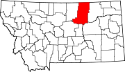
List of lakes in Phillips County, Montana

Last updated
Map all coordinates using: OpenStreetMap  ·  Google Maps
Download coordinates as: KML  ·  GPX

There are at least 147 named lakes and reservoirs in Phillips County, Montana .

Lake A body of relatively still water, in a basin surrounded by land

A lake is an area filled with water, localized in a basin, that is surrounded by land, apart from any river or other outlet that serves to feed or drain the lake. Lakes lie on land and are not part of the ocean, and therefore are distinct from lagoons, and are also larger and deeper than ponds, though there are no official or scientific definitions. Lakes can be contrasted with rivers or streams, which are usually flowing. Most lakes are fed and drained by rivers and streams.

Reservoir A storage space for fluids

A reservoir is, most commonly, an enlarged natural or artificial lake, pond or impoundment created using a dam or lock to store water.

Phillips County, Montana County in the United States

Phillips County is a county in the U.S. state of Montana. As of the 2010 United States Census, the population was 4,253. Its county seat is Malta. Before February 5, 1915, Phillips County was part of Blaine County, Montana, and before 1912 both were part of Chouteau County, Montana. It was named for rancher and state senator Benjamin D. Phillips.

Contents

Lakes

Bennett Lake lake


Bennett Lake is a lake in the Province of British Columbia and Yukon Territory in northwestern Canada. It is just north of the border with the United States state of Alaska, near the Alaskan port of Skagway.

There are over a dozen lakes named Mud Lake within the U.S. state of Montana.

The Plunge historic swim center in Richmond California


The Richmond Municipal Natatorium, commonly known as The Plunge or The Richmond Plunge, is a historic swim center in the Point Richmond neighborhood of Richmond, California. It was closed in August 2001 for seismic retrofitting and reopened in August 2010. It now is back to a regular schedule.

Reservoirs

Fort Peck Lake

Fort Peck Lake, or Lake Fort Peck, is a major reservoir in Montana, formed by the Fort Peck Dam on the Missouri River. The lake lies in the eastern prairie region of Montana approximately 140 miles (230 km) east of Great Falls and 120 miles (190 km) north of Billings, reaching into portions of six counties.

Nelson Reservoir is a reservoir located in Apache County, Arizona between Springerville and Alpine. The Reservoir is a long and narrow lake which follows the Nutrioso Creek Valley for nearly a mile. Fish that remain in Nelson Reservoir after summer stockings can grow to good size, making it a popular fishing site with local anglers.

Rock Creek reservoir, also known as Scott King reservoir, is 7 miles (11 km) north of the city of Ardmore, Carter County, Oklahoma in the United States. Created in 1979, it is operated by the city of Ardmore as a water supply recreational area. The lake has a normal surface area of 232 acres (94 ha) with 5 miles (8 km) of shoreline and a mean depth of 14.5 feet (4.4 m). The lake has a capacity of 3,550 acre feet (4,380,000 m3).

See also

Notes

  1. "Austin Lake". Geographic Names Information System . United States Geological Survey.
  2. "Beam Lake". Geographic Names Information System . United States Geological Survey.
  3. "Bennett Lake". Geographic Names Information System . United States Geological Survey.
  4. "Buckley Lake". Geographic Names Information System . United States Geological Survey.
  5. "Carter Lake". Geographic Names Information System . United States Geological Survey.
  6. "Drumbo Unit". Geographic Names Information System . United States Geological Survey.
  7. "Dry Lake". Geographic Names Information System . United States Geological Survey.
  8. "Dry Lake". Geographic Names Information System . United States Geological Survey.
  9. "Dry Lake Unit". Geographic Names Information System . United States Geological Survey.
  10. "Erphit Lake". Geographic Names Information System . United States Geological Survey.
  11. "Ester Lake". Geographic Names Information System . United States Geological Survey.
  12. "Horse Shoe Lake". Geographic Names Information System . United States Geological Survey.
  13. "Horseshoe Lake". Geographic Names Information System . United States Geological Survey.
  14. "Indian Lake". Geographic Names Information System . United States Geological Survey.
  15. "Lake Bowdoin". Geographic Names Information System . United States Geological Survey.
  16. "Lakeside Unit". Geographic Names Information System . United States Geological Survey.
  17. "Lone Tree Lake (historical)". Geographic Names Information System . United States Geological Survey.
  18. "McNeil Slough". Geographic Names Information System . United States Geological Survey.
  19. "Mud Lake". Geographic Names Information System . United States Geological Survey.
  20. "Mud Lake (historical)". Geographic Names Information System . United States Geological Survey.
  21. "Parrot Lake". Geographic Names Information System . United States Geological Survey.
  22. "Pea Lake". Geographic Names Information System . United States Geological Survey.
  23. "Shed Lake". Geographic Names Information System . United States Geological Survey.
  24. "Solberg Slough". Geographic Names Information System . United States Geological Survey.
  25. "The Plunge". Geographic Names Information System . United States Geological Survey.
  26. "Whitcomb Lake". Geographic Names Information System . United States Geological Survey.
  27. "3 Way Number 2 Reservoir". Geographic Names Information System . United States Geological Survey.
  28. "Ada Reservoir". Geographic Names Information System . United States Geological Survey.
  29. "Adair Reservoir". Geographic Names Information System . United States Geological Survey.
  30. "Archie Reservoir". Geographic Names Information System . United States Geological Survey.
  31. "Artie Reservoir". Geographic Names Information System . United States Geological Survey.
  32. "Ashfield Reservoir". Geographic Names Information System . United States Geological Survey.
  33. "Badger Reservoir". Geographic Names Information System . United States Geological Survey.
  34. "Bass Reservoir". Geographic Names Information System . United States Geological Survey.
  35. "Bauer Reservoir". Geographic Names Information System . United States Geological Survey.
  36. "Bell Reservoir". Geographic Names Information System . United States Geological Survey.
  37. "Big McNeil Slough". Geographic Names Information System . United States Geological Survey.
  38. "Big Reservoir". Geographic Names Information System . United States Geological Survey.
  39. "Big Rock Reservoir". Geographic Names Information System . United States Geological Survey.
  40. "Big Sage Reservoir". Geographic Names Information System . United States Geological Survey.
  41. "Big Snowy Reservoir". Geographic Names Information System . United States Geological Survey.
  42. "Bison Bone Reservoir". Geographic Names Information System . United States Geological Survey.
  43. "Black Coulee Pond". Geographic Names Information System . United States Geological Survey.
  44. "Black Cow Reservoir". Geographic Names Information System . United States Geological Survey.
  45. "Blizzard Reservoir". Geographic Names Information System . United States Geological Survey.
  46. "Blue Stem Reservoir". Geographic Names Information System . United States Geological Survey.
  47. "Bog Reservoir". Geographic Names Information System . United States Geological Survey.
  48. "Buckskin Reservoir". Geographic Names Information System . United States Geological Survey.
  49. "Carberry Reservoir". Geographic Names Information System . United States Geological Survey.
  50. "Carter Reservoir". Geographic Names Information System . United States Geological Survey.
  51. "Charley Reservoir". Geographic Names Information System . United States Geological Survey.
  52. "Cole Ponds". Geographic Names Information System . United States Geological Survey.
  53. "Converse Reservoir". Geographic Names Information System . United States Geological Survey.
  54. "Dan Reservoir". Geographic Names Information System . United States Geological Survey.
  55. "Dead Cedar Reservoir". Geographic Names Information System . United States Geological Survey.
  56. "Deep Reservoir". Geographic Names Information System . United States Geological Survey.
  57. "Detail Reservoir". Geographic Names Information System . United States Geological Survey.
  58. "Dione Reservoir". Geographic Names Information System . United States Geological Survey.
  59. "Drabbels Reservoir". Geographic Names Information System . United States Geological Survey.
  60. "Dry Lake Reservoir". Geographic Names Information System . United States Geological Survey.
  61. "Dusky Reservoir". Geographic Names Information System . United States Geological Survey.
  62. "Ethel Reservoir". Geographic Names Information System . United States Geological Survey.
  63. "Eva May Reservoir". Geographic Names Information System . United States Geological Survey.
  64. "Express Reservoir". Geographic Names Information System . United States Geological Survey.
  65. "Farm Pond". Geographic Names Information System . United States Geological Survey.
  66. "First Creek Reservoir". Geographic Names Information System . United States Geological Survey.
  67. "First Creek Reservoir". Geographic Names Information System . United States Geological Survey.
  68. "Fish Fossil Reservoir". Geographic Names Information System . United States Geological Survey.
  69. "Fjeldheim Reservoir". Geographic Names Information System . United States Geological Survey.
  70. "Fort Peck Lake". Geographic Names Information System . United States Geological Survey.
  71. "Fowler Reservoir". Geographic Names Information System . United States Geological Survey.
  72. "Frenchman Reservoir". Geographic Names Information System . United States Geological Survey.
  73. "Goose Island Pond". Geographic Names Information System . United States Geological Survey.
  74. "Government Field Reservoir". Geographic Names Information System . United States Geological Survey.
  75. "Grag Reservoir". Geographic Names Information System . United States Geological Survey.
  76. "Gullwing Reservoir". Geographic Names Information System . United States Geological Survey.
  77. "Happy Gang Reservoir". Geographic Names Information System . United States Geological Survey.
  78. "Hewitt Lake". Geographic Names Information System . United States Geological Survey.
  79. "Hilo Reservoir". Geographic Names Information System . United States Geological Survey.
  80. "Holzhey Reservoir". Geographic Names Information System . United States Geological Survey.
  81. "Holzhey Reservoir". Geographic Names Information System . United States Geological Survey.
  82. "Hoverson Reservoir". Geographic Names Information System . United States Geological Survey.
  83. "J D Reservoir". Geographic Names Information System . United States Geological Survey.
  84. "Jones Reservoir". Geographic Names Information System . United States Geological Survey.
  85. "King Reservoir". Geographic Names Information System . United States Geological Survey.
  86. "Kohola Reservoir". Geographic Names Information System . United States Geological Survey.
  87. "Lake PR-19". Geographic Names Information System . United States Geological Survey.
  88. "Lake Reservoir". Geographic Names Information System . United States Geological Survey.
  89. "LeNoir Reservoir". Geographic Names Information System . United States Geological Survey.
  90. "Lester Reservoir". Geographic Names Information System . United States Geological Survey.
  91. "Little Warm Reservoir". Geographic Names Information System . United States Geological Survey.
  92. "Louie Reservoir". Geographic Names Information System . United States Geological Survey.
  93. "Manning Corral Reservoir". Geographic Names Information System . United States Geological Survey.
  94. "Martin Lake". Geographic Names Information System . United States Geological Survey.
  95. "Martin Retaining Pit". Geographic Names Information System . United States Geological Survey.
  96. "Mary Reservoir". Geographic Names Information System . United States Geological Survey.
  97. "McChesney Reservoir". Geographic Names Information System . United States Geological Survey.
  98. "McChesney Reservoir". Geographic Names Information System . United States Geological Survey.
  99. "McNeil Reservoir". Geographic Names Information System . United States Geological Survey.
  100. "Monster Reservoir". Geographic Names Information System . United States Geological Survey.
  101. "Morgan Reservoir". Geographic Names Information System . United States Geological Survey.
  102. "Nelson Reservoir". Geographic Names Information System . United States Geological Survey.
  103. "Nelson Reservoir". Geographic Names Information System . United States Geological Survey.
  104. "Nerve Reservoir". Geographic Names Information System . United States Geological Survey.
  105. "Number Twenty Reservoir". Geographic Names Information System . United States Geological Survey.
  106. "Palea Reservoir". Geographic Names Information System . United States Geological Survey.
  107. "Paleface Reservoir". Geographic Names Information System . United States Geological Survey.
  108. "Partnership Reservoir". Geographic Names Information System . United States Geological Survey.
  109. "Patrol Road Pond". Geographic Names Information System . United States Geological Survey.
  110. "Pearl Reservoir". Geographic Names Information System . United States Geological Survey.
  111. "Pep Reservoir". Geographic Names Information System . United States Geological Survey.
  112. "Phillips Reservoir". Geographic Names Information System . United States Geological Survey.
  113. "Plum Reservoir". Geographic Names Information System . United States Geological Survey.
  114. "Point of Rocks Reservoir". Geographic Names Information System . United States Geological Survey.
  115. "PR 40 Reservoir". Geographic Names Information System . United States Geological Survey.
  116. "Private Reservoir". Geographic Names Information System . United States Geological Survey.
  117. "Puckett Reservoir". Geographic Names Information System . United States Geological Survey.
  118. "Rock Creek Reservoir". Geographic Names Information System . United States Geological Survey.
  119. "Sagebrush Reservoir". Geographic Names Information System . United States Geological Survey.
  120. "Salene Reservoir". Geographic Names Information System . United States Geological Survey.
  121. "Salsbery Reservoir". Geographic Names Information System . United States Geological Survey.
  122. "Sarm Reservoir". Geographic Names Information System . United States Geological Survey.
  123. "Schmittou Reservoir". Geographic Names Information System . United States Geological Survey.
  124. "Seven-Up Reservoir". Geographic Names Information System . United States Geological Survey.
  125. "Seymour Reservoir". Geographic Names Information System . United States Geological Survey.
  126. "Shale Reservoir". Geographic Names Information System . United States Geological Survey.
  127. "Siwash Reservoir". Geographic Names Information System . United States Geological Survey.
  128. "Skull Reservoir". Geographic Names Information System . United States Geological Survey.
  129. "Sorrell Reservoir". Geographic Names Information System . United States Geological Survey.
  130. "Starter Pond". Geographic Names Information System . United States Geological Survey.
  131. "Stratton Reservoir". Geographic Names Information System . United States Geological Survey.
  132. "Taint Reservoir". Geographic Names Information System . United States Geological Survey.
  133. "Timber Pit Reservoir". Geographic Names Information System . United States Geological Survey.
  134. "Titan Reservoir". Geographic Names Information System . United States Geological Survey.
  135. "Tondra Reservoir". Geographic Names Information System . United States Geological Survey.
  136. "Twin Snag Reservoir". Geographic Names Information System . United States Geological Survey.
  137. "Veseth Reservoir". Geographic Names Information System . United States Geological Survey.
  138. "Waterfowl Reservoir". Geographic Names Information System . United States Geological Survey.
  139. "Waydown Reservoir". Geographic Names Information System . United States Geological Survey.
  140. "Weigand Reservoir". Geographic Names Information System . United States Geological Survey.
  141. "West Alkali Reservoir". Geographic Names Information System . United States Geological Survey.
  142. "Whiteface Reservoir". Geographic Names Information System . United States Geological Survey.
  143. "Wild Horse Reservoir". Geographic Names Information System . United States Geological Survey.
  144. "Wildlife Reservoir". Geographic Names Information System . United States Geological Survey.
  145. "Williams Coulee Reservoir". Geographic Names Information System . United States Geological Survey.
  146. "Wilson Reservoir". Geographic Names Information System . United States Geological Survey.
  147. "Wrangler Reservoir". Geographic Names Information System . United States Geological Survey.