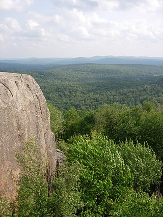
Vilas County has more lakes than any other county in Wisconsin, [1] with 563 named and 755 unnamed lakes covering 93,889 acres. Lac Vieux Desert near Phelps, at 4017 acres, is the largest.
Named lakes are listed below. Alternate names are indicated in parentheses. [1]

La Vérendrye wildlife reserve is one of the largest reserves in the province of Quebec, Canada, covering 12,589 square kilometres (4,861 sq mi) of contiguous land and lake area. It is named after Pierre Gaultier de Varennes, sieur de La Vérendrye, a French-Canadian explorer. Located 180 kilometres (110 mi) north of Ottawa, it is traversed from south to north by Route 117.

Area codes 715 and 534 are telephone area codes in the North American Numbering Plan (NANP) for the U.S. state of Wisconsin. The numbering plan area (NPA) comprises most of the northern part of the state. 715 was one of the original North American area codes created in 1947, while 534 was added in 2010 as an additional code for the same numbering plan area to form an overlay plan.

The Five Ponds Wilderness Area, an Adirondack Park unit of New York's Forest Preserve, is located in the towns of Fine and Clifton in St. Lawrence County, the town of Webb in Herkimer County and the town of Long Lake in Hamilton County. It includes 1,064 acres (4.3 km2) of private inholdings, 99 bodies of water covering 1,964 acres (7.9 km2), 57.9 miles (93.2 km) of trails, and 14 lean-tos.

South Twin Lake having about 3,200 acres (13 km2) is wholly within Penobscot County, Maine. It is about 6 miles (10 km) west of Millinocket, Maine and is part of the Pemadumcook Chain of Lakes. The lake is centered at 45°37.25′N68°51′W and has spillway elevation 492 feet (150 m) above sea level. It is part of the watershed of the West Branch of the Penobscot River.

Waterloo State Recreation Area is the third-largest park in Michigan, encompassing over 21,000 acres (85 km2) of forest, lakes and wetlands. Located in northeast Jackson County and parts of Washtenaw County, the park is the largest in the Lower Peninsula of Michigan and features 4 campgrounds, 11 lakes, a nature center, and over 50 miles (80 km) of trails - some for horses, bicycles, hiking and cross-country skiing. Waterloo SRA includes the Black Spruce Bog Natural Area, a National Natural Landmark and borders the 11,000-acre (45 km2) Pinckney Recreation Area on the east and the 950-acre (3.8 km2) Phyllis Haehnle Memorial Audubon Sanctuary to the west. The land preserved by the park is not all contiguous and numerous private landholdings and roads run through the park area. The area is characterized by moraines, kettle lakes, swamps and bogs left by retreating glaciers after the last ice age. The park was created by the federal government during the Great Depression and is long-term leased to the state.