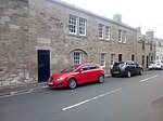
Name Location Date Listed Grid Ref. [note 1] Geo-coordinates Notes LB Number [note 2] Image 13, 15, 17 Horsemarket 55°35′56″N 2°25′58″W / 55.598802°N 2.432813°W / 55.598802; -2.432813 (13, 15, 17 Horsemarket ) Category B 35753 Upload Photo 2, 4, 6 Horsemarket 55°35′56″N 2°26′00″W / 55.598871°N 2.433433°W / 55.598871; -2.433433 (2, 4, 6 Horsemarket ) Category B 35756 Upload Photo 46-48 Horsemarket 55°35′58″N 2°25′55″W / 55.599523°N 2.432012°W / 55.599523; -2.432012 (46-48 Horsemarket ) Category C(S) 35759 Upload Photo Maxwell Lane 'Dalveen' 55°35′52″N 2°25′45″W / 55.597691°N 2.429199°W / 55.597691; -2.429199 (Maxwell Lane 'Dalveen' ) Category C(S) 35768 Upload another image
Maxwell Lane, Maxwell Place And Bellachroy 55°35′52″N 2°25′44″W / 55.597747°N 2.428819°W / 55.597747; -2.428819 (Maxwell Lane, Maxwell Place And Bellachroy ) Category B 35769 Upload another image
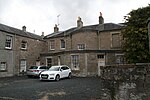
3, 4, And 5, 6 Maxwellheugh Terrace 55°35′33″N 2°25′52″W / 55.592437°N 2.43103°W / 55.592437; -2.43103 (3, 4, And 5, 6 Maxwellheugh Terrace ) Category B 35772 Upload another image
1, 3, 5 Roxburgh Street 55°35′55″N 2°26′06″W / 55.598731°N 2.434892°W / 55.598731; -2.434892 (1, 3, 5 Roxburgh Street ) Category B 35783 Upload Photo 9 Roxburgh Street 55°35′56″N 2°26′06″W / 55.598839°N 2.435036°W / 55.598839; -2.435036 (9 Roxburgh Street ) Category C(S) 35784 Upload Photo 31-33 Sheddon Park Road 55°35′57″N 2°25′44″W / 55.599058°N 2.428944°W / 55.599058; -2.428944 (31-33 Sheddon Park Road ) Category C(S) 35815 Upload another image
10, 11 The Square 55°35′53″N 2°26′03″W / 55.597997°N 2.434265°W / 55.597997; -2.434265 (10, 11 The Square ) Category B 35832 Upload Photo 15 The Square 55°35′53″N 2°26′04″W / 55.598131°N 2.434409°W / 55.598131; -2.434409 (15 The Square ) Category B 35833 Upload Photo 18, 19 The Square 55°35′54″N 2°26′04″W / 55.598221°N 2.434378°W / 55.598221; -2.434378 (18, 19 The Square ) Category B 35834 Upload Photo 21, 22 The Square, Kelso Savings Bank 55°35′54″N 2°26′05″W / 55.5984°N 2.434729°W / 55.5984; -2.434729 (21, 22 The Square, Kelso Savings Bank ) Category C(S) 35837 Upload Photo 38, 39, 40 The Square 55°35′56″N 2°26′03″W / 55.598842°N 2.434179°W / 55.598842; -2.434179 (38, 39, 40 The Square ) Category B 35843 Upload Photo 42, 44, 45, 46 The Square 55°35′56″N 2°26′02″W / 55.598924°N 2.433862°W / 55.598924; -2.433862 (42, 44, 45, 46 The Square ) Category B 35844 Upload Photo Teviot Bridge 55°35′41″N 2°26′46″W / 55.594738°N 2.446114°W / 55.594738; -2.446114 (Teviot Bridge ) Category A 35847 Upload another image
9, 11, 13, 15 Union Street 55°35′58″N 2°26′07″W / 55.599449°N 2.435233°W / 55.599449; -2.435233 (9, 11, 13, 15 Union Street ) Category C(S) 35849 Upload Photo 21 And 23 Woodmarket Sinclair Mcgill, Nursery-Men And Seedsmen 55°35′55″N 2°25′58″W / 55.598497°N 2.432731°W / 55.598497; -2.432731 (21 And 23 Woodmarket Sinclair Mcgill, Nursery-Men And Seedsmen ) Category B 35857 Upload Photo 15, 16, 26, 28, 30 Abbey Court, Belmont Place And Gatepiers 55°35′46″N 2°26′00″W / 55.596231°N 2.433214°W / 55.596231; -2.433214 (15, 16, 26, 28, 30 Abbey Court, Belmont Place And Gatepiers ) Category B 35693 Upload Photo Bridge Street, Abbey House (Offices Of Croall & Bryson) 55°35′49″N 2°25′58″W / 55.596915°N 2.432904°W / 55.596915; -2.432904 (Bridge Street, Abbey House (Offices Of Croall & Bryson) ) Category B 35723 Upload Photo Bridge Street, Queens Head Hotel 55°35′51″N 2°26′00″W / 55.597632°N 2.433324°W / 55.597632; -2.433324 (Bridge Street, Queens Head Hotel ) Category B 35729 Upload another image
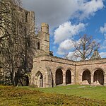
36, 38 Bridge Street 55°35′51″N 2°25′59″W / 55.597435°N 2.432957°W / 55.597435; -2.432957 (36, 38 Bridge Street ) Category C(S) 35731 Upload Photo Bridge Street Kelso Abbey 55°35′50″N 2°25′57″W / 55.597194°N 2.432494°W / 55.597194; -2.432494 (Bridge Street Kelso Abbey ) Category A 35734 Upload another image
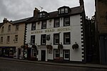
Hermitage Lane Pointfield 55°35′55″N 2°25′33″W / 55.59871°N 2.425782°W / 55.59871; -2.425782 (Hermitage Lane Pointfield ) Category B 35750 Upload Photo 1, 3 Horsemarket 55°35′55″N 2°26′00″W / 55.598665°N 2.433288°W / 55.598665; -2.433288 (1, 3 Horsemarket ) Category B 35751 Upload Photo Crawford Street, Red Lion Inn 55°35′57″N 2°26′05″W / 55.599254°N 2.434643°W / 55.599254; -2.434643 (Crawford Street, Red Lion Inn ) Category C(S) 51109 Upload Photo 12, 14 Woodmarket Border Hotel 55°35′55″N 2°25′59″W / 55.598612°N 2.433192°W / 55.598612; -2.433192 (12, 14 Woodmarket Border Hotel ) Category C(S) 35864 Upload another image
40-42 Woodmarket 55°35′56″N 2°25′56″W / 55.598956°N 2.432276°W / 55.598956; -2.432276 (40-42 Woodmarket ) Category C(S) 35867 Upload Photo 50 Horsemarket 55°35′59″N 2°25′55″W / 55.599604°N 2.432045°W / 55.599604; -2.432045 (50 Horsemarket ) Category C(S) 35760 Upload Photo Jedburgh Road Maxwellheugh Cottage 55°35′35″N 2°25′56″W / 55.593081°N 2.4321°W / 55.593081; -2.4321 (Jedburgh Road Maxwellheugh Cottage ) Category B 35763 Upload Photo Mill Wynd, Kelso Mills, (John Hogarth Ltd) 55°35′52″N 2°26′08″W / 55.597857°N 2.43566°W / 55.597857; -2.43566 (Mill Wynd, Kelso Mills, (John Hogarth Ltd) ) Category B 35775 Upload Photo 9, 11 Oven Wynd (North Side) And Unnumbered House (Veitch) 55°35′52″N 2°26′05″W / 55.597779°N 2.434833°W / 55.597779; -2.434833 (9, 11 Oven Wynd (North Side) And Unnumbered House (Veitch) ) Category C(S) 35778 Upload Photo 13, 15 Oven Wynd (North Side) 55°35′52″N 2°26′06″W / 55.597688°N 2.435102°W / 55.597688; -2.435102 (13, 15 Oven Wynd (North Side) ) Category C(S) 35779 Upload Photo Oven Wynd, (South Side) Premises Of J Utterson And J Walker, Plumbers And Slaters 55°35′52″N 2°26′04″W / 55.597708°N 2.434515°W / 55.597708; -2.434515 (Oven Wynd, (South Side) Premises Of J Utterson And J Walker, Plumbers And Slaters ) Category C(S) 35782 Upload Photo 48 Roxburgh Street 55°35′58″N 2°26′11″W / 55.59932°N 2.436279°W / 55.59932; -2.436279 (48 Roxburgh Street ) Category B 35796 Upload Photo 132-134 Roxburgh Street 55°36′06″N 2°26′24″W / 55.601562°N 2.440033°W / 55.601562; -2.440033 (132-134 Roxburgh Street ) Category C(S) 35804 Upload Photo 15-23 Sheddon Park Road (Odd Nos) 55°35′56″N 2°25′47″W / 55.598875°N 2.429799°W / 55.598875; -2.429799 (15-23 Sheddon Park Road (Odd Nos) ) Category C(S) 35812 Upload another image See more images
Shedden Park Road Tweedbank With Walled Garden, Boundary Walls And Gatepiers 55°36′00″N 2°25′34″W / 55.600029°N 2.426098°W / 55.600029; -2.426098 (Shedden Park Road Tweedbank With Walled Garden, Boundary Walls And Gatepiers ) Category B 35819 Upload Photo Shedden Park Road, Rosebank 55°36′05″N 2°25′24″W / 55.601288°N 2.423366°W / 55.601288; -2.423366 (Shedden Park Road, Rosebank ) Category B 35820 Upload Photo The Square, Kelso Town Hall 55°35′55″N 2°26′01″W / 55.598557°N 2.433541°W / 55.598557; -2.433541 (The Square, Kelso Town Hall ) Category B 35828 Upload another image
33, 34, 35 The Square 55°35′56″N 2°26′05″W / 55.598804°N 2.434765°W / 55.598804; -2.434765 (33, 34, 35 The Square ) Category B 35841 Upload Photo 47, 48, 49 The Square 55°35′56″N 2°26′01″W / 55.598916°N 2.433545°W / 55.598916; -2.433545 (47, 48, 49 The Square ) Category B 35845 Upload Photo 7 Woodmarket 55°35′54″N 2°25′59″W / 55.598288°N 2.433157°W / 55.598288; -2.433157 (7 Woodmarket ) Category B 35854 Upload Photo 7 Abbey Court 55°35′49″N 2°26′01″W / 55.596912°N 2.433602°W / 55.596912; -2.433602 (7 Abbey Court ) Category B 35687 Upload Photo 10 Abbey Row 55°35′54″N 2°25′58″W / 55.598335°N 2.432777°W / 55.598335; -2.432777 (10 Abbey Row ) Category B 35695 Upload Photo Abbotsford Grove Korea House 55°35′52″N 2°25′37″W / 55.597726°N 2.427073°W / 55.597726; -2.427073 (Abbotsford Grove Korea House ) Category B 35698 Upload another image See more images
3, 4, 5, 6, Bowmont Street 55°35′56″N 2°26′01″W / 55.599023°N 2.433673°W / 55.599023; -2.433673 (3, 4, 5, 6, Bowmont Street ) Category C(S) 35699 Upload Photo 22 Bowmont Street Bowmont House 55°35′59″N 2°26′06″W / 55.599773°N 2.435014°W / 55.599773; -2.435014 (22 Bowmont Street Bowmont House ) Category B 35703 Upload Photo Bowmont Street Orchard House, Orchard Cottage, And Dovecot 55°36′11″N 2°26′29″W / 55.603183°N 2.44148°W / 55.603183; -2.44148 (Bowmont Street Orchard House, Orchard Cottage, And Dovecot ) Category B 35711 Upload Photo 1 Bridge Street 55°35′52″N 2°26′03″W / 55.597863°N 2.434073°W / 55.597863; -2.434073 (1 Bridge Street ) Category B 35713 Upload Photo Bridge Street, Ednam House Hotel Gatepiers 55°35′48″N 2°26′01″W / 55.59675°N 2.433584°W / 55.59675; -2.433584 (Bridge Street, Ednam House Hotel Gatepiers ) Category B 35719 Upload Photo 40 - 44 (Even Nos) Bridge Street And 2, 2A Abbey Row 55°35′50″N 2°25′59″W / 55.597319°N 2.43294°W / 55.597319; -2.43294 (40 - 44 (Even Nos) Bridge Street And 2, 2A Abbey Row ) Category B 35732 Upload another image
Broomlands House 55°36′24″N 2°25′21″W / 55.606799°N 2.422537°W / 55.606799; -2.422537 (Broomlands House ) Category B 35738 Upload Photo Edenside Road Edenside 55°36′10″N 2°25′47″W / 55.602838°N 2.429811°W / 55.602838; -2.429811 (Edenside Road Edenside ) Category B 35747 Upload Photo Hermitage Lane Hermitage 55°35′58″N 2°25′35″W / 55.599364°N 2.426281°W / 55.599364; -2.426281 (Hermitage Lane Hermitage ) Category B 35749 Upload Photo Horsemarket, Black Swan 55°35′55″N 2°25′59″W / 55.598684°N 2.433034°W / 55.598684; -2.433034 (Horsemarket, Black Swan ) Category C(S) 35752 Upload Photo Springwood Estate, (Springwood Caravan Park), Walled Garden 55°35′38″N 2°27′16″W / 55.593853°N 2.454482°W / 55.593853; -2.454482 (Springwood Estate, (Springwood Caravan Park), Walled Garden ) Category B 12954 Upload Photo Springwood Estate, Springwood Home Farm 55°35′23″N 2°27′06″W / 55.589676°N 2.451736°W / 55.589676; -2.451736 (Springwood Estate, Springwood Home Farm ) Category B 12955 Upload Photo 65 Horsemarket 55°35′59″N 2°25′53″W / 55.599804°N 2.431317°W / 55.599804; -2.431317 (65 Horsemarket ) Category C(S) 35755 Upload Photo 44 Horsemarket Former Post Office 55°35′58″N 2°25′56″W / 55.599558°N 2.432346°W / 55.599558; -2.432346 (44 Horsemarket Former Post Office ) Category B 35758 Upload Photo The Knowes, Waverley Lodge 55°35′51″N 2°25′46″W / 55.597501°N 2.42953°W / 55.597501; -2.42953 (The Knowes, Waverley Lodge ) Category C(S) 35767 Upload another image
7, 8 Maxwellheugh Terrace 55°35′34″N 2°25′53″W / 55.592715°N 2.431334°W / 55.592715; -2.431334 (7, 8 Maxwellheugh Terrace ) Category B 35773 Upload another image
Oven Wynd, Ramsay Lodge 55°35′52″N 2°26′08″W / 55.597696°N 2.435483°W / 55.597696; -2.435483 (Oven Wynd, Ramsay Lodge ) Category B 35780 Upload Photo 3, 4 Oven Wynd (South Side) 55°35′52″N 2°26′03″W / 55.597817°N 2.434215°W / 55.597817; -2.434215 (3, 4 Oven Wynd (South Side) ) Category C(S) 35781 Upload Photo 2, 4 Roxburgh Street 55°35′55″N 2°26′06″W / 55.598533°N 2.435112°W / 55.598533; -2.435112 (2, 4 Roxburgh Street ) Category B 35792 Upload Photo 18, 20, 22, 24 Roxburgh Street 55°35′56″N 2°26′08″W / 55.598918°N 2.435481°W / 55.598918; -2.435481 (18, 20, 22, 24 Roxburgh Street ) Category B 35795 Upload Photo 60 Roxburgh Street 55°35′59″N 2°26′11″W / 55.599687°N 2.436521°W / 55.599687; -2.436521 (60 Roxburgh Street ) Category B 35798 Upload Photo 126 Roxburgh Street 55°36′05″N 2°26′22″W / 55.601348°N 2.439428°W / 55.601348; -2.439428 (126 Roxburgh Street ) Category B 35803 Upload Photo 142 Roxburgh Street 55°36′07″N 2°26′28″W / 55.601899°N 2.441116°W / 55.601899; -2.441116 (142 Roxburgh Street ) Category C(S) 35808 Upload Photo 51 Sheddon Park Road, Lyme House 55°35′59″N 2°25′39″W / 55.599755°N 2.42746°W / 55.599755; -2.42746 (51 Sheddon Park Road, Lyme House ) Category C(S) 35817 Upload Photo 3 Simon Square 55°35′56″N 2°25′53″W / 55.598807°N 2.431433°W / 55.598807; -2.431433 (3 Simon Square ) Category B 35825 Upload Photo 3, 4, 5, 6 Winchester Row 55°36′04″N 2°26′16″W / 55.601085°N 2.437695°W / 55.601085; -2.437695 (3, 4, 5, 6 Winchester Row ) Category C(S) 35852 Upload Photo Abbey Court St Andrew's Episcopal Church And Churyard Walls 55°35′47″N 2°26′01″W / 55.596489°N 2.433692°W / 55.596489; -2.433692 (Abbey Court St Andrew's Episcopal Church And Churyard Walls ) Category B 35689 Upload Photo Bridge Street, Ednam House Hotel 55°35′51″N 2°26′04″W / 55.597376°N 2.434512°W / 55.597376; -2.434512 (Bridge Street, Ednam House Hotel ) Category A 35716 Upload another image
Bridge Street Bridge-End Cottage 55°35′45″N 2°25′58″W / 55.595882°N 2.432813°W / 55.595882; -2.432813 (Bridge Street Bridge-End Cottage ) Category A 35724 Upload Photo 4, 6, 8 Bridge Street 55°35′53″N 2°26′01″W / 55.59799°N 2.433582°W / 55.59799; -2.433582 (4, 6, 8 Bridge Street ) Category B 35725 Upload another image
14 Bridge Street 55°35′52″N 2°26′00″W / 55.597847°N 2.43339°W / 55.597847; -2.43339 (14 Bridge Street ) Category C(S) 35727 Upload Photo Edenside Road Kerfield 55°36′08″N 2°25′45″W / 55.602238°N 2.429074°W / 55.602238; -2.429074 (Edenside Road Kerfield ) Category B 35746 Upload Photo Springwood Estate (Springwood Caravan Park), Scott-Douglas Mausoleum 55°35′42″N 2°27′18″W / 55.594885°N 2.455033°W / 55.594885; -2.455033 (Springwood Estate (Springwood Caravan Park), Scott-Douglas Mausoleum ) Category A 12952 Upload another image
Wooden House 55°35′47″N 2°24′47″W / 55.596489°N 2.412984°W / 55.596489; -2.412984 (Wooden House ) Category B 10471 Upload Photo Steward's House In Floors Castle Policies 55°36′25″N 2°28′06″W / 55.606875°N 2.468331°W / 55.606875; -2.468331 (Steward's House In Floors Castle Policies ) Category B 10478 Upload Photo 8, 10 Woodmarket 55°35′55″N 2°26′00″W / 55.598558°N 2.433239°W / 55.598558; -2.433239 (8, 10 Woodmarket ) Category C(S) 35863 Upload Photo 32-38 Woodmarket (Even Nos.) 55°35′56″N 2°25′57″W / 55.598938°N 2.432386°W / 55.598938; -2.432386 (32-38 Woodmarket (Even Nos.) ) Category B 35866 Upload Photo 44-50 Woodmarket (Even Nos.) 55°35′57″N 2°25′55″W / 55.599047°N 2.432054°W / 55.599047; -2.432054 (44-50 Woodmarket (Even Nos.) ) Category C(S) 35868 Upload Photo The Square, K6 Telephone Kiosk Adjacent To Town Hall 55°35′55″N 2°26′01″W / 55.598583°N 2.433605°W / 55.598583; -2.433605 (The Square, K6 Telephone Kiosk Adjacent To Town Hall ) Category B 35870 Upload Photo 52 Horsemarket 55°35′59″N 2°25′55″W / 55.599605°N 2.43187°W / 55.599605; -2.43187 (52 Horsemarket ) Category C(S) 35761 Upload Photo Kelso Bridge 55°35′43″N 2°26′00″W / 55.595386°N 2.433315°W / 55.595386; -2.433315 (Kelso Bridge ) Category A 35764 Upload Photo The Knowes; Abbey Bank 55°35′50″N 2°25′49″W / 55.597095°N 2.430208°W / 55.597095; -2.430208 (The Knowes; Abbey Bank ) Category B 35765 Upload another image
21 Roxburgh Street 55°35′57″N 2°26′07″W / 55.599081°N 2.435181°W / 55.599081; -2.435181 (21 Roxburgh Street ) Category B 35785 Upload Photo 47-49 Roxburgh Street 55°35′58″N 2°26′08″W / 55.599457°N 2.43563°W / 55.599457; -2.43563 (47-49 Roxburgh Street ) Category C(S) 35789 Upload Photo 108 Roxburgh Street Falcon Hall 55°36′04″N 2°26′18″W / 55.601001°N 2.43844°W / 55.601001; -2.43844 (108 Roxburgh Street Falcon Hall ) Category B 35802 Upload Photo Roxburgh Street Walton Hall, And Stable Wing 55°36′06″N 2°26′26″W / 55.601604°N 2.440637°W / 55.601604; -2.440637 (Roxburgh Street Walton Hall, And Stable Wing ) Category A 35805 Upload Photo Roxburgh Street Walton Hall, Entrance Gateways And Wall 55°36′06″N 2°26′26″W / 55.601604°N 2.440637°W / 55.601604; -2.440637 (Roxburgh Street Walton Hall, Entrance Gateways And Wall ) Category A 35806 Upload Photo 1 The Square And Abbey Row 55°35′54″N 2°25′59″W / 55.598208°N 2.43314°W / 55.598208; -2.43314 (1 The Square And Abbey Row ) Category B 35829 Upload Photo 20 The Square 55°35′54″N 2°26′04″W / 55.598293°N 2.434347°W / 55.598293; -2.434347 (20 The Square ) Category B 35835 Upload Photo The Square, Robert Macdonald(Now Peter Dominic) 55°35′54″N 2°26′05″W / 55.598319°N 2.434697°W / 55.598319; -2.434697 (The Square, Robert Macdonald(Now Peter Dominic) ) Category B 35836 Upload Photo 26, 27, 29 The Square 55°35′55″N 2°26′06″W / 55.59848°N 2.434921°W / 55.59848; -2.434921 (26, 27, 29 The Square ) Category B 35839 Upload Photo 1 Union Street 55°35′58″N 2°26′08″W / 55.599358°N 2.435454°W / 55.599358; -2.435454 (1 Union Street ) Category C(S) 35848 Upload Photo 8 Abbey Court Turret House 55°35′48″N 2°26′00″W / 55.596653°N 2.433202°W / 55.596653; -2.433202 (8 Abbey Court Turret House ) Category B 35692 Upload Photo 7 Bowmont Street Commercial Inn 55°35′57″N 2°26′02″W / 55.599094°N 2.433912°W / 55.599094; -2.433912 (7 Bowmont Street Commercial Inn ) Category C(S) 35700 Upload Photo 5, 7 Bridge Street 55°35′52″N 2°26′02″W / 55.59772°N 2.433801°W / 55.59772; -2.433801 (5, 7 Bridge Street ) Category C(S) 35714 Upload Photo 31 Bridge Street Wares And Mcdonald 55°35′50″N 2°26′00″W / 55.597093°N 2.433223°W / 55.597093; -2.433223 (31 Bridge Street Wares And Mcdonald ) Category B 35722 Upload Photo 46 Bridge Street And 1 Abbey Row 55°35′50″N 2°25′58″W / 55.597274°N 2.432876°W / 55.597274; -2.432876 (46 Bridge Street And 1 Abbey Row ) Category C(S) 35733 Upload another image
Butts, Property Of 2Nd Roxburghe Discretionary Trust 55°35′53″N 2°25′49″W / 55.598002°N 2.430281°W / 55.598002; -2.430281 (Butts, Property Of 2Nd Roxburghe Discretionary Trust ) Category C(S) 35740 Upload another image
1 Cross Street 55°35′59″N 2°25′53″W / 55.599741°N 2.431396°W / 55.599741; -2.431396 (1 Cross Street ) Category C(S) 35743 Upload Photo Wooden Gardener's House, Icehouse 55°35′51″N 2°24′41″W / 55.597591°N 2.411313°W / 55.597591; -2.411313 (Wooden Gardener's House, Icehouse ) Category C(S) 10472 Upload Photo Kelso Racecourse , Grandstand 55°36′46″N 2°26′12″W / 55.612661°N 2.436681°W / 55.612661; -2.436681 (Kelso Racecourse, Grandstand ) Category A 51742 Upload another image See more images
41 Woodmarket 55°35′56″N 2°25′54″W / 55.598877°N 2.431735°W / 55.598877; -2.431735 (41 Woodmarket ) Category C(S) 35861 Upload Photo 2, 6 Woodmarket 55°35′55″N 2°26′00″W / 55.598512°N 2.43335°W / 55.598512; -2.43335 (2, 6 Woodmarket ) Category C(S) 35862 Upload Photo Mill Wynd, Kelso Mills, Offices 55°35′52″N 2°26′09″W / 55.59791°N 2.435946°W / 55.59791; -2.435946 (Mill Wynd, Kelso Mills, Offices ) Category B 35776 Upload Photo 37, 39, 41, 43 Roxburgh Street 55°35′58″N 2°26′08″W / 55.599332°N 2.435454°W / 55.599332; -2.435454 (37, 39, 41, 43 Roxburgh Street ) Category B 35788 Upload Photo 6, 12 Roxburgh Street 55°35′55″N 2°26′07″W / 55.598659°N 2.435145°W / 55.598659; -2.435145 (6, 12 Roxburgh Street ) Category C(S) 35793 Upload Photo 14, 16, Roxburgh Street 55°35′55″N 2°26′07″W / 55.59873°N 2.435288°W / 55.59873; -2.435288 (14, 16, Roxburgh Street ) Category C(S) 35794 Upload Photo 106 Roxburgh Street And Ormiston Cottage 55°36′03″N 2°26′18″W / 55.60084°N 2.438264°W / 55.60084; -2.438264 (106 Roxburgh Street And Ormiston Cottage ) Category B 35801 Upload Photo 146 Roxburgh Street 55°36′07″N 2°26′29″W / 55.601934°N 2.441402°W / 55.601934; -2.441402 (146 Roxburgh Street ) Category B 35810 Upload Photo 47-49 Sheddon Park Road 55°35′59″N 2°25′40″W / 55.599673°N 2.427681°W / 55.599673; -2.427681 (47-49 Sheddon Park Road ) Category C(S) 35816 Upload Photo Shedden Park Road Rosebank, Lodge And Gatepiers 55°36′06″N 2°25′27″W / 55.601609°N 2.424147°W / 55.601609; -2.424147 (Shedden Park Road Rosebank, Lodge And Gatepiers ) Category C(S) 35821 Upload Photo Shedden Park Road Gateway To Shedden Park 55°36′00″N 2°25′40″W / 55.599952°N 2.427748°W / 55.599952; -2.427748 (Shedden Park Road Gateway To Shedden Park ) Category B 35822 Upload Photo Sprouston Road Pinnaclehill Lodge And Gatepiers 55°35′35″N 2°25′41″W / 55.593167°N 2.428102°W / 55.593167; -2.428102 (Sprouston Road Pinnaclehill Lodge And Gatepiers ) Category C(S) 35827 Upload Photo 30, 31, 32 The Square 55°35′56″N 2°26′05″W / 55.598768°N 2.434813°W / 55.598768; -2.434813 (30, 31, 32 The Square ) Category B 35840 Upload Photo The Square Cross Keys Hotel 55°35′56″N 2°26′03″W / 55.598832°N 2.43429°W / 55.598832; -2.43429 (The Square Cross Keys Hotel ) Category B 35842 Upload another image
4 Union Street 55°35′58″N 2°26′08″W / 55.599538°N 2.435567°W / 55.599538; -2.435567 (4 Union Street ) Category C(S) 35850 Upload Photo 6 Union Street 55°35′59″N 2°26′08″W / 55.599637°N 2.435505°W / 55.599637; -2.435505 (6 Union Street ) Category C(S) 35851 Upload Photo 1, 3, 5 Woodmarket 55°35′54″N 2°26′00″W / 55.598279°N 2.43322°W / 55.598279; -2.43322 (1, 3, 5 Woodmarket ) Category B 35853 Upload Photo 13, 15, 17, 19 Woodmarket 55°35′54″N 2°25′59″W / 55.598406°N 2.433015°W / 55.598406; -2.433015 (13, 15, 17, 19 Woodmarket ) Category B 35856 Upload Photo Woodmarket, Corn Exchange 55°35′55″N 2°25′56″W / 55.598615°N 2.432256°W / 55.598615; -2.432256 (Woodmarket, Corn Exchange ) Category B 35859 Upload another image
3 Abbey Court 55°35′49″N 2°26′00″W / 55.596949°N 2.433396°W / 55.596949; -2.433396 (3 Abbey Court ) Category B 35685 Upload Photo Bowmont Street R C Church Of The Immaculate Conception 55°36′09″N 2°26′24″W / 55.602505°N 2.440107°W / 55.602505; -2.440107 (Bowmont Street R C Church Of The Immaculate Conception ) Category C(S) 35707 Upload Photo Bowmont Street, Kelso High School, Formerly Kelso Academy 55°36′12″N 2°26′21″W / 55.603209°N 2.439242°W / 55.603209; -2.439242 (Bowmont Street, Kelso High School, Formerly Kelso Academy ) Category B 35712 Upload Photo Bridge Street Ednam House Hotel, Garden House 55°35′51″N 2°26′07″W / 55.597526°N 2.43518°W / 55.597526; -2.43518 (Bridge Street Ednam House Hotel, Garden House ) Category B 35717 Upload Photo Bridge Street Ednam House Hotel, Garden Walls And Terrace Walls 55°35′48″N 2°26′01″W / 55.59675°N 2.433584°W / 55.59675; -2.433584 (Bridge Street Ednam House Hotel, Garden Walls And Terrace Walls ) Category B 35718 Upload Photo 21 And 23-25 Bridge Street 55°35′50″N 2°26′00″W / 55.597246°N 2.433272°W / 55.597246; -2.433272 (21 And 23-25 Bridge Street ) Category B 35720 Upload Photo 10, 12 Bridge Street 55°35′52″N 2°26′01″W / 55.597901°N 2.433502°W / 55.597901; -2.433502 (10, 12 Bridge Street ) Category C(S) 35726 Upload another image
30,32 Bridge Street 55°35′51″N 2°25′59″W / 55.597525°N 2.43318°W / 55.597525; -2.43318 (30,32 Bridge Street ) Category B 35730 Upload another image
East Bowmont Street. Former Trinity North Church Of Scotland And Church Halls 55°35′59″N 2°26′01″W / 55.599706°N 2.433744°W / 55.599706; -2.433744 (East Bowmont Street. Former Trinity North Church Of Scotland And Church Halls ) Category B 35744 Upload Photo 4 East Bowmont Street (Colesdale House) 55°36′01″N 2°26′01″W / 55.600201°N 2.43348°W / 55.600201; -2.43348 (4 East Bowmont Street (Colesdale House) ) Category B 35745 Upload Photo Sharpitlaw House 55°36′32″N 2°24′41″W / 55.608876°N 2.411511°W / 55.608876; -2.411511 (Sharpitlaw House ) Category B 10473 Upload Photo Hendersyde Park, Hendersyde West Lodge Including Quadrant Walls, Gatepiers And Part Boundary Wall 55°36′25″N 2°24′50″W / 55.606945°N 2.413967°W / 55.606945; -2.413967 (Hendersyde Park, Hendersyde West Lodge Including Quadrant Walls, Gatepiers And Part Boundary Wall ) Category C(S) 10475 Upload Photo Woodside House Hotel 55°36′14″N 2°25′36″W / 55.603936°N 2.426632°W / 55.603936; -2.426632 (Woodside House Hotel ) Category B 35869 Upload Photo Cauld On River Tweed 55°36′00″N 2°26′22″W / 55.6°N 2.439524°W / 55.6; -2.439524 (Cauld On River Tweed ) Category B 35871 Upload Photo 22 Horsemarket 55°35′57″N 2°25′58″W / 55.599107°N 2.432849°W / 55.599107; -2.432849 (22 Horsemarket ) Category C(S) 35757 Upload Photo The Knowes; Walton Grove 55°35′50″N 2°25′47″W / 55.597205°N 2.429622°W / 55.597205; -2.429622 (The Knowes; Walton Grove ) Category C(S) 35766 Upload another image
Maxwell Lane, St Leonards 55°35′53″N 2°25′41″W / 55.598109°N 2.428061°W / 55.598109; -2.428061 (Maxwell Lane, St Leonards ) Category B 35770 Upload another image
1, 2 Maxwellheugh Terrace 55°35′32″N 2°25′51″W / 55.592222°N 2.430821°W / 55.592222; -2.430821 (1, 2 Maxwellheugh Terrace ) Category C(S) 35771 Upload another image
Roxburgh Street Selkirk And Kelso Society Co-Op 55°35′57″N 2°26′07″W / 55.599116°N 2.435293°W / 55.599116; -2.435293 (Roxburgh Street Selkirk And Kelso Society Co-Op ) Category C(S) 35786 Upload Photo 51 Roxburgh Street 55°35′58″N 2°26′09″W / 55.599537°N 2.43571°W / 55.599537; -2.43571 (51 Roxburgh Street ) Category B 35790 Upload Photo 66 Roxburgh Street 55°36′00″N 2°26′12″W / 55.599929°N 2.436651°W / 55.599929; -2.436651 (66 Roxburgh Street ) Category C(S) 35799 Upload another image
Roxburgh Street St John's Edenside And Ednam Church Of Scotland 55°36′02″N 2°26′13″W / 55.600647°N 2.436849°W / 55.600647; -2.436849 (Roxburgh Street St John's Edenside And Ednam Church Of Scotland ) Category A 35800 Upload another image
1 Simon Square 55°35′56″N 2°25′53″W / 55.598897°N 2.431402°W / 55.598897; -2.431402 (1 Simon Square ) Category C(S) 35824 Upload another image
Springwood Park, Gateway And Gates 55°35′38″N 2°26′08″W / 55.594003°N 2.435537°W / 55.594003; -2.435537 (Springwood Park, Gateway And Gates ) Category A 35826 Upload Photo 27 Woodmarket, Wm Roxburgh (Lauder Bros Ltd) And N B Douglas Also Frazer Tennant Ltd 55°35′55″N 2°25′57″W / 55.59857°N 2.432367°W / 55.59857; -2.432367 (27 Woodmarket, Wm Roxburgh (Lauder Bros Ltd) And N B Douglas Also Frazer Tennant Ltd ) Category B 35858 Upload another image
Abbey Court, Gardens Shop 55°35′49″N 2°26′00″W / 55.597003°N 2.433254°W / 55.597003; -2.433254 (Abbey Court, Gardens Shop ) Category C(S) 35684 Upload Photo 5 Abbey Court 55°35′49″N 2°26′01″W / 55.596912°N 2.433554°W / 55.596912; -2.433554 (5 Abbey Court ) Category B 35686 Upload Photo 6 Abbey Court 55°35′48″N 2°26′00″W / 55.596797°N 2.43322°W / 55.596797; -2.43322 (6 Abbey Court ) Category C(S) 35691 Upload Photo Abbey Row And The Butts, Kelso Old Parish Church, Church-Yard Wall And Gates 55°35′55″N 2°25′54″W / 55.598483°N 2.431572°W / 55.598483; -2.431572 (Abbey Row And The Butts, Kelso Old Parish Church, Church-Yard Wall And Gates ) Category C(S) 35697 Upload another image See more images
20 Bowmont Street 55°35′59″N 2°26′05″W / 55.599648°N 2.434791°W / 55.599648; -2.434791 (20 Bowmont Street ) Category C(S) 35702 Upload Photo 36 Bowmont Street 55°36′02″N 2°26′11″W / 55.600523°N 2.436387°W / 55.600523; -2.436387 (36 Bowmont Street ) Category C(S) 35704 Upload Photo 38 Bowmont Street 55°36′02″N 2°26′11″W / 55.600613°N 2.436404°W / 55.600613; -2.436404 (38 Bowmont Street ) Category C(S) 35705 Upload Photo 20 Bridge Street 55°35′52″N 2°26′00″W / 55.597677°N 2.433388°W / 55.597677; -2.433388 (20 Bridge Street ) Category B 35728 Upload another image
Chalkheugh Terrace Royal British Legion Club 55°36′00″N 2°26′12″W / 55.599929°N 2.436651°W / 55.599929; -2.436651 (Chalkheugh Terrace Royal British Legion Club ) Category C(S) 35742 Upload Photo 22, 24 Woodmarket 55°35′56″N 2°25′58″W / 55.598811°N 2.432687°W / 55.598811; -2.432687 (22, 24 Woodmarket ) Category B 35865 Upload Photo 56 Horsemarket 55°35′59″N 2°25′55″W / 55.599668°N 2.431823°W / 55.599668; -2.431823 (56 Horsemarket ) Category C(S) 35762 Upload Photo 4, 5, 6, Mill Wynd 55°35′53″N 2°26′05″W / 55.598184°N 2.434616°W / 55.598184; -2.434616 (4, 5, 6, Mill Wynd ) Category C(S) 35774 Upload Photo 35 Roxburgh Street 55°35′57″N 2°26′07″W / 55.599224°N 2.435294°W / 55.599224; -2.435294 (35 Roxburgh Street ) Category B 35787 Upload Photo 50 Roxburgh Street 55°35′58″N 2°26′10″W / 55.599527°N 2.436138°W / 55.599527; -2.436138 (50 Roxburgh Street ) Category C(S) 35797 Upload Photo 144 Roxburgh Street 55°36′07″N 2°26′28″W / 55.601961°N 2.441244°W / 55.601961; -2.441244 (144 Roxburgh Street ) Category B 35809 Upload Photo 53 Sheddon Park Road, Lyme Cottage 55°35′59″N 2°25′38″W / 55.599711°N 2.427221°W / 55.599711; -2.427221 (53 Sheddon Park Road, Lyme Cottage ) Category C(S) 35818 Upload Photo Shedden Park Road Shedden Park Pavilion Or Keeper's Lodge 55°35′59″N 2°25′47″W / 55.599774°N 2.429666°W / 55.599774; -2.429666 (Shedden Park Road Shedden Park Pavilion Or Keeper's Lodge ) Category B 35823 Upload Photo Abbey Row Masonic Lodge 55°35′54″N 2°25′58″W / 55.598289°N 2.432887°W / 55.598289; -2.432887 (Abbey Row Masonic Lodge ) Category C(S) 35694 Upload Photo Abbey Row Kelso Old Parish Church 55°35′53″N 2°25′52″W / 55.598044°N 2.431139°W / 55.598044; -2.431139 (Abbey Row Kelso Old Parish Church ) Category A 35696 Upload Photo 13, 14, 16 Bowmont Street 55°35′58″N 2°26′04″W / 55.59956°N 2.434504°W / 55.59956; -2.434504 (13, 14, 16 Bowmont Street ) Category B 35701 Upload Photo 46 Bowmont Street Allanbank 55°36′04″N 2°26′14″W / 55.601168°N 2.43714°W / 55.601168; -2.43714 (46 Bowmont Street Allanbank ) Category C(S) 35706 Upload Photo 23 Bowmont Street 55°36′01″N 2°26′04″W / 55.600279°N 2.434369°W / 55.600279; -2.434369 (23 Bowmont Street ) Category B 35709 Upload Photo 9, 11 Bridge Street Robert Swan, Cycle And Sports Depot 55°35′51″N 2°26′02″W / 55.597576°N 2.4338°W / 55.597576; -2.4338 (9, 11 Bridge Street Robert Swan, Cycle And Sports Depot ) Category B 35715 Upload Photo 27-29 Bridge Street W & M Cockburn 55°35′50″N 2°26′00″W / 55.597128°N 2.433382°W / 55.597128; -2.433382 (27-29 Bridge Street W & M Cockburn ) Category B 35721 Upload Photo Bridge Street, Kelso Abbey, Monument To The Dukes Of Roxburghe 55°35′49″N 2°25′56″W / 55.596971°N 2.432206°W / 55.596971; -2.432206 (Bridge Street, Kelso Abbey, Monument To The Dukes Of Roxburghe ) Category B 35735 Upload another image
Chalkheugh Terrace Duncan House 55°35′58″N 2°26′11″W / 55.599508°N 2.436471°W / 55.599508; -2.436471 (Chalkheugh Terrace Duncan House ) Category B 35741 Upload Photo Edenside Road Edenside, Stables And Gatepiers 55°36′08″N 2°25′47″W / 55.602299°N 2.42963°W / 55.602299; -2.42963 (Edenside Road Edenside, Stables And Gatepiers ) Category C(S) 35748 Upload Photo Wooden Estate, Stable Court And Coachhouse Range 55°35′47″N 2°24′43″W / 55.596385°N 2.411999°W / 55.596385; -2.411999 (Wooden Estate, Stable Court And Coachhouse Range ) Category B 12953 Upload Photo Floors Castle 55°36′17″N 2°27′36″W / 55.604776°N 2.4601°W / 55.604776; -2.4601 (Floors Castle ) Category A 10480 Upload Photo 61 Horsemarket 55°35′58″N 2°25′53″W / 55.599534°N 2.431473°W / 55.599534; -2.431473 (61 Horsemarket ) Category C(S) 35754 Upload Photo 1 Oven Wynd (North Side) And Pettigrew's Property 55°35′53″N 2°26′03″W / 55.597952°N 2.434264°W / 55.597952; -2.434264 (1 Oven Wynd (North Side) And Pettigrew's Property ) Category C(S) 35777 Upload Photo 53 Roxburgh Street 55°35′59″N 2°26′09″W / 55.599618°N 2.435806°W / 55.599618; -2.435806 (53 Roxburgh Street ) Category C(S) 35791 Upload Photo 140 Roxburgh Street, Haybank 55°36′07″N 2°26′28″W / 55.601855°N 2.441005°W / 55.601855; -2.441005 (140 Roxburgh Street, Haybank ) Category C(S) 35807 Upload Photo Roxburgh Street Floors Castle Gates And Gate Lodges 55°36′09″N 2°26′34″W / 55.602585°N 2.44279°W / 55.602585; -2.44279 (Roxburgh Street Floors Castle Gates And Gate Lodges ) Category A 35811 Upload another image
3, 4 The Square 55°35′53″N 2°26′00″W / 55.598126°N 2.433282°W / 55.598126; -2.433282 (3, 4 The Square ) Category C(S) 35830 Upload Photo 8, 9 The Square, Bank Of Scotland 55°35′53″N 2°26′01″W / 55.59808°N 2.433599°W / 55.59808; -2.433599 (8, 9 The Square, Bank Of Scotland ) Category B 35831 Upload another image
23-25 The Square 55°35′54″N 2°26′06″W / 55.598417°N 2.434888°W / 55.598417; -2.434888 (23-25 The Square ) Category C(S) 35838 Upload Photo 50, 51, 52 The Square 55°35′55″N 2°26′00″W / 55.598575°N 2.433414°W / 55.598575; -2.433414 (50, 51, 52 The Square ) Category C(S) 35846 Upload Photo 9-11 Woodmarket 55°35′54″N 2°25′59″W / 55.598343°N 2.433078°W / 55.598343; -2.433078 (9-11 Woodmarket ) Category B 35855 Upload Photo 33-35 Woodmarket, The Priory 55°35′56″N 2°25′55″W / 55.598787°N 2.432004°W / 55.598787; -2.432004 (33-35 Woodmarket, The Priory ) Category B 35860 Upload Photo Abbey Court, Ednam House Hotel, Boundary Walls, Gates And Gatepiers 55°35′48″N 2°26′01″W / 55.59675°N 2.433584°W / 55.59675; -2.433584 (Abbey Court, Ednam House Hotel, Boundary Walls, Gates And Gatepiers ) Category B 35688 Upload Photo Bowmont Street Public Library 55°36′00″N 2°26′04″W / 55.599919°N 2.434524°W / 55.599919; -2.434524 (Bowmont Street Public Library ) Category B 35708 Upload Photo 29 Bowmont Street 55°36′01″N 2°26′07″W / 55.600141°N 2.435161°W / 55.600141; -2.435161 (29 Bowmont Street ) Category C(S) 35710 Upload Photo Bridge Street, War Memorial 55°35′48″N 2°25′56″W / 55.596666°N 2.432123°W / 55.596666; -2.432123 (Bridge Street, War Memorial ) Category B 35736 Upload another image
Bridge Street, Manse 55°35′48″N 2°25′53″W / 55.596776°N 2.431474°W / 55.596776; -2.431474 (Bridge Street, Manse ) Category B 35737 Upload Photo Broomlands House Walled Gardens 55°36′27″N 2°25′23″W / 55.607399°N 2.423035°W / 55.607399; -2.423035 (Broomlands House Walled Gardens ) Category C(S) 35739 Upload Photo Sydenham House 55°37′18″N 2°25′50″W / 55.621776°N 2.430558°W / 55.621776; -2.430558 (Sydenham House ) Category B 10477 Upload Photo