This article relies largely or entirely on a single source .(March 2024) |
Here is a list of mergers in Shiga Prefecture, Japan since the Heisei era.
This article relies largely or entirely on a single source .(March 2024) |
Here is a list of mergers in Shiga Prefecture, Japan since the Heisei era.

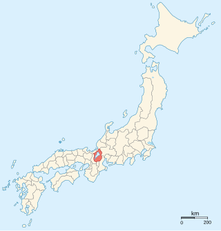
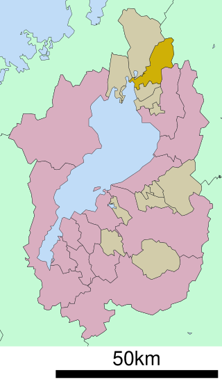
Shiga Prefecture is a landlocked prefecture of Japan located in the Kansai region of Honshu. Shiga Prefecture has a population of 1,412,916 and has a geographic area of 4,017 km2 (1,551 sq mi). Shiga Prefecture borders Fukui Prefecture to the north, Gifu Prefecture to the northeast, Mie Prefecture to the southeast, and Kyoto Prefecture to the west.
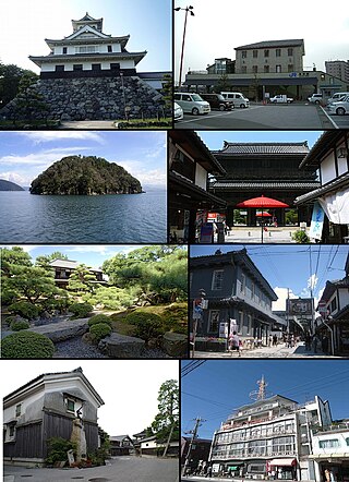
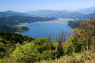
Nagahama is a city located in Shiga Prefecture, Japan. As of 1 November 2021, the city had an estimated population of 116,043 in 46858 households and a population density of 120 persons per km². The total area of the city is 680.79 square kilometres (262.85 sq mi).
Ōmi Province was a province of Japan, which today comprises Shiga Prefecture. It was one of the provinces that made up the Tōsandō circuit. Its nickname is Gōshū (江州). Under the Engishiki classification system, Ōmi was ranked as one of the 13 "great countries" (大国) in terms of importance, and one of the "near countries" (近国) in terms of distance from the capital.
Gamō was a town located in Gamō District, Shiga, Japan.

Ryūō is a town located in Gamō District, Shiga Prefecture, Japan. As of 31 August 2021, the town had an estimated population of 11,786 in 4499 households and a population density of 260 persons per km2. The total area of the town is 44.52 square kilometres (17.19 sq mi).

Notogawa was a town located in Kanzaki District, Shiga Prefecture, Japan.

Kanzaki was a district located in Shiga Prefecture, Japan.

Aitō was a town located in Echi District, Shiga Prefecture, Japan. "Aitō" means "eastern Echi".

Sakata was a district located in Shiga Prefecture, Japan.

Torahime was a town located in Higashiazai District, Shiga Prefecture, Japan.
Kohoku was a town located in Higashiazai District, Shiga Prefecture, Japan. The ruins of Odani Castle are located in Kohoku.

Takatsuki was a town located in Ika District, Shiga Prefecture, Japan.
Kinomoto was a town located in Ika District, Shiga Prefecture, Japan. It was the center of the district. In Sengoku period, Battle of Shizugatake broke out at a mountain in the west of Kinomoto.
Yogo was a town located in Ika District, Shiga Prefecture, Japan.
Nishiazai was a town located in Ika District, Shiga Prefecture, Japan. It is on the northern tip of Lake Biwa.

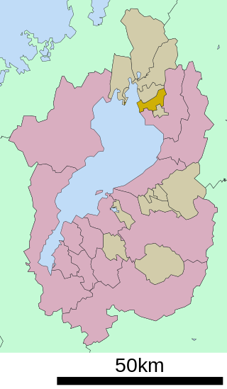
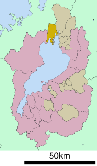
Higashiōmi is a city located in Shiga Prefecture, Japan. As of 1 September 2021, the city had an estimated population of 113,229 in 45771 households and a population density of 290 persons per km2. The total area of the city is 388.58 square kilometres (150.03 sq mi).
Yamakami Domain was a Fudai feudal domain under the Tokugawa shogunate of Edo period Japan. It was located in southeastern Ōmi Province, in the Kansai region of central Honshu. The domain was centered at Yamakami jin'ya, located in what is now the Yamakami neighborhood of the city of Higashiōmi in Shiga Prefecture.
Nagahara Goten (永原御殿) was an early Edo period Japanese castle located in what is now the city of Yasu, Shiga Prefecture, in the Kansai region of Japan. Its ruins have been protected as a National Historic Site since 2020.
Ōmi-Miyagawa Domain was a Fudai feudal domain under the Tokugawa shogunate of Edo period Japan. It was located in southeastern Ōmi Province, in the Kansai region of central Honshu. The domain was centered at Miyagawa jin'ya, located in what is now the city of Nagahama in Shiga Prefecture.
| Core city | ||
|---|---|---|
| Cities | ||
| Districts | ||